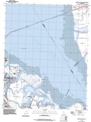
Redwood Point Topo Map California
To zoom in, hover over the map of Redwood Point
USGS Topo Quad 37122e2 - 1:24,000 scale
| Topo Map Name: | Redwood Point |
| USGS Topo Quad ID: | 37122e2 |
| Print Size: | ca. 21 1/4" wide x 27" high |
| Southeast Coordinates: | 37.5° N latitude / 122.125° W longitude |
| Map Center Coordinates: | 37.5625° N latitude / 122.1875° W longitude |
| U.S. State: | CA |
| Filename: | o37122e2.jpg |
| Download Map JPG Image: | Redwood Point topo map 1:24,000 scale |
| Map Type: | Topographic |
| Topo Series: | 7.5´ |
| Map Scale: | 1:24,000 |
| Source of Map Images: | United States Geological Survey (USGS) |
| Alternate Map Versions: |
Redwood Point CA 1948 Download PDF Buy paper map Redwood Point CA 1959, updated 1960 Download PDF Buy paper map Redwood Point CA 1959, updated 1966 Download PDF Buy paper map Redwood Point CA 1959, updated 1969 Download PDF Buy paper map Redwood Point CA 1959, updated 1975 Download PDF Buy paper map Redwood Point CA 1959, updated 1986 Download PDF Buy paper map Redwood Point CA 1959, updated 1986 Download PDF Buy paper map Redwood Point CA 1993, updated 1997 Download PDF Buy paper map Redwood Point CA 2012 Download PDF Buy paper map Redwood Point CA 2015 Download PDF Buy paper map |
1:24,000 Topo Quads surrounding Redwood Point
> Back to 37122e1 at 1:100,000 scale
> Back to 37122a1 at 1:250,000 scale
> Back to U.S. Topo Maps home
Redwood Point topo map: Gazetteer
Redwood Point: Bridges
San Mateo Bridge elevation 0m 0′Redwood Point: Capes
Ravenswood Point elevation 1m 3′Redwood Point elevation 1m 3′
Redwood Point: Guts
Bay Slough elevation 0m 0′First Slough elevation 0m 0′
Smith Slough elevation 0m 0′
Steinberger Slough elevation 0m 0′
Westpoint Slough elevation 0m 0′
Redwood Point: Harbors
Petes Harbor elevation -3m -10′Port of Redwood City elevation 2m 6′
Redwood Point: Islands
Bair Island elevation 0m 0′Bird Island elevation 1m 3′
Greco Island elevation 1m 3′
Redwood Point: Parks
Mariner Park elevation 2m 6′Marlin Park elevation 2m 6′
Shannon Park elevation 2m 6′
Redwood Point: Populated Places
Redwood Shores elevation 2m 6′Redwood Point: Streams
Alameda Creek elevation -8m -27′Belmont Slough elevation 0m 0′
Mount Eden Creek elevation 1m 3′
Pulgas Creek elevation 2m 6′
Redwood Creek elevation 0m 0′
Redwood Point digital topo map on disk
Buy this Redwood Point topo map showing relief, roads, GPS coordinates and other geographical features, as a high-resolution digital map file on DVD:


