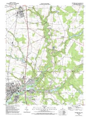
Seaford East Topo Map Delaware
To zoom in, hover over the map of Seaford East
USGS Topo Quad 38075f5 - 1:24,000 scale
| Topo Map Name: | Seaford East |
| USGS Topo Quad ID: | 38075f5 |
| Print Size: | ca. 21 1/4" wide x 27" high |
| Southeast Coordinates: | 38.625° N latitude / 75.5° W longitude |
| Map Center Coordinates: | 38.6875° N latitude / 75.5625° W longitude |
| U.S. State: | DE |
| Filename: | o38075f5.jpg |
| Download Map JPG Image: | Seaford East topo map 1:24,000 scale |
| Map Type: | Topographic |
| Topo Series: | 7.5´ |
| Map Scale: | 1:24,000 |
| Source of Map Images: | United States Geological Survey (USGS) |
| Alternate Map Versions: |
Seaford East DE 1955, updated 1957 Download PDF Buy paper map Seaford East DE 1955, updated 1983 Download PDF Buy paper map Seaford East DE 1992, updated 1992 Download PDF Buy paper map Seaford East DE 2011 Download PDF Buy paper map Seaford East DE 2014 Download PDF Buy paper map Seaford East DE 2016 Download PDF Buy paper map |
1:24,000 Topo Quads surrounding Seaford East
> Back to 38075e1 at 1:100,000 scale
> Back to 38074a1 at 1:250,000 scale
> Back to U.S. Topo Maps home
Seaford East topo map: Gazetteer
Seaford East: Bridges
Fishers Mill Bridge elevation 3m 9′Seaford East: Canals
Deep Gully Ditch elevation 10m 32′Swain and Truitt Ditch elevation 12m 39′
Seaford East: Dams
Collins Pond Dam elevation 9m 29′Concord Pond Dam elevation 2m 6′
Fleetwood Pond Dam elevation 7m 22′
Hearns Pond Dam elevation 8m 26′
Williams Pond Dam elevation 2m 6′
Seaford East: Flats
Bull Island elevation 5m 16′Seaford East: Islands
Bell Memorial Chapel elevation 2m 6′Morgan Island elevation 0m 0′
The Island elevation 6m 19′
Seaford East: Parks
Blades Public Park elevation 5m 16′Fillmore Clifton Stadium elevation 14m 45′
Passwaters Park elevation 14m 45′
Soroptimist Park elevation 4m 13′
Williams Pond Park elevation 6m 19′
Seaford East: Populated Places
Beaver Dam Heights elevation 4m 13′Blades elevation 4m 13′
Bridgeville elevation 13m 42′
Bridgeville Manor elevation 13m 42′
Broad Acres elevation 8m 26′
Bryan Park elevation 11m 36′
Cannon elevation 12m 39′
Cantebury Apartments elevation 12m 39′
Cherrytree Landing elevation 1m 3′
Collins Mill Park elevation 9m 29′
Collins Pond Acres elevation 10m 32′
Concord elevation 8m 26′
Concord Heights elevation 9m 29′
Coverdale Crossroads elevation 10m 32′
Douglas Forge elevation 4m 13′
Fernwood elevation 6m 19′
Fisher Mill Park elevation 7m 22′
Friedel Property elevation 6m 19′
Hasting Estates Mobile Home Park elevation 6m 19′
Hastings Park Mobile Home Park elevation 6m 19′
Hearns Mill elevation 9m 29′
Hurley Heights elevation 10m 32′
Kenmore Park elevation 6m 19′
Lake Shores elevation 9m 29′
Lakeside Estates Mobile Home Park elevation 7m 22′
Lakewood elevation 8m 26′
Lightfoots Furnace elevation 7m 22′
Meadow Acres elevation 6m 19′
Meadows elevation 7m 22′
Messick Development elevation 10m 32′
Middleford elevation 6m 19′
Middleford Acres elevation 9m 29′
Mobile Gardens Mobile Home Park elevation 6m 19′
Nanticoke Acres elevation 7m 22′
North Seaford Heights elevation 8m 26′
North Shores elevation 5m 16′
North Shores Addition elevation 6m 19′
Old Furnace elevation 6m 19′
Ross elevation 11m 36′
Ruth Harbor elevation 9m 29′
Seaford elevation 7m 22′
Seaford Heights elevation 9m 29′
Snug Harbor elevation 5m 16′
The Island elevation 3m 9′
The Oaks elevation 9m 29′
Victor E Hurley Estates elevation 5m 16′
Waterview Acres elevation 8m 26′
Seaford East: Post Offices
Bridgeville Post Office elevation 13m 42′Seaford East: Reservoirs
Collins Pond elevation 9m 29′Concord Pond elevation 2m 6′
Fleetwood Pond elevation 7m 22′
Hearns Pond elevation 8m 26′
Williams Pond elevation 2m 6′
Seaford East: Streams
Ake Ditch elevation 5m 16′Baker Mill Branch elevation 2m 6′
Bridgeville Branch elevation 7m 22′
Bucks Branch elevation 9m 29′
Clear Brook elevation 0m 0′
Cool Branch elevation 6m 19′
Deep Creek elevation 0m 0′
Graham Branch elevation 6m 19′
Gravelly Branch elevation 2m 6′
Gully Camp Ditch elevation 6m 19′
Gum Branch elevation 6m 19′
Herring Run elevation 3m 9′
Hurley Drain elevation 1m 3′
Morgan Branch elevation 0m 0′
Shorts Ditch elevation 6m 19′
Smith-Short and Willin Ditch elevation 9m 29′
Tubbs Branch elevation 1m 3′
Turkey Branch elevation 5m 16′
Tussocky Branch elevation 9m 29′
Tyndall Branch elevation 4m 13′
William H Newton Ditch elevation 3m 9′
Seaford East: Swamps
Greens Pond elevation 3m 9′Seaford East digital topo map on disk
Buy this Seaford East topo map showing relief, roads, GPS coordinates and other geographical features, as a high-resolution digital map file on DVD:
Atlantic Coast (NY, NJ, PA, DE, MD, VA, NC)
Buy digital topo maps: Atlantic Coast (NY, NJ, PA, DE, MD, VA, NC)


