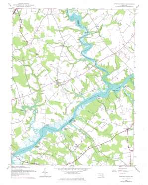
Fowling Creek Topo Map Maryland
To zoom in, hover over the map of Fowling Creek
USGS Topo Quad 38075g8 - 1:24,000 scale
| Topo Map Name: | Fowling Creek |
| USGS Topo Quad ID: | 38075g8 |
| Print Size: | ca. 21 1/4" wide x 27" high |
| Southeast Coordinates: | 38.75° N latitude / 75.875° W longitude |
| Map Center Coordinates: | 38.8125° N latitude / 75.9375° W longitude |
| U.S. State: | MD |
| Filename: | o38075g8.jpg |
| Download Map JPG Image: | Fowling Creek topo map 1:24,000 scale |
| Map Type: | Topographic |
| Topo Series: | 7.5´ |
| Map Scale: | 1:24,000 |
| Source of Map Images: | United States Geological Survey (USGS) |
| Alternate Map Versions: |
Fowling Creek MD 1944, updated 1962 Download PDF Buy paper map Fowling Creek MD 1944, updated 1968 Download PDF Buy paper map Fowling Creek MD 1944, updated 1976 Download PDF Buy paper map Fowling Creek MD 2011 Download PDF Buy paper map Fowling Creek MD 2014 Download PDF Buy paper map Fowling Creek MD 2017 Download PDF Buy paper map |
1:24,000 Topo Quads surrounding Fowling Creek
> Back to 38075e1 at 1:100,000 scale
> Back to 38074a1 at 1:250,000 scale
> Back to U.S. Topo Maps home
Fowling Creek topo map: Gazetteer
Fowling Creek: Airports
Ewing Airport elevation 16m 52′Fowling Creek: Bridges
Dover Bridge elevation 0m 0′Tuckahoe Bridge elevation 0m 0′
Fowling Creek: Capes
Cowards Point elevation 0m 0′Gilpin Point elevation 3m 9′
Tuckahoe Neck elevation 15m 49′
Fowling Creek: Crossings
Dover Ferry (historical) elevation 0m 0′Fowling Creek: Dams
Scull Farm Pond Dam elevation 5m 16′Fowling Creek: Parks
Harmony Community Park elevation 12m 39′Fowling Creek: Populated Places
Blairtown (historical) elevation 12m 39′Chapel Woods elevation 17m 55′
Country Life Acres elevation 9m 29′
Forest Gardens elevation 17m 55′
Griffin elevation 9m 29′
Harmony elevation 13m 42′
High Banks elevation 3m 9′
Hopeland Acres elevation 13m 42′
Kingston Landing elevation 1m 3′
Kitty Corner Park elevation 15m 49′
Kittys Corner elevation 18m 59′
Lewistown elevation 13m 42′
Matthews elevation 12m 39′
New Hope elevation 4m 13′
Newton elevation 12m 39′
Providence elevation 4m 13′
Providence Landing elevation 3m 9′
Ross Farm Woods elevation 10m 32′
Tanyard elevation 4m 13′
Tuckahoe Springs elevation 10m 32′
Wings Landing elevation 1m 3′
Fowling Creek: Post Offices
Cordova Post Office elevation 14m 45′Fowling Creek: Streams
Beaverdam Branch elevation 5m 16′Bell Creek elevation 0m 0′
Berry Run elevation 1m 3′
Chancellors Branch elevation 1m 3′
Crowberry Creek elevation 3m 9′
Dawson Branch elevation 2m 6′
Deep Branch elevation 5m 16′
Fowling Creek elevation 0m 0′
Hog Creek elevation 1m 3′
Jadwins Creek elevation 1m 3′
Kings Creek elevation 1m 3′
Mitchell Run elevation 2m 6′
Robins Creek elevation 2m 6′
Tuckahoe Creek elevation 0m 0′
Turkey Creek elevation 0m 0′
Fowling Creek digital topo map on disk
Buy this Fowling Creek topo map showing relief, roads, GPS coordinates and other geographical features, as a high-resolution digital map file on DVD:
Atlantic Coast (NY, NJ, PA, DE, MD, VA, NC)
Buy digital topo maps: Atlantic Coast (NY, NJ, PA, DE, MD, VA, NC)


