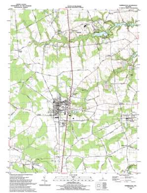
Harrington Topo Map Delaware
To zoom in, hover over the map of Harrington
USGS Topo Quad 38075h5 - 1:24,000 scale
| Topo Map Name: | Harrington |
| USGS Topo Quad ID: | 38075h5 |
| Print Size: | ca. 21 1/4" wide x 27" high |
| Southeast Coordinates: | 38.875° N latitude / 75.5° W longitude |
| Map Center Coordinates: | 38.9375° N latitude / 75.5625° W longitude |
| U.S. State: | DE |
| Filename: | o38075h5.jpg |
| Download Map JPG Image: | Harrington topo map 1:24,000 scale |
| Map Type: | Topographic |
| Topo Series: | 7.5´ |
| Map Scale: | 1:24,000 |
| Source of Map Images: | United States Geological Survey (USGS) |
| Alternate Map Versions: |
Harrington DE 1955, updated 1957 Download PDF Buy paper map Harrington DE 1955, updated 1957 Download PDF Buy paper map Harrington DE 1955, updated 1982 Download PDF Buy paper map Harrington DE 1993, updated 1993 Download PDF Buy paper map Harrington DE 2011 Download PDF Buy paper map Harrington DE 2014 Download PDF Buy paper map Harrington DE 2016 Download PDF Buy paper map |
1:24,000 Topo Quads surrounding Harrington
> Back to 38075e1 at 1:100,000 scale
> Back to 38074a1 at 1:250,000 scale
> Back to U.S. Topo Maps home
Harrington topo map: Gazetteer
Harrington: Areas
Delaware Department of Transportation Maintenance Area elevation 15m 49′Harrington: Dams
Coursey Pond Dam elevation 1m 3′Killen Pond Dam elevation 5m 16′
Harrington: Parks
Harrington Racetrack elevation 18m 59′Killens Pond State Park elevation 12m 39′
Harrington: Populated Places
Argos Choice elevation 13m 42′Bloomfield Acres elevation 12m 39′
Circle Haven Mobile Home Park elevation 15m 49′
D and K Mobile Home Park elevation 15m 49′
Fernwood elevation 12m 39′
Fleming Corners elevation 18m 59′
Harrington elevation 18m 59′
Houston elevation 15m 49′
I and I Mobile Home Park elevation 14m 45′
Jacksons Ridge elevation 15m 49′
John Char Estates elevation 17m 55′
Lake Forest Mobile Home Est elevation 17m 55′
Lucky Estates elevation 15m 49′
Marvels Crossroads elevation 15m 49′
Mastens Corner elevation 19m 62′
Melvins elevation 13m 42′
Melvins Crossroads elevation 13m 42′
Paris Woods elevation 10m 32′
Pine Ridge elevation 15m 49′
Pleasant Woods elevation 15m 49′
Powelton elevation 18m 59′
Reeves Crossing elevation 12m 39′
Roesville elevation 15m 49′
Six Forks elevation 17m 55′
Warrington Manor elevation 16m 52′
Williamsville elevation 15m 49′
Harrington: Post Offices
Harrington Post Office elevation 18m 59′Houston Post Office elevation 15m 49′
Harrington: Reservoirs
Coursey Pond elevation 1m 3′Killen Pond elevation 5m 16′
Harrington: Streams
Beaverdam Branch elevation 15m 49′Black Swamp Creek elevation 7m 22′
Fan Branch elevation 14m 45′
Indian Branch elevation 3m 9′
Spring Branch elevation 3m 9′
Harrington digital topo map on disk
Buy this Harrington topo map showing relief, roads, GPS coordinates and other geographical features, as a high-resolution digital map file on DVD:
Atlantic Coast (NY, NJ, PA, DE, MD, VA, NC)
Buy digital topo maps: Atlantic Coast (NY, NJ, PA, DE, MD, VA, NC)


