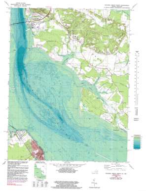
Colonial Beach North Topo Map Maryland
To zoom in, hover over the map of Colonial Beach North
USGS Topo Quad 38076c8 - 1:24,000 scale
| Topo Map Name: | Colonial Beach North |
| USGS Topo Quad ID: | 38076c8 |
| Print Size: | ca. 21 1/4" wide x 27" high |
| Southeast Coordinates: | 38.25° N latitude / 76.875° W longitude |
| Map Center Coordinates: | 38.3125° N latitude / 76.9375° W longitude |
| U.S. States: | MD, VA |
| Filename: | o38076c8.jpg |
| Download Map JPG Image: | Colonial Beach North topo map 1:24,000 scale |
| Map Type: | Topographic |
| Topo Series: | 7.5´ |
| Map Scale: | 1:24,000 |
| Source of Map Images: | United States Geological Survey (USGS) |
| Alternate Map Versions: |
Morgantown VA 1953, updated 1954 Download PDF Buy paper map Morgantown VA 1953, updated 1954 Download PDF Buy paper map Morgantown VA 1953, updated 1966 Download PDF Buy paper map Colonial Beach North VA 1968, updated 1972 Download PDF Buy paper map Colonial Beach North VA 1968, updated 1977 Download PDF Buy paper map Colonial Beach North VA 1968, updated 1983 Download PDF Buy paper map Colonial Beach North VA 1968, updated 1987 Download PDF Buy paper map Colonial Beach North VA 1968, updated 1991 Download PDF Buy paper map Colonial Beach North VA 2011 Download PDF Buy paper map Colonial Beach North VA 2013 Download PDF Buy paper map Colonial Beach North VA 2016 Download PDF Buy paper map |
1:24,000 Topo Quads surrounding Colonial Beach North
> Back to 38076a1 at 1:100,000 scale
> Back to 38076a1 at 1:250,000 scale
> Back to U.S. Topo Maps home
Colonial Beach North topo map: Gazetteer
Colonial Beach North: Airports
Aqua-Land Airport (historical) elevation 7m 22′Pilots Cove Airport elevation 2m 6′
Colonial Beach North: Bays
Cuckold Creek elevation 0m 0′Matthews Cove elevation 6m 19′
Perry Branch elevation 0m 0′
Colonial Beach North: Bridges
Harry W Nice Memorial Bridge elevation 0m 0′Colonial Beach North: Capes
Bachelors Hope Point elevation 1m 3′Bluff Point elevation 5m 16′
Cobb Neck elevation 5m 16′
Lloyd Point elevation 3m 9′
Lower Cedar Point elevation 1m 3′
Smoots Point elevation 1m 3′
Swan Point elevation 3m 9′
Swan Point Neck elevation 4m 13′
Waverly Point elevation 5m 16′
White Point elevation 2m 6′
Colonial Beach North: Crossings
Ludlow Ferry (historical) elevation 0m 0′Colonial Beach North: Parks
Crain Memorial Park elevation 32m 104′Southern Park elevation 2m 6′
Colonial Beach North: Populated Places
Anchorage Anchors elevation 3m 9′Classic Shore elevation 6m 19′
Clifton on the Potomac elevation 8m 26′
Colonial Beach elevation 3m 9′
Idlewood Acres elevation 5m 16′
Lone Holly elevation 3m 9′
Middletown elevation 5m 16′
Morgantown elevation 4m 13′
Mount Victoria elevation 44m 144′
Potomac Beach elevation 6m 19′
Potomac View elevation 4m 13′
Shiloh elevation 40m 131′
Swan Point elevation 3m 9′
Tompkinsville elevation 5m 16′
Waverly Point elevation 4m 13′
Woodland Point elevation 2m 6′
Colonial Beach North: Post Offices
Colonial Beach Post Office elevation 3m 9′Issue Post Office elevation 5m 16′
Mount Victoria Post Office elevation 44m 144′
Colonial Beach North: Streams
Clifton Creek elevation 2m 6′Ditchley Prong elevation 1m 3′
Goldman Creek elevation 2m 6′
Lloyd Creek elevation 2m 6′
Middletown Branch elevation 0m 0′
Mill Run elevation 1m 3′
Pasquahanza Creek elevation 0m 0′
Persimmon Point Creek elevation 1m 3′
Piccowaxen Creek elevation 0m 0′
Ravens Crest Creek elevation 2m 6′
Rosier Creek elevation 0m 0′
Shaws Branch elevation 3m 9′
Swindler Creek elevation 1m 3′
Trunk Gut elevation 1m 3′
Waverly Creek elevation 2m 6′
Weir Creek elevation 2m 6′
Wilkerson Creek elevation 3m 9′
Colonial Beach North: Swamps
Wise Marsh elevation 3m 9′Colonial Beach North digital topo map on disk
Buy this Colonial Beach North topo map showing relief, roads, GPS coordinates and other geographical features, as a high-resolution digital map file on DVD:
Atlantic Coast (NY, NJ, PA, DE, MD, VA, NC)
Buy digital topo maps: Atlantic Coast (NY, NJ, PA, DE, MD, VA, NC)


