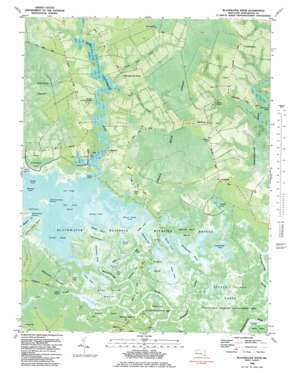
Blackwater River Topo Map Maryland
To zoom in, hover over the map of Blackwater River
USGS Topo Quad 38076d1 - 1:24,000 scale
| Topo Map Name: | Blackwater River |
| USGS Topo Quad ID: | 38076d1 |
| Print Size: | ca. 21 1/4" wide x 27" high |
| Southeast Coordinates: | 38.375° N latitude / 76° W longitude |
| Map Center Coordinates: | 38.4375° N latitude / 76.0625° W longitude |
| U.S. State: | MD |
| Filename: | p38076d1.jpg |
| Download Map JPG Image: | Blackwater River topo map 1:24,000 scale |
| Map Type: | Orthophoto |
| Topo Series: | 7.5´ |
| Map Scale: | 1:24,000 |
| Source of Map Images: | United States Geological Survey (USGS) |
| Alternate Map Versions: |
Blackwater River MD 1942, updated 1962 Download PDF Buy paper map Blackwater River MD 1942, updated 1962 Download PDF Buy paper map Blackwater River MD 1982, updated 1983 Download PDF Buy paper map Blackwater River MD 1982, updated 1983 Download PDF Buy paper map Blackwater River MD 2011 Download PDF Buy paper map Blackwater River MD 2014 Download PDF Buy paper map Blackwater River MD 2016 Download PDF Buy paper map |
1:24,000 Topo Quads surrounding Blackwater River
> Back to 38076a1 at 1:100,000 scale
> Back to 38076a1 at 1:250,000 scale
> Back to U.S. Topo Maps home
Blackwater River topo map: Gazetteer
Blackwater River: Canals
Keenes Ditch elevation 0m 0′Simons Ditch elevation 0m 0′
Blackwater River: Capes
Bull Point elevation -2m -7′Groggs Point elevation 0m 0′
Insleys Point elevation 0m 0′
Blackwater River: Guts
Snarepole Gut elevation 0m 0′Blackwater River: Islands
Bull Point Island elevation 1m 3′Blackwater River: Lakes
Backgarden Pond elevation -1m -4′Barbadoes Pond elevation -3m -10′
Blackwater Pond elevation -3m -10′
Bullock Pond elevation 2m 6′
Cattail Pond elevation -2m -7′
Coulson Pond elevation 0m 0′
Dieffenbach Pond elevation 1m 3′
Goose Pond elevation 0m 0′
Harpers Pond elevation -2m -7′
Hog Rooting Pond elevation -3m -10′
Kuehnle Pond elevation 0m 0′
Lans Pond elevation 0m 0′
Otter Pond elevation -4m -14′
Raymond Pond elevation -2m -7′
Round Pond elevation -7m -23′
Shorts Creek Pond elevation -2m -7′
Swan Pond elevation -2m -7′
Twin Ponds elevation -2m -7′
Wolfpit Pond elevation -1m -4′
Blackwater River: Parks
Blackwater National Wildlife Refuge elevation -2m -7′Blackwater River: Populated Places
Barnes Landing elevation 0m 0′Bucktown elevation 1m 3′
Indianbone elevation 3m 9′
Longfield elevation 1m 3′
Robbins elevation 1m 3′
Robbins Landing elevation 0m 0′
Seward elevation 1m 3′
Blackwater River: Streams
Backgarden Creek elevation 0m 0′Bullock Creek elevation 0m 0′
Coles Creek elevation 0m 0′
Hughs Dam Creek elevation -2m -7′
Little Blackwater River elevation -2m -7′
Pitcher Dam Creek elevation -2m -7′
Scotland Creek elevation 0m 0′
Blackwater River: Swamps
Becker Island Marsh elevation 0m 0′Dragon Swamp elevation 0m 0′
Green Brier Swamp elevation 2m 6′
Guinea Marsh elevation 0m 0′
Harpers Marsh elevation -2m -7′
Kentuck Swamp elevation 2m 6′
Shorters Marsh elevation 0m 0′
Squirrel Point Marsh elevation 0m 0′
Sunken Island Marsh elevation 0m 0′
Swan Pond Marsh elevation 0m 0′
Twin Pond Marsh elevation -2m -7′
Wolfpit Marsh elevation 0m 0′
Blackwater River digital topo map on disk
Buy this Blackwater River topo map showing relief, roads, GPS coordinates and other geographical features, as a high-resolution digital map file on DVD:
Atlantic Coast (NY, NJ, PA, DE, MD, VA, NC)
Buy digital topo maps: Atlantic Coast (NY, NJ, PA, DE, MD, VA, NC)


