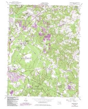
Brandywine Topo Map Maryland
To zoom in, hover over the map of Brandywine
USGS Topo Quad 38076f7 - 1:24,000 scale
| Topo Map Name: | Brandywine |
| USGS Topo Quad ID: | 38076f7 |
| Print Size: | ca. 21 1/4" wide x 27" high |
| Southeast Coordinates: | 38.625° N latitude / 76.75° W longitude |
| Map Center Coordinates: | 38.6875° N latitude / 76.8125° W longitude |
| U.S. State: | MD |
| Filename: | o38076f7.jpg |
| Download Map JPG Image: | Brandywine topo map 1:24,000 scale |
| Map Type: | Topographic |
| Topo Series: | 7.5´ |
| Map Scale: | 1:24,000 |
| Source of Map Images: | United States Geological Survey (USGS) |
| Alternate Map Versions: |
Brandywine MD 1956, updated 1958 Download PDF Buy paper map Brandywine MD 1956, updated 1971 Download PDF Buy paper map Brandywine MD 1956, updated 1979 Download PDF Buy paper map Brandywine MD 1956, updated 1986 Download PDF Buy paper map Brandywine MD 2011 Download PDF Buy paper map Brandywine MD 2014 Download PDF Buy paper map Brandywine MD 2016 Download PDF Buy paper map |
1:24,000 Topo Quads surrounding Brandywine
> Back to 38076e1 at 1:100,000 scale
> Back to 38076a1 at 1:250,000 scale
> Back to U.S. Topo Maps home
Brandywine topo map: Gazetteer
Brandywine: Airports
Curtis Field elevation 60m 196′Brandywine: Forests
Cedarville State Forest elevation 61m 200′Brandywine: Parks
Brandywine Area Recreation Area elevation 69m 226′Cedarville Natural Resources Management Area elevation 61m 200′
Cheltenham Acres Recreation Area elevation 68m 223′
Pinefield Community Park elevation 65m 213′
Western Regional Park elevation 57m 187′
Brandywine: Populated Places
Ashbox elevation 67m 219′Baden elevation 63m 206′
Brandywine elevation 70m 229′
Brandywine Forest elevation 68m 223′
Brandywine Heights elevation 69m 226′
Cedarville elevation 64m 209′
Cedarville Mobile Home Park elevation 64m 209′
Cheltenham elevation 73m 239′
Cheltenham Acres elevation 68m 223′
Country Club South elevation 61m 200′
Duley elevation 64m 209′
Early Manor elevation 67m 219′
Gwynn Park elevation 69m 226′
Heatherwick elevation 67m 219′
Holt Manor elevation 68m 223′
Horsehead elevation 61m 200′
Land Tree elevation 50m 164′
Marlton South elevation 56m 183′
Mattawoman Estates elevation 62m 203′
North Keys elevation 47m 154′
North Keys Estates elevation 44m 144′
Orme elevation 61m 200′
Pinefield elevation 62m 203′
Sunrise Hills elevation 36m 118′
T B elevation 72m 236′
Talbert (historical) elevation 71m 232′
The Village elevation 67m 219′
Townshend elevation 62m 203′
West End Farms elevation 44m 144′
Windsor Manor elevation 34m 111′
Brandywine: Post Offices
Brandywine Post Office elevation 67m 219′Cheltenham Post Office elevation 73m 239′
Brandywine: Reservoirs
Cedarville Pond elevation 47m 154′Brandywine: Trails
Bee Oak Trail elevation 57m 187′County Line Trail elevation 51m 167′
Cross Road Trail elevation 61m 200′
Hidden Spring Trail elevation 56m 183′
Left Trail elevation 61m 200′
Loop Trail elevation 54m 177′
Magnolia Trail elevation 53m 173′
Mistletoe Trail elevation 49m 160′
Panhandle Trail elevation 60m 196′
South Trail elevation 54m 177′
Sunset Trail elevation 57m 187′
West Trail elevation 58m 190′
Wolf Den Trail elevation 43m 141′
Brandywine digital topo map on disk
Buy this Brandywine topo map showing relief, roads, GPS coordinates and other geographical features, as a high-resolution digital map file on DVD:
Atlantic Coast (NY, NJ, PA, DE, MD, VA, NC)
Buy digital topo maps: Atlantic Coast (NY, NJ, PA, DE, MD, VA, NC)


