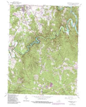
Independent Hill Topo Map Virginia
To zoom in, hover over the map of Independent Hill
USGS Topo Quad 38077f4 - 1:24,000 scale
| Topo Map Name: | Independent Hill |
| USGS Topo Quad ID: | 38077f4 |
| Print Size: | ca. 21 1/4" wide x 27" high |
| Southeast Coordinates: | 38.625° N latitude / 77.375° W longitude |
| Map Center Coordinates: | 38.6875° N latitude / 77.4375° W longitude |
| U.S. State: | VA |
| Filename: | o38077f4.jpg |
| Download Map JPG Image: | Independent Hill topo map 1:24,000 scale |
| Map Type: | Topographic |
| Topo Series: | 7.5´ |
| Map Scale: | 1:24,000 |
| Source of Map Images: | United States Geological Survey (USGS) |
| Alternate Map Versions: |
Independent Hill VA 1951, updated 1953 Download PDF Buy paper map Independent Hill VA 1956, updated 1959 Download PDF Buy paper map Independent Hill VA 1966, updated 1968 Download PDF Buy paper map Independent Hill VA 1966, updated 1971 Download PDF Buy paper map Independent Hill VA 1966, updated 1980 Download PDF Buy paper map Independent Hill VA 1966, updated 1984 Download PDF Buy paper map Independent Hill VA 1966, updated 1987 Download PDF Buy paper map Independent Hill VA 1977, updated 1982 Download PDF Buy paper map Independent Hill VA 1994, updated 1998 Download PDF Buy paper map Independent Hill VA 2011 Download PDF Buy paper map Independent Hill VA 2013 Download PDF Buy paper map Independent Hill VA 2016 Download PDF Buy paper map |
1:24,000 Topo Quads surrounding Independent Hill
> Back to 38077e1 at 1:100,000 scale
> Back to 38076a1 at 1:250,000 scale
> Back to U.S. Topo Maps home
Independent Hill topo map: Gazetteer
Independent Hill: Bridges
Blands Ford Bridge elevation 38m 124′Independent Hill: Crossings
Shallow Ford (historical) elevation 37m 121′Spriggs Ford elevation 38m 124′
Woodyards Ford (historical) elevation 36m 118′
Independent Hill: Dams
Lake Jackson Dam elevation 42m 137′Independent Hill: Parks
Baldwin Park elevation 93m 305′Brentsville Historic District elevation 72m 236′
Brentsville Park elevation 59m 193′
George Hellwig District Park elevation 116m 380′
Hawison Homestead Park elevation 100m 328′
Independent Hill Park elevation 112m 367′
Minnieville Manor Park elevation 77m 252′
Shenandoah Park elevation 104m 341′
Independent Hill: Populated Places
Algonquin Hills elevation 96m 314′Azalea Mobile Home Park elevation 108m 354′
Bell Forest elevation 91m 298′
Bent Tree Estates elevation 82m 269′
Blandsford elevation 70m 229′
Bloom Hill elevation 82m 269′
Bradley Forest elevation 72m 236′
Brentsville elevation 69m 226′
Buckhall elevation 95m 311′
Camelot elevation 73m 239′
Canova elevation 107m 351′
Carriage Hill Estates elevation 112m 367′
Champ Mills Estates elevation 79m 259′
Chevalle elevation 79m 259′
Cornwell elevation 97m 318′
Country Roads elevation 83m 272′
Deerfield elevation 76m 249′
Devonshire elevation 112m 367′
Dozer Mill Acres elevation 71m 232′
Fair Estates elevation 98m 321′
Forest Hills elevation 104m 341′
Forest Park Mobile Home Village elevation 107m 351′
Fostern Estates elevation 82m 269′
Foxridge elevation 76m 249′
Gaila Woods elevation 108m 354′
Georgetown South elevation 87m 285′
Heritage Woods elevation 98m 321′
Hillcrest Estates elevation 82m 269′
Hunters Grove Estates elevation 78m 255′
Hunters Square elevation 82m 269′
Hynson Knolls elevation 91m 298′
Independent Hill elevation 125m 410′
Johnson Woods elevation 74m 242′
Kimberly Knolls elevation 112m 367′
Lake Jackson elevation 71m 232′
Lake Occoquan Shores elevation 73m 239′
Landview Estates elevation 98m 321′
Lee Manor elevation 73m 239′
Limstrong elevation 84m 275′
Lindau Woods elevation 99m 324′
Locust Hill elevation 75m 246′
Longview elevation 81m 265′
Meadowbrook elevation 99m 324′
Minnieville Manor elevation 95m 311′
Mockingbird Ridge elevation 82m 269′
Montyville elevation 91m 298′
Montyville Estates elevation 84m 275′
Moor Green Estates elevation 69m 226′
Morningside elevation 76m 249′
Oak Hill Estates elevation 102m 334′
Oak Hill Farms elevation 111m 364′
Oak Ridge Estates elevation 107m 351′
Oaks of Shenandoah elevation 96m 314′
Occoquan Forest elevation 55m 180′
Occoquan River Hills elevation 38m 124′
Orangedale elevation 99m 324′
Plantation Pines Estates elevation 107m 351′
Prestige Manor elevation 98m 321′
Princedale elevation 109m 357′
Raintree elevation 72m 236′
Ravenwood elevation 60m 196′
Ridge Wood Estates elevation 109m 357′
Ridgedale elevation 101m 331′
Riverview Estates elevation 65m 213′
Shenandoah elevation 94m 308′
Silverdale elevation 99m 324′
Tall Trees Estates elevation 68m 223′
Terrapin Forest elevation 116m 380′
Valley Vue elevation 113m 370′
Vernon Estates elevation 95m 311′
Walton elevation 117m 383′
Westchester elevation 76m 249′
Wildwood Estates elevation 87m 285′
Windy Hill elevation 54m 177′
Woodbine elevation 117m 383′
Woodbine Forest elevation 97m 318′
Woodbine Woods elevation 98m 321′
Wooded Acres elevation 96m 314′
Woodhaven elevation 117m 383′
Woodlawn Meadows elevation 93m 305′
Independent Hill: Reservoirs
Lake Jackson elevation 42m 137′Independent Hill: Streams
Broad Run elevation 45m 147′Bull Run elevation 36m 118′
Cabin Run elevation 43m 141′
Cedar Run elevation 45m 147′
Champs Mill Branch elevation 36m 118′
Cock Pen Branch elevation 38m 124′
Crooked Creek elevation 37m 121′
Piney Branch elevation 46m 150′
Purcell Branch elevation 39m 127′
Turkey Branch elevation 51m 167′
Independent Hill digital topo map on disk
Buy this Independent Hill topo map showing relief, roads, GPS coordinates and other geographical features, as a high-resolution digital map file on DVD:
Atlantic Coast (NY, NJ, PA, DE, MD, VA, NC)
Buy digital topo maps: Atlantic Coast (NY, NJ, PA, DE, MD, VA, NC)


