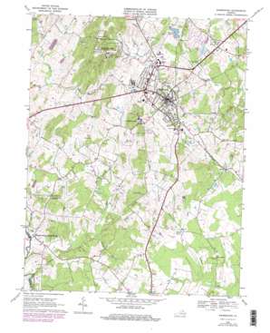
Warrenton Topo Map Virginia
To zoom in, hover over the map of Warrenton
USGS Topo Quad 38077f7 - 1:24,000 scale
| Topo Map Name: | Warrenton |
| USGS Topo Quad ID: | 38077f7 |
| Print Size: | ca. 21 1/4" wide x 27" high |
| Southeast Coordinates: | 38.625° N latitude / 77.75° W longitude |
| Map Center Coordinates: | 38.6875° N latitude / 77.8125° W longitude |
| U.S. State: | VA |
| Filename: | o38077f7.jpg |
| Download Map JPG Image: | Warrenton topo map 1:24,000 scale |
| Map Type: | Topographic |
| Topo Series: | 7.5´ |
| Map Scale: | 1:24,000 |
| Source of Map Images: | United States Geological Survey (USGS) |
| Alternate Map Versions: |
Warrenton VA 1966, updated 1968 Download PDF Buy paper map Warrenton VA 1966, updated 1972 Download PDF Buy paper map Warrenton VA 1966, updated 1978 Download PDF Buy paper map Warrenton VA 1966, updated 1978 Download PDF Buy paper map Warrenton VA 1994, updated 1999 Download PDF Buy paper map Warrenton VA 2011 Download PDF Buy paper map Warrenton VA 2013 Download PDF Buy paper map Warrenton VA 2016 Download PDF Buy paper map |
1:24,000 Topo Quads surrounding Warrenton
> Back to 38077e1 at 1:100,000 scale
> Back to 38076a1 at 1:250,000 scale
> Back to U.S. Topo Maps home
Warrenton topo map: Gazetteer
Warrenton: Airports
Fauquier Hospital Emergency Transport Heliport elevation 177m 580′Horse Feathers Airport elevation 118m 387′
Warrenton Air Park elevation 132m 433′
Warrenton: Dams
Lower Warrenton Lakes Dam elevation 140m 459′Warrenton Dam elevation 131m 429′
Warrenton Lake Dam elevation 132m 433′
Warrenton: Forests
Whitney State Forest elevation 134m 439′Warrenton: Parks
Warrenton Fairgrounds elevation 168m 551′Warrenton Historic District elevation 195m 639′
Warrenton: Populated Places
Alwington elevation 187m 613′Frytown elevation 158m 518′
Hurleyville elevation 132m 433′
Lousetown elevation 108m 354′
Meetze elevation 128m 419′
Turnbull elevation 148m 485′
Warrenton elevation 195m 639′
Warrenton: Reservoirs
Warrenton Lake elevation 132m 433′Warrenton Reservoir elevation 131m 429′
Warrenton: Streams
Borrows Run elevation 92m 301′Cattail Branch elevation 147m 482′
Jordan Branch elevation 101m 331′
Mill Run elevation 127m 416′
Towser Branch elevation 140m 459′
Warrenton: Summits
Viewtree Mountain elevation 325m 1066′Warrenton digital topo map on disk
Buy this Warrenton topo map showing relief, roads, GPS coordinates and other geographical features, as a high-resolution digital map file on DVD:
Atlantic Coast (NY, NJ, PA, DE, MD, VA, NC)
Buy digital topo maps: Atlantic Coast (NY, NJ, PA, DE, MD, VA, NC)


