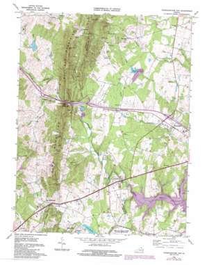
Thoroughfare Gap Topo Map Virginia
To zoom in, hover over the map of Thoroughfare Gap
USGS Topo Quad 38077g6 - 1:24,000 scale
| Topo Map Name: | Thoroughfare Gap |
| USGS Topo Quad ID: | 38077g6 |
| Print Size: | ca. 21 1/4" wide x 27" high |
| Southeast Coordinates: | 38.75° N latitude / 77.625° W longitude |
| Map Center Coordinates: | 38.8125° N latitude / 77.6875° W longitude |
| U.S. State: | VA |
| Filename: | o38077g6.jpg |
| Download Map JPG Image: | Thoroughfare Gap topo map 1:24,000 scale |
| Map Type: | Topographic |
| Topo Series: | 7.5´ |
| Map Scale: | 1:24,000 |
| Source of Map Images: | United States Geological Survey (USGS) |
| Alternate Map Versions: |
Thorofare Gap VA 1943, updated 1960 Download PDF Buy paper map Thoroughfare Gap VA 1966, updated 1969 Download PDF Buy paper map Thoroughfare Gap VA 1966, updated 1973 Download PDF Buy paper map Thoroughfare Gap VA 1966, updated 1984 Download PDF Buy paper map Thoroughfare Gap VA 1977, updated 1982 Download PDF Buy paper map Thoroughfare Gap VA 1989, updated 1996 Download PDF Buy paper map Thoroughfare Gap VA 1994, updated 1998 Download PDF Buy paper map Thoroughfare Gap VA 2010 Download PDF Buy paper map Thoroughfare Gap VA 2013 Download PDF Buy paper map Thoroughfare Gap VA 2016 Download PDF Buy paper map |
1:24,000 Topo Quads surrounding Thoroughfare Gap
> Back to 38077e1 at 1:100,000 scale
> Back to 38076a1 at 1:250,000 scale
> Back to U.S. Topo Maps home
Thoroughfare Gap topo map: Gazetteer
Thoroughfare Gap: Airports
Vint Hills Farm Station Heliport elevation 119m 390′Thoroughfare Gap: Crossings
Interchange 40 elevation 107m 351′Thoroughfare Gap: Dams
Buckland Dam elevation 100m 328′Echo Lake Dam elevation 170m 557′
Kinloch Farm Dam elevation 172m 564′
Lake Anne Dam elevation 132m 433′
Silver Lake Dam elevation 124m 406′
Thoroughfare Gap: Gaps
Hopewell Gap elevation 256m 839′Thoroughfare Gap elevation 127m 416′
Thoroughfare Gap: Mines
Paynes Quarry elevation 303m 994′Sisslers Quarry elevation 326m 1069′
Thoroughfare Gap: Parks
Buckland Historic District elevation 94m 308′James S Long Park elevation 123m 403′
Vint Hill Park elevation 103m 337′
Waterfall Park elevation 155m 508′
Thoroughfare Gap: Populated Places
Antioch elevation 178m 583′Beverley Mill elevation 116m 380′
Broad Run elevation 125m 410′
Broken Hill elevation 139m 456′
Buckland elevation 94m 308′
Burke Meadows elevation 183m 600′
Crescent elevation 161m 528′
Haymarket elevation 112m 367′
Hopewell elevation 207m 679′
Kennard Ridge elevation 129m 423′
Knollwood Estates elevation 183m 600′
Little Georgetown elevation 143m 469′
Mountain View Estates elevation 140m 459′
New Baltimore elevation 151m 495′
Pilgrims Rest elevation 138m 452′
Waterfall elevation 153m 501′
Waterfall Village elevation 164m 538′
Woolsey elevation 122m 400′
Thoroughfare Gap: Post Offices
Haymarket Post Office elevation 111m 364′Thoroughfare Gap: Ranges
Pond Mountains elevation 271m 889′Thoroughfare Gap: Reservoirs
Buckland Lake elevation 100m 328′Echo Lake elevation 170m 557′
Kinloch Farm Pond elevation 172m 564′
Silver Lake elevation 124m 406′
Thoroughfare Gap: Streams
Catletts Branch elevation 106m 347′Cattail Run elevation 149m 488′
Mill Run elevation 137m 449′
North Fork Broad Run elevation 87m 285′
South Run elevation 87m 285′
Trapp Branch elevation 130m 426′
Thoroughfare Gap: Summits
Bisquit Mountain elevation 268m 879′High Point Mountain elevation 397m 1302′
Thoroughfare Gap: Valleys
Jackson Hollow elevation 165m 541′Thoroughfare Gap digital topo map on disk
Buy this Thoroughfare Gap topo map showing relief, roads, GPS coordinates and other geographical features, as a high-resolution digital map file on DVD:
Atlantic Coast (NY, NJ, PA, DE, MD, VA, NC)
Buy digital topo maps: Atlantic Coast (NY, NJ, PA, DE, MD, VA, NC)


