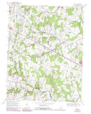
Arcola Topo Map Virginia
To zoom in, hover over the map of Arcola
USGS Topo Quad 38077h5 - 1:24,000 scale
| Topo Map Name: | Arcola |
| USGS Topo Quad ID: | 38077h5 |
| Print Size: | ca. 21 1/4" wide x 27" high |
| Southeast Coordinates: | 38.875° N latitude / 77.5° W longitude |
| Map Center Coordinates: | 38.9375° N latitude / 77.5625° W longitude |
| U.S. State: | VA |
| Filename: | o38077h5.jpg |
| Download Map JPG Image: | Arcola topo map 1:24,000 scale |
| Map Type: | Topographic |
| Topo Series: | 7.5´ |
| Map Scale: | 1:24,000 |
| Source of Map Images: | United States Geological Survey (USGS) |
| Alternate Map Versions: |
Arcola VA 1943, updated 1957 Download PDF Buy paper map Arcola VA 1943, updated 1958 Download PDF Buy paper map Arcola VA 1943, updated 1961 Download PDF Buy paper map Arcola VA 1968, updated 1970 Download PDF Buy paper map Arcola VA 1968, updated 1978 Download PDF Buy paper map Arcola VA 1968, updated 1985 Download PDF Buy paper map Arcola VA 1968, updated 1989 Download PDF Buy paper map Arcola VA 1968, updated 1989 Download PDF Buy paper map Arcola VA 1977, updated 1982 Download PDF Buy paper map Arcola VA 2010 Download PDF Buy paper map Arcola VA 2013 Download PDF Buy paper map Arcola VA 2016 Download PDF Buy paper map |
1:24,000 Topo Quads surrounding Arcola
> Back to 38077e1 at 1:100,000 scale
> Back to 38076a1 at 1:250,000 scale
> Back to U.S. Topo Maps home
Arcola topo map: Gazetteer
Arcola: Airports
Glascock Airport elevation 97m 318′Smith Airport elevation 107m 351′
Arcola: Dams
Quail Ridge Dam elevation 98m 321′Arcola: Parks
Brambleton Regional Park elevation 106m 347′Byrne's Ridge Park elevation 110m 360′
Arcola: Populated Places
Arcola elevation 87m 285′Boxwood Farms elevation 97m 318′
Brambleton elevation 115m 377′
Burns Crossroads elevation 117m 383′
Butler elevation 111m 364′
Conklin elevation 94m 308′
Forest Hills Estates elevation 89m 291′
German elevation 101m 331′
Gilberts Corner elevation 110m 360′
Hickory Grove Acres elevation 110m 360′
Hutchinson elevation 95m 311′
Lenah elevation 109m 357′
Olde South Estates elevation 103m 337′
Royville elevation 100m 328′
South Riding elevation 98m 321′
Swansen elevation 106m 347′
Watson elevation 118m 387′
Arcola: Post Offices
Arcola Post Office elevation 93m 305′Arcola: Reservoirs
Quail Ridge Lake elevation 98m 321′Arcola: Streams
Black Branch elevation 90m 295′Cabin Branch elevation 79m 259′
Chestnut Lick elevation 78m 255′
Foley Branch elevation 70m 229′
Lenah Run elevation 85m 278′
South Fork Broad Run elevation 79m 259′
Arcola digital topo map on disk
Buy this Arcola topo map showing relief, roads, GPS coordinates and other geographical features, as a high-resolution digital map file on DVD:
Atlantic Coast (NY, NJ, PA, DE, MD, VA, NC)
Buy digital topo maps: Atlantic Coast (NY, NJ, PA, DE, MD, VA, NC)


