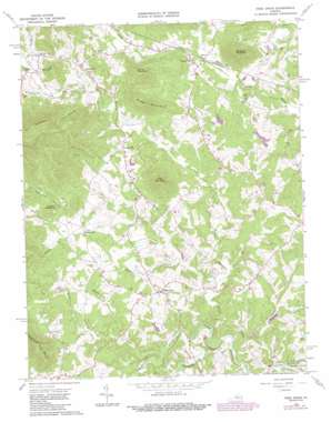
Free Union Topo Map Virginia
To zoom in, hover over the map of Free Union
USGS Topo Quad 38078b5 - 1:24,000 scale
| Topo Map Name: | Free Union |
| USGS Topo Quad ID: | 38078b5 |
| Print Size: | ca. 21 1/4" wide x 27" high |
| Southeast Coordinates: | 38.125° N latitude / 78.5° W longitude |
| Map Center Coordinates: | 38.1875° N latitude / 78.5625° W longitude |
| U.S. State: | VA |
| Filename: | o38078b5.jpg |
| Download Map JPG Image: | Free Union topo map 1:24,000 scale |
| Map Type: | Topographic |
| Topo Series: | 7.5´ |
| Map Scale: | 1:24,000 |
| Source of Map Images: | United States Geological Survey (USGS) |
| Alternate Map Versions: |
Free Union VA 1965, updated 1976 Download PDF Buy paper map Free Union VA 1965, updated 1987 Download PDF Buy paper map Free Union VA 1977, updated 1982 Download PDF Buy paper map Free Union VA 2011 Download PDF Buy paper map Free Union VA 2013 Download PDF Buy paper map Free Union VA 2016 Download PDF Buy paper map |
1:24,000 Topo Quads surrounding Free Union
> Back to 38078a1 at 1:100,000 scale
> Back to 38078a1 at 1:250,000 scale
> Back to U.S. Topo Maps home
Free Union topo map: Gazetteer
Free Union: Dams
Chisholm Dam Number One elevation 153m 501′Craig Dam elevation 142m 465′
Laughlins Dam elevation 127m 416′
Morris Dam elevation 142m 465′
Wilsdorf Dam elevation 168m 551′
Free Union: Populated Places
Blue Ridge View elevation 177m 580′Blueridge Forest elevation 171m 561′
Boonesville elevation 229m 751′
Brinnington elevation 175m 574′
Cedarmere elevation 240m 787′
Crossroads elevation 195m 639′
Davis Shop elevation 192m 629′
Fairgrove elevation 143m 469′
Free Union elevation 179m 587′
Hickory Ridge elevation 177m 580′
Mallard Lake elevation 169m 554′
Nortonsville elevation 207m 679′
Patterson Store elevation 186m 610′
Wilhait elevation 185m 606′
Windrift elevation 183m 600′
Free Union: Post Offices
Free Union Post Office elevation 181m 593′Free Union: Reservoirs
Chisholm Lake Number One elevation 153m 501′Craig Pond elevation 142m 465′
Laughlins Lake elevation 127m 416′
Morris Pond elevation 142m 465′
Wilsdorf Pond elevation 168m 551′
Free Union: Streams
Buck Mountain Creek elevation 116m 380′Burruss Branch elevation 133m 436′
Elk Run elevation 130m 426′
Fishing Creek elevation 116m 380′
Mechums River elevation 119m 390′
Moormans River elevation 119m 390′
Muddy Run elevation 207m 679′
Piney Creek elevation 126m 413′
Rocky Creek elevation 137m 449′
Wards Creek elevation 126m 413′
Free Union: Summits
Bingham Mountain elevation 397m 1302′Buck Mountain elevation 410m 1345′
Cherry Mountain elevation 297m 974′
Green Mountain elevation 362m 1187′
Harris Mountain elevation 365m 1197′
Lick Mountain elevation 361m 1184′
Free Union: Valleys
Blackwells Hollow elevation 210m 688′Peavine Hollow elevation 193m 633′
Rich Hollow elevation 196m 643′
Rockybar Hollow elevation 229m 751′
Free Union digital topo map on disk
Buy this Free Union topo map showing relief, roads, GPS coordinates and other geographical features, as a high-resolution digital map file on DVD:
Western Virginia & Southern West Virginia
Buy digital topo maps: Western Virginia & Southern West Virginia


