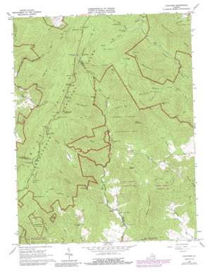
Fletcher Topo Map Virginia
To zoom in, hover over the map of Fletcher
USGS Topo Quad 38078d4 - 1:24,000 scale
| Topo Map Name: | Fletcher |
| USGS Topo Quad ID: | 38078d4 |
| Print Size: | ca. 21 1/4" wide x 27" high |
| Southeast Coordinates: | 38.375° N latitude / 78.375° W longitude |
| Map Center Coordinates: | 38.4375° N latitude / 78.4375° W longitude |
| U.S. State: | VA |
| Filename: | o38078d4.jpg |
| Download Map JPG Image: | Fletcher topo map 1:24,000 scale |
| Map Type: | Topographic |
| Topo Series: | 7.5´ |
| Map Scale: | 1:24,000 |
| Source of Map Images: | United States Geological Survey (USGS) |
| Alternate Map Versions: |
Fletcher VA 1965, updated 1967 Download PDF Buy paper map Fletcher VA 1965, updated 1979 Download PDF Buy paper map Fletcher VA 1965, updated 1988 Download PDF Buy paper map Fletcher VA 1965, updated 1988 Download PDF Buy paper map Fletcher VA 1977, updated 1981 Download PDF Buy paper map Fletcher VA 1999, updated 2000 Download PDF Buy paper map Fletcher VA 2010 Download PDF Buy paper map Fletcher VA 2013 Download PDF Buy paper map Fletcher VA 2016 Download PDF Buy paper map |
1:24,000 Topo Quads surrounding Fletcher
> Back to 38078a1 at 1:100,000 scale
> Back to 38078a1 at 1:250,000 scale
> Back to U.S. Topo Maps home
Fletcher topo map: Gazetteer
Fletcher: Basins
The Laurels elevation 822m 2696′Fletcher: Cliffs
Huckleberry Cliff elevation 864m 2834′Fletcher: Falls
Big Rock Falls elevation 815m 2673′Fletcher: Gaps
Bootens Gap elevation 985m 3231′Broyles Gap elevation 831m 2726′
Laurel Gap elevation 987m 3238′
The Sag elevation 1021m 3349′
Fletcher: Parks
Rapidan Wildlife Management Area elevation 587m 1925′Fletcher: Populated Places
Fletcher elevation 285m 935′Upper Pocosin elevation 833m 2732′
Fletcher: Post Offices
Fletcher Post Office (historical) elevation 267m 875′Towles Post Office (historical) elevation 586m 1922′
Fletcher: Ridges
Long Ridge elevation 891m 2923′Fletcher: Streams
Bootens Run elevation 518m 1699′Bush Mountain Stream elevation 521m 1709′
Collects Run elevation 359m 1177′
Devils Ditch elevation 423m 1387′
Garth Spring Run elevation 641m 2103′
Haunted Branch elevation 424m 1391′
Laurel Prong elevation 756m 2480′
Little Creek elevation 454m 1489′
Long Point Branch elevation 349m 1145′
Mill Prong elevation 756m 2480′
Pocosin Creek elevation 314m 1030′
Wilson Run elevation 348m 1141′
Fletcher: Summits
Bear Church Rock elevation 916m 3005′Bearfence Mountain elevation 1083m 3553′
Bluff Mountain elevation 1066m 3497′
Bush Mountain elevation 1076m 3530′
Buzzard Rocks elevation 725m 2378′
Cat Knob elevation 985m 3231′
Cliff Mountain elevation 943m 3093′
Doubletop Mountain elevation 1051m 3448′
Fork Mountain elevation 1172m 3845′
Hazeltop elevation 1149m 3769′
Jones Mountain elevation 1061m 3480′
Kirtley Mountain elevation 788m 2585′
Lewis Mountain elevation 1087m 3566′
Lighted Top elevation 809m 2654′
Peters Point elevation 612m 2007′
Powell Mountain elevation 807m 2647′
Fletcher: Trails
Allen Hollow Trail elevation 595m 1952′East Branch Naked Creek Trail elevation 586m 1922′
Jones Mountain Trail elevation 960m 3149′
Laurel Prong Trail elevation 997m 3270′
Lewis Mountain Trail elevation 870m 2854′
Mill Prong Trail elevation 877m 2877′
Pocosin Hollow Trail elevation 474m 1555′
Pocosin Trail elevation 768m 2519′
Powell Mountain Trail elevation 772m 2532′
Staunton River Trail elevation 511m 1676′
West Branch Naked Creek Trail elevation 501m 1643′
Fletcher: Valleys
McDaniel Hollow elevation 633m 2076′Pocosin Hollow elevation 314m 1030′
Walnut Hollow elevation 206m 675′
Fletcher digital topo map on disk
Buy this Fletcher topo map showing relief, roads, GPS coordinates and other geographical features, as a high-resolution digital map file on DVD:
Western Virginia & Southern West Virginia
Buy digital topo maps: Western Virginia & Southern West Virginia


