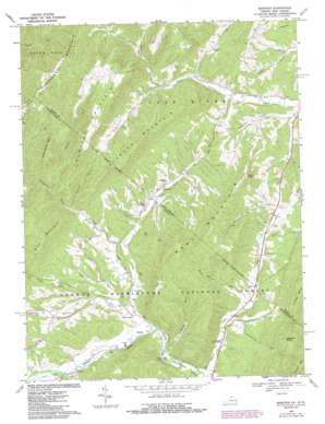
Bergton Topo Map West Virginia
To zoom in, hover over the map of Bergton
USGS Topo Quad 38078g8 - 1:24,000 scale
| Topo Map Name: | Bergton |
| USGS Topo Quad ID: | 38078g8 |
| Print Size: | ca. 21 1/4" wide x 27" high |
| Southeast Coordinates: | 38.75° N latitude / 78.875° W longitude |
| Map Center Coordinates: | 38.8125° N latitude / 78.9375° W longitude |
| U.S. States: | WV, VA |
| Filename: | o38078g8.jpg |
| Download Map JPG Image: | Bergton topo map 1:24,000 scale |
| Map Type: | Topographic |
| Topo Series: | 7.5´ |
| Map Scale: | 1:24,000 |
| Source of Map Images: | United States Geological Survey (USGS) |
| Alternate Map Versions: |
Bergton VA 1967, updated 1969 Download PDF Buy paper map Bergton VA 1967, updated 1976 Download PDF Buy paper map Bergton VA 1967, updated 1979 Download PDF Buy paper map Bergton VA 1967, updated 1987 Download PDF Buy paper map Bergton VA 1994, updated 1997 Download PDF Buy paper map Bergton VA 2011 Download PDF Buy paper map Bergton VA 2013 Download PDF Buy paper map Bergton VA 2016 Download PDF Buy paper map |
| FStopo: | US Forest Service topo Bergton is available: Download FStopo PDF Download FStopo TIF |
1:24,000 Topo Quads surrounding Bergton
> Back to 38078e1 at 1:100,000 scale
> Back to 38078a1 at 1:250,000 scale
> Back to U.S. Topo Maps home
Bergton topo map: Gazetteer
Bergton: Bays
Blue Hole elevation 422m 1384′Bergton: Populated Places
Bergton elevation 431m 1414′Bergton: Streams
Bennett Run elevation 433m 1420′Brushy Run elevation 425m 1394′
Crab Run elevation 432m 1417′
Crab Run elevation 428m 1404′
German River elevation 433m 1420′
Martin Lick Run elevation 407m 1335′
Overly Run elevation 457m 1499′
Rader Run elevation 433m 1420′
Rattlesnake Run elevation 469m 1538′
Siever Run elevation 463m 1519′
Sirks Run elevation 456m 1496′
Spring Run elevation 542m 1778′
Spring Run elevation 541m 1774′
Spruce Run elevation 433m 1420′
Spruce Run elevation 434m 1423′
Teams Hollow Run elevation 459m 1505′
Bergton: Summits
Bald Knob elevation 760m 2493′Fallbush Mountain elevation 781m 2562′
Fallbush Mountain elevation 838m 2749′
Flattop Mountain elevation 864m 2834′
Flattop Mountain elevation 893m 2929′
Gobblebark Mountain elevation 879m 2883′
Mine Mountain elevation 794m 2604′
Weavers Knob elevation 803m 2634′
West Mountain elevation 822m 2696′
West Mountain elevation 821m 2693′
Bergton: Valleys
Feathers Hollow elevation 519m 1702′Halterman Hollow elevation 491m 1610′
Mongold Hollow elevation 475m 1558′
Shipe Hollow elevation 563m 1847′
Wetzel Hollow elevation 518m 1699′
Bergton digital topo map on disk
Buy this Bergton topo map showing relief, roads, GPS coordinates and other geographical features, as a high-resolution digital map file on DVD:
Western Virginia & Southern West Virginia
Buy digital topo maps: Western Virginia & Southern West Virginia


