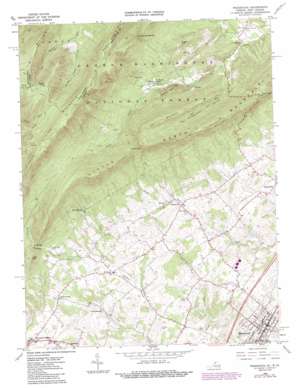
Woodstock Topo Map Virginia
To zoom in, hover over the map of Woodstock
USGS Topo Quad 38078h5 - 1:24,000 scale
| Topo Map Name: | Woodstock |
| USGS Topo Quad ID: | 38078h5 |
| Print Size: | ca. 21 1/4" wide x 27" high |
| Southeast Coordinates: | 38.875° N latitude / 78.5° W longitude |
| Map Center Coordinates: | 38.9375° N latitude / 78.5625° W longitude |
| U.S. States: | VA, WV |
| Filename: | o38078h5.jpg |
| Download Map JPG Image: | Woodstock topo map 1:24,000 scale |
| Map Type: | Topographic |
| Topo Series: | 7.5´ |
| Map Scale: | 1:24,000 |
| Source of Map Images: | United States Geological Survey (USGS) |
| Alternate Map Versions: |
Woodstock VA 1966, updated 1968 Download PDF Buy paper map Woodstock VA 1966, updated 1987 Download PDF Buy paper map Woodstock VA 1994, updated 1997 Download PDF Buy paper map Woodstock VA 2011 Download PDF Buy paper map Woodstock VA 2013 Download PDF Buy paper map Woodstock VA 2016 Download PDF Buy paper map |
| FStopo: | US Forest Service topo Woodstock is available: Download FStopo PDF Download FStopo TIF |
1:24,000 Topo Quads surrounding Woodstock
> Back to 38078e1 at 1:100,000 scale
> Back to 38078a1 at 1:250,000 scale
> Back to U.S. Topo Maps home
Woodstock topo map: Gazetteer
Woodstock: Gaps
Fetzer Gap elevation 573m 1879′Sheffer Gap elevation 614m 2014′
Stultz Gap elevation 407m 1335′
Sulphur Springs Gap elevation 576m 1889′
Woodstock: Populated Places
Alonzaville elevation 332m 1089′Coffmantown elevation 318m 1043′
Kern Springs elevation 435m 1427′
Saint Luke elevation 311m 1020′
Van Buren Furnace elevation 400m 1312′
Woodstock elevation 239m 784′
Woodstock: Post Offices
Woodstock Post Office elevation 243m 797′Woodstock: Streams
Cove Run elevation 345m 1131′Millers Run elevation 323m 1059′
Woodstock: Summits
Capola Mountain elevation 528m 1732′Little Mountain elevation 529m 1735′
Little Sluice Mountain elevation 948m 3110′
Little Sluice Mountain elevation 951m 3120′
Sugar Hill elevation 548m 1797′
Sugar Knob elevation 976m 3202′
Sugar Knob elevation 976m 3202′
Tea Mountain elevation 705m 2312′
Woodstock: Trails
Fetzer Gap Trail elevation 696m 2283′Little Sluice Mountain Trail elevation 802m 2631′
Peer Trail elevation 676m 2217′
Woodstock: Valleys
Mountain Hollow elevation 345m 1131′Racer Camp Hollow elevation 570m 1870′
Spring Hollow elevation 250m 820′
Tea Mountain Hollow elevation 421m 1381′
Woodstock digital topo map on disk
Buy this Woodstock topo map showing relief, roads, GPS coordinates and other geographical features, as a high-resolution digital map file on DVD:
Western Virginia & Southern West Virginia
Buy digital topo maps: Western Virginia & Southern West Virginia


