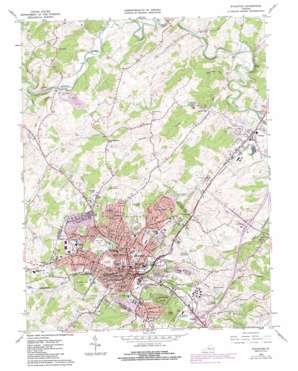
Staunton Topo Map Virginia
To zoom in, hover over the map of Staunton
USGS Topo Quad 38079b1 - 1:24,000 scale
| Topo Map Name: | Staunton |
| USGS Topo Quad ID: | 38079b1 |
| Print Size: | ca. 21 1/4" wide x 27" high |
| Southeast Coordinates: | 38.125° N latitude / 79° W longitude |
| Map Center Coordinates: | 38.1875° N latitude / 79.0625° W longitude |
| U.S. State: | VA |
| Filename: | o38079b1.jpg |
| Download Map JPG Image: | Staunton topo map 1:24,000 scale |
| Map Type: | Topographic |
| Topo Series: | 7.5´ |
| Map Scale: | 1:24,000 |
| Source of Map Images: | United States Geological Survey (USGS) |
| Alternate Map Versions: |
Staunton VA 1964, updated 1966 Download PDF Buy paper map Staunton VA 1964, updated 1968 Download PDF Buy paper map Staunton VA 1964, updated 1978 Download PDF Buy paper map Staunton VA 1964, updated 1986 Download PDF Buy paper map Staunton VA 1998, updated 2001 Download PDF Buy paper map Staunton VA 2010 Download PDF Buy paper map Staunton VA 2013 Download PDF Buy paper map Staunton VA 2016 Download PDF Buy paper map |
1:24,000 Topo Quads surrounding Staunton
> Back to 38079a1 at 1:100,000 scale
> Back to 38078a1 at 1:250,000 scale
> Back to U.S. Topo Maps home
Staunton topo map: Gazetteer
Staunton: Crossings
Interchange 222 elevation 425m 1394′Interchange 225 elevation 395m 1295′
Staunton: Parks
Betsy Bell Park elevation 598m 1961′Beverley Historic District elevation 423m 1387′
Gospel Hill Historic District elevation 449m 1473′
Gypsy Hill Park elevation 476m 1561′
Montgomery Hall Park elevation 490m 1607′
Newtown Historic District elevation 451m 1479′
Stuart Addition Historic District elevation 439m 1440′
Wharf Area Historic District elevation 435m 1427′
Wilson Park elevation 463m 1519′
Staunton: Populated Places
College Park elevation 470m 1541′Dogwood Hill elevation 454m 1489′
Franks Mill elevation 408m 1338′
Millbrook elevation 413m 1354′
Peyton elevation 438m 1437′
Plunkettsville elevation 482m 1581′
Quicks Mill elevation 417m 1368′
Selma elevation 462m 1515′
Skymont elevation 467m 1532′
Staunton elevation 432m 1417′
Staunton Park elevation 469m 1538′
Verona elevation 394m 1292′
West End elevation 443m 1453′
Woodlee elevation 455m 1492′
Staunton: Post Offices
Staunton Post Office elevation 441m 1446′Verona Post Office elevation 394m 1292′
Staunton: Reservoirs
Massie Pond elevation 421m 1381′Staunton: Streams
Asylum Creek elevation 460m 1509′Bell Creek elevation 414m 1358′
Falling Spring Run elevation 379m 1243′
Moffett Creek elevation 407m 1335′
Poague Run elevation 378m 1240′
Staunton: Summits
Bald Rock elevation 436m 1430′Betsey Bell elevation 593m 1945′
Huckleberry Hill elevation 522m 1712′
Mary Gray elevation 555m 1820′
Staunton: Valleys
Thackers Hollow elevation 377m 1236′Staunton digital topo map on disk
Buy this Staunton topo map showing relief, roads, GPS coordinates and other geographical features, as a high-resolution digital map file on DVD:
Western Virginia & Southern West Virginia
Buy digital topo maps: Western Virginia & Southern West Virginia


