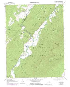
Williamsville Topo Map Virginia
To zoom in, hover over the map of Williamsville
USGS Topo Quad 38079b5 - 1:24,000 scale
| Topo Map Name: | Williamsville |
| USGS Topo Quad ID: | 38079b5 |
| Print Size: | ca. 21 1/4" wide x 27" high |
| Southeast Coordinates: | 38.125° N latitude / 79.5° W longitude |
| Map Center Coordinates: | 38.1875° N latitude / 79.5625° W longitude |
| U.S. State: | VA |
| Filename: | o38079b5.jpg |
| Download Map JPG Image: | Williamsville topo map 1:24,000 scale |
| Map Type: | Topographic |
| Topo Series: | 7.5´ |
| Map Scale: | 1:24,000 |
| Source of Map Images: | United States Geological Survey (USGS) |
| Alternate Map Versions: |
Williamsville VA 1969, updated 1971 Download PDF Buy paper map Williamsville VA 1969, updated 1988 Download PDF Buy paper map Williamsville VA 1969, updated 1988 Download PDF Buy paper map Williamsville VA 1999, updated 2000 Download PDF Buy paper map Williamsville VA 2011 Download PDF Buy paper map Williamsville VA 2013 Download PDF Buy paper map Williamsville VA 2016 Download PDF Buy paper map |
| FStopo: | US Forest Service topo Williamsville is available: Download FStopo PDF Download FStopo TIF |
1:24,000 Topo Quads surrounding Williamsville
> Back to 38079a1 at 1:100,000 scale
> Back to 38078a1 at 1:250,000 scale
> Back to U.S. Topo Maps home
Williamsville topo map: Gazetteer
Williamsville: Basins
Water Sinks elevation 597m 1958′Williamsville: Cliffs
Byrd Point elevation 597m 1958′Williamsville: Lakes
Browns Pond elevation 620m 2034′Persimmon Pond (historical) elevation 608m 1994′
Williamsville: Populated Places
Fort Lewis elevation 501m 1643′Patna elevation 519m 1702′
Williamsville elevation 493m 1617′
Williamsville: Ridges
Chesnut Ridge elevation 789m 2588′Shanty Ridge elevation 636m 2086′
Short Ridge elevation 953m 3126′
Williamsville: Streams
Brushy Fork elevation 514m 1686′Bullpasture River elevation 487m 1597′
Bullpasture River elevation 487m 1597′
Campbell Run elevation 467m 1532′
Hulit Draft elevation 536m 1758′
Mill Run elevation 528m 1732′
Pheasanty Run elevation 481m 1578′
Sinking Creek elevation 593m 1945′
Williamsville: Summits
Alum Rock elevation 550m 1804′Meadow Knob elevation 584m 1916′
North Sister Knob elevation 1002m 3287′
Northeast Peak elevation 1160m 3805′
Ratcliff Hill elevation 568m 1863′
Rock Hill elevation 600m 1968′
Round Hill elevation 742m 2434′
South Sister Knob elevation 942m 3090′
Sugarloaf Knob elevation 647m 2122′
Summers Mountain elevation 763m 2503′
Wallace Peak elevation 1151m 3776′
Williamsville: Trails
Hupman Valley Trail elevation 634m 2080′Jerkemtight Trail elevation 596m 1955′
Marshall Draft Trail elevation 668m 2191′
Williamsville: Valleys
Barracks Draft elevation 502m 1646′Buck Lick Hollow elevation 473m 1551′
Bullpasture Gorge elevation 495m 1624′
Foxtail Hollow elevation 459m 1505′
Knox Lick Draft elevation 507m 1663′
Lick Draft elevation 537m 1761′
Marshall Draft elevation 504m 1653′
McCrays Draft elevation 503m 1650′
Nelson Draft elevation 531m 1742′
Poplar Hollow elevation 463m 1519′
Rail Hollow elevation 473m 1551′
Scotchtown Draft elevation 466m 1528′
Slaty Lick Draft elevation 482m 1581′
Sugar Tree Draft elevation 530m 1738′
White Oak Draft elevation 515m 1689′
Wide Hollow elevation 475m 1558′
Wide Hollow elevation 525m 1722′
Williamsville digital topo map on disk
Buy this Williamsville topo map showing relief, roads, GPS coordinates and other geographical features, as a high-resolution digital map file on DVD:
Western Virginia & Southern West Virginia
Buy digital topo maps: Western Virginia & Southern West Virginia


