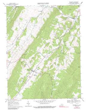
Monterey Topo Map Virginia
To zoom in, hover over the map of Monterey
USGS Topo Quad 38079d5 - 1:24,000 scale
| Topo Map Name: | Monterey |
| USGS Topo Quad ID: | 38079d5 |
| Print Size: | ca. 21 1/4" wide x 27" high |
| Southeast Coordinates: | 38.375° N latitude / 79.5° W longitude |
| Map Center Coordinates: | 38.4375° N latitude / 79.5625° W longitude |
| U.S. States: | VA, WV |
| Filename: | o38079d5.jpg |
| Download Map JPG Image: | Monterey topo map 1:24,000 scale |
| Map Type: | Topographic |
| Topo Series: | 7.5´ |
| Map Scale: | 1:24,000 |
| Source of Map Images: | United States Geological Survey (USGS) |
| Alternate Map Versions: |
Monterey VA 1969, updated 1971 Download PDF Buy paper map Monterey VA 1969, updated 1989 Download PDF Buy paper map Monterey VA 1969, updated 1989 Download PDF Buy paper map Monterey VA 1999, updated 2001 Download PDF Buy paper map Monterey VA 2011 Download PDF Buy paper map Monterey VA 2013 Download PDF Buy paper map Monterey VA 2016 Download PDF Buy paper map |
| FStopo: | US Forest Service topo Monterey is available: Download FStopo PDF Download FStopo TIF |
1:24,000 Topo Quads surrounding Monterey
> Back to 38079a1 at 1:100,000 scale
> Back to 38078a1 at 1:250,000 scale
> Back to U.S. Topo Maps home
Monterey topo map: Gazetteer
Monterey: Airports
Hannah Airfield elevation 927m 3041′Monterey: Populated Places
Monterey elevation 882m 2893′New Hampden elevation 792m 2598′
Possum Trot elevation 768m 2519′
Monterey: Ridges
Miracle Ridge elevation 1064m 3490′Monterey: Streams
Burners Run elevation 848m 2782′Elk Run elevation 757m 2483′
Frank Run elevation 780m 2559′
Key Run elevation 754m 2473′
Laurel Run elevation 766m 2513′
Peck Run elevation 728m 2388′
Simmons Run elevation 780m 2559′
Strait Creek elevation 705m 2312′
West Strait Creek elevation 779m 2555′
White Run elevation 819m 2687′
Wooden Run elevation 760m 2493′
Monterey: Summits
Barren Rock elevation 1335m 4379′Doe Hill elevation 1210m 3969′
Ginseng Mountain elevation 978m 3208′
Gulf Mountain elevation 1006m 3300′
Lantz Mountain elevation 1199m 3933′
Monterey Mountain elevation 1235m 4051′
Rich Hills elevation 1000m 3280′
Seybert Hills elevation 967m 3172′
Trimble Knob elevation 952m 3123′
Monterey: Valleys
Bluegrass Valley elevation 759m 2490′Monterey digital topo map on disk
Buy this Monterey topo map showing relief, roads, GPS coordinates and other geographical features, as a high-resolution digital map file on DVD:
Western Virginia & Southern West Virginia
Buy digital topo maps: Western Virginia & Southern West Virginia


