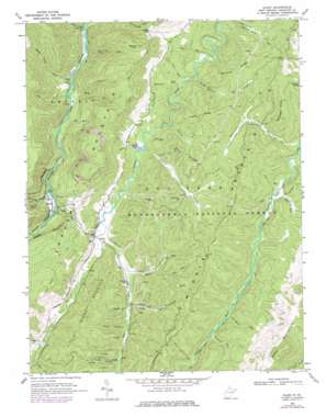
Glady Topo Map West Virginia
To zoom in, hover over the map of Glady
USGS Topo Quad 38079g6 - 1:24,000 scale
| Topo Map Name: | Glady |
| USGS Topo Quad ID: | 38079g6 |
| Print Size: | ca. 21 1/4" wide x 27" high |
| Southeast Coordinates: | 38.75° N latitude / 79.625° W longitude |
| Map Center Coordinates: | 38.8125° N latitude / 79.6875° W longitude |
| U.S. State: | WV |
| Filename: | o38079g6.jpg |
| Download Map JPG Image: | Glady topo map 1:24,000 scale |
| Map Type: | Topographic |
| Topo Series: | 7.5´ |
| Map Scale: | 1:24,000 |
| Source of Map Images: | United States Geological Survey (USGS) |
| Alternate Map Versions: |
Glady WV 1968, updated 1971 Download PDF Buy paper map Glady WV 1968, updated 1977 Download PDF Buy paper map Glady WV 1995, updated 1998 Download PDF Buy paper map Glady WV 2011 Download PDF Buy paper map Glady WV 2014 Download PDF Buy paper map Glady WV 2016 Download PDF Buy paper map |
| FStopo: | US Forest Service topo Glady is available: Download FStopo PDF Download FStopo TIF |
1:24,000 Topo Quads surrounding Glady
> Back to 38079e1 at 1:100,000 scale
> Back to 38078a1 at 1:250,000 scale
> Back to U.S. Topo Maps home
Glady topo map: Gazetteer
Glady: Gaps
Collett Gap elevation 963m 3159′Glady: Parks
Beaver Dam Wildlife Management Area elevation 1005m 3297′Glady: Populated Places
Bemis elevation 787m 2582′Flint elevation 736m 2414′
Glady elevation 872m 2860′
Montes (historical) elevation 739m 2424′
Wheeler (historical) elevation 876m 2874′
Glady: Post Offices
Glady Post Office elevation 872m 2860′Glady: Ridges
Beaverdam Ridge elevation 1059m 3474′Frazier Ridge elevation 1001m 3284′
McCray Ridge elevation 970m 3182′
Middle Mountain elevation 1122m 3681′
Panther Ridge elevation 1062m 3484′
Shavers Mountain elevation 1177m 3861′
Zinn Ridge elevation 930m 3051′
Glady: Springs
Montoncy Spring elevation 896m 2939′Pat Spring elevation 758m 2486′
William Harris Spring elevation 904m 2965′
Glady: Streams
Adamson Run elevation 908m 2979′Beaverdam Run elevation 870m 2854′
Bill White Run elevation 901m 2956′
Bonelick Branch elevation 748m 2454′
Carr Run elevation 878m 2880′
Coal Run elevation 742m 2434′
Daniels Creek elevation 856m 2808′
East Fork Glady Fork elevation 866m 2841′
Fishing Hawk Creek elevation 781m 2562′
Frazier Creek elevation 849m 2785′
Gap Run elevation 834m 2736′
Halfway Run elevation 842m 2762′
Louk Run elevation 895m 2936′
Lower Pond Lick elevation 714m 2342′
McCray Creek elevation 839m 2752′
Mud Run elevation 878m 2880′
Red Creek elevation 734m 2408′
Spicelick Run elevation 725m 2378′
Spruce Run elevation 857m 2811′
Upper Pond Lick elevation 733m 2404′
West Fork Glady Fork elevation 866m 2841′
White Run elevation 880m 2887′
Wolf Run elevation 732m 2401′
Glady: Summits
Little Beech Mountain elevation 1110m 3641′Spruce Knob elevation 1158m 3799′
Glady: Trails
Laurel Fork Trail elevation 913m 2995′Laurel Lick Run Trail elevation 859m 2818′
Laurel Lick Trail elevation 877m 2877′
McCray Creek Trail elevation 863m 2831′
Middle Mountain Trail elevation 973m 3192′
Stone Camp Run Trail elevation 922m 3024′
Zinn Ridge Trail elevation 1016m 3333′
Glady: Valleys
Camp Hollow elevation 931m 3054′Miller Hollow elevation 911m 2988′
Glady digital topo map on disk
Buy this Glady topo map showing relief, roads, GPS coordinates and other geographical features, as a high-resolution digital map file on DVD:
Western Virginia & Southern West Virginia
Buy digital topo maps: Western Virginia & Southern West Virginia


