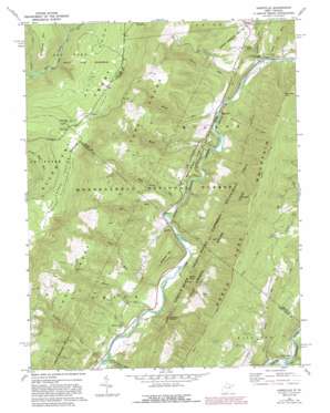
Hopeville Topo Map West Virginia
To zoom in, hover over the map of Hopeville
USGS Topo Quad 38079h3 - 1:24,000 scale
| Topo Map Name: | Hopeville |
| USGS Topo Quad ID: | 38079h3 |
| Print Size: | ca. 21 1/4" wide x 27" high |
| Southeast Coordinates: | 38.875° N latitude / 79.25° W longitude |
| Map Center Coordinates: | 38.9375° N latitude / 79.3125° W longitude |
| U.S. State: | WV |
| Filename: | o38079h3.jpg |
| Download Map JPG Image: | Hopeville topo map 1:24,000 scale |
| Map Type: | Topographic |
| Topo Series: | 7.5´ |
| Map Scale: | 1:24,000 |
| Source of Map Images: | United States Geological Survey (USGS) |
| Alternate Map Versions: |
Hopeville WV 1969, updated 1973 Download PDF Buy paper map Hopeville WV 1969, updated 1982 Download PDF Buy paper map Hopeville WV 1969, updated 1988 Download PDF Buy paper map Hopeville WV 1995, updated 1998 Download PDF Buy paper map Hopeville WV 2011 Download PDF Buy paper map Hopeville WV 2014 Download PDF Buy paper map Hopeville WV 2016 Download PDF Buy paper map |
| FStopo: | US Forest Service topo Hopeville is available: Download FStopo PDF Download FStopo TIF |
1:24,000 Topo Quads surrounding Hopeville
> Back to 38079e1 at 1:100,000 scale
> Back to 38078a1 at 1:250,000 scale
> Back to U.S. Topo Maps home
Hopeville topo map: Gazetteer
Hopeville: Flats
Red Creek Plains elevation 1226m 4022′Hopeville: Gaps
Hopeville Gap elevation 411m 1348′Hopeville: Parks
Dolly Sods Picnic Area elevation 1220m 4002′Spruce Knob-Seneca Rocks National Recreation Area elevation 896m 2939′
Hopeville: Pillars
Champe Rocks elevation 688m 2257′Chimney Top elevation 918m 3011′
Yellow Rocks elevation 639m 2096′
Hopeville: Populated Places
Hopeville elevation 353m 1158′Ketterman elevation 373m 1223′
Hopeville: Post Offices
Hopeville Post Office (historical) elevation 353m 1158′Hopeville: Ridges
Kimble Ridge elevation 750m 2460′Red Bud Ridge elevation 399m 1309′
Round Bottom Ridge elevation 491m 1610′
Shroud Ridge elevation 523m 1715′
Hopeville: Springs
Mill Spring elevation 374m 1227′Trout Rocks Spring elevation 395m 1295′
Hopeville: Streams
Big Run elevation 399m 1309′Broad Run elevation 350m 1148′
Fisher Spring Run elevation 941m 3087′
High Ridge Run elevation 385m 1263′
Jordan Run elevation 334m 1095′
Long Run elevation 372m 1220′
Mill Run elevation 390m 1279′
Moyer Run elevation 365m 1197′
Powdermill Run elevation 434m 1423′
Samuel Run elevation 348m 1141′
Sawmill Run elevation 431m 1414′
Shafter Run elevation 428m 1404′
Stonecoal Run elevation 851m 2791′
Tool Run elevation 395m 1295′
Zeke Run elevation 408m 1338′
Hopeville: Summits
Breathed Mountain elevation 1173m 3848′Champe Knobs elevation 630m 2066′
River Knob elevation 697m 2286′
Skidmore Mountain elevation 692m 2270′
Hopeville: Trails
Red Creek Trail elevation 895m 2936′Redman Trail elevation 786m 2578′
South Prong Trail elevation 1069m 3507′
Hopeville: Valleys
Long Hollow elevation 386m 1266′Hopeville digital topo map on disk
Buy this Hopeville topo map showing relief, roads, GPS coordinates and other geographical features, as a high-resolution digital map file on DVD:
Western Virginia & Southern West Virginia
Buy digital topo maps: Western Virginia & Southern West Virginia


