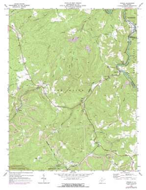
Winona Topo Map West Virginia
To zoom in, hover over the map of Winona
USGS Topo Quad 38080a8 - 1:24,000 scale
| Topo Map Name: | Winona |
| USGS Topo Quad ID: | 38080a8 |
| Print Size: | ca. 21 1/4" wide x 27" high |
| Southeast Coordinates: | 38° N latitude / 80.875° W longitude |
| Map Center Coordinates: | 38.0625° N latitude / 80.9375° W longitude |
| U.S. State: | WV |
| Filename: | o38080a8.jpg |
| Download Map JPG Image: | Winona topo map 1:24,000 scale |
| Map Type: | Topographic |
| Topo Series: | 7.5´ |
| Map Scale: | 1:24,000 |
| Source of Map Images: | United States Geological Survey (USGS) |
| Alternate Map Versions: |
Winona WV 1969, updated 1973 Download PDF Buy paper map Winona WV 1969, updated 1977 Download PDF Buy paper map Winona WV 2000, updated 2001 Download PDF Buy paper map Winona WV 2011 Download PDF Buy paper map Winona WV 2014 Download PDF Buy paper map Winona WV 2016 Download PDF Buy paper map |
1:24,000 Topo Quads surrounding Winona
> Back to 38080a1 at 1:100,000 scale
> Back to 38080a1 at 1:250,000 scale
> Back to U.S. Topo Maps home
Winona topo map: Gazetteer
Winona: Pillars
Spy Rock elevation 770m 2526′Winona: Populated Places
Babcock elevation 592m 1942′Clifftop elevation 701m 2299′
Divide elevation 721m 2365′
Dubree (historical) elevation 611m 2004′
Hilton Village elevation 792m 2598′
Lookout elevation 704m 2309′
Medo elevation 646m 2119′
Nallen elevation 576m 1889′
Ravenseye elevation 834m 2736′
Russellville elevation 580m 1902′
Spy Rock elevation 767m 2516′
Winona elevation 584m 1916′
Winona: Ridges
Crooked Ridge elevation 778m 2552′Hogpen Ridge elevation 769m 2522′
Miller Ridge elevation 706m 2316′
The Divide elevation 741m 2431′
Trace Ridge elevation 786m 2578′
Winona: Streams
Brackens Creek elevation 577m 1893′Fallrock Branch elevation 536m 1758′
Floyd Creek elevation 700m 2296′
Haynes Branch elevation 585m 1919′
Haynes Branch elevation 579m 1899′
Laurel Creek elevation 591m 1938′
Little Glade Creek elevation 612m 2007′
Road Fork elevation 621m 2037′
Spring Creek elevation 575m 1886′
Toms Branch elevation 574m 1883′
Youngs Creek elevation 573m 1879′
Winona: Summits
Betty Bell Knob elevation 747m 2450′Winona digital topo map on disk
Buy this Winona topo map showing relief, roads, GPS coordinates and other geographical features, as a high-resolution digital map file on DVD:
Western Virginia & Southern West Virginia
Buy digital topo maps: Western Virginia & Southern West Virginia


