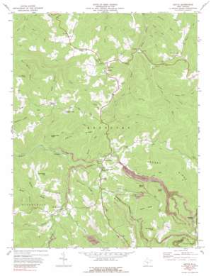
Nettie Topo Map West Virginia
To zoom in, hover over the map of Nettie
USGS Topo Quad 38080b6 - 1:24,000 scale
| Topo Map Name: | Nettie |
| USGS Topo Quad ID: | 38080b6 |
| Print Size: | ca. 21 1/4" wide x 27" high |
| Southeast Coordinates: | 38.125° N latitude / 80.625° W longitude |
| Map Center Coordinates: | 38.1875° N latitude / 80.6875° W longitude |
| U.S. State: | WV |
| Filename: | o38080b6.jpg |
| Download Map JPG Image: | Nettie topo map 1:24,000 scale |
| Map Type: | Topographic |
| Topo Series: | 7.5´ |
| Map Scale: | 1:24,000 |
| Source of Map Images: | United States Geological Survey (USGS) |
| Alternate Map Versions: |
Nettie WV 1972, updated 1974 Download PDF Buy paper map Nettie WV 1972, updated 1989 Download PDF Buy paper map Nettie WV 1995, updated 1998 Download PDF Buy paper map Nettie WV 2011 Download PDF Buy paper map Nettie WV 2014 Download PDF Buy paper map Nettie WV 2016 Download PDF Buy paper map |
| FStopo: | US Forest Service topo Nettie is available: Download FStopo PDF Download FStopo TIF |
1:24,000 Topo Quads surrounding Nettie
> Back to 38080a1 at 1:100,000 scale
> Back to 38080a1 at 1:250,000 scale
> Back to U.S. Topo Maps home
Nettie topo map: Gazetteer
Nettie: Gaps
Hughey Divide elevation 906m 2972′Nettie: Populated Places
Grassy Falls elevation 710m 2329′Hominy Falls elevation 715m 2345′
Leivasy elevation 711m 2332′
Nettie elevation 846m 2775′
Odell Town elevation 807m 2647′
Ophelia (historical) elevation 787m 2582′
Tolbert elevation 828m 2716′
Nettie: Post Offices
Nettie Post Office elevation 837m 2746′Nettie: Ridges
Barn Ridge elevation 800m 2624′Clements Divide elevation 810m 2657′
Davis Ridge elevation 818m 2683′
Grassy Ridge elevation 902m 2959′
Hurricane Ridge elevation 835m 2739′
Middle Ridge elevation 806m 2644′
Rocky Ridge elevation 930m 3051′
Nettie: Streams
Bowen Run elevation 654m 2145′Brushy Meadow Creek elevation 636m 2086′
Chestnut Lick Run elevation 715m 2345′
Conn Run elevation 653m 2142′
Cranes Nest Run elevation 732m 2401′
Geho Run elevation 636m 2086′
Grassy Creek elevation 684m 2244′
Holcomb Run elevation 619m 2030′
Jims Branch elevation 668m 2191′
Lick Run elevation 570m 1870′
Line Laurel Creek elevation 713m 2339′
Nettle Run elevation 719m 2358′
North Run elevation 688m 2257′
Odell Spring Branch elevation 574m 1883′
Packlets Creek elevation 689m 2260′
Riley Branch elevation 652m 2139′
Roaring Creek elevation 700m 2296′
Skelt Run elevation 567m 1860′
Sugar Branch elevation 716m 2349′
Nettie: Summits
Beech Knob elevation 886m 2906′Fury Knob elevation 790m 2591′
Laurel Knob elevation 922m 3024′
Potato Hole Knob elevation 783m 2568′
Short Back Hill elevation 869m 2851′
Thorny Knob elevation 878m 2880′
White Buck Knob elevation 987m 3238′
Nettie digital topo map on disk
Buy this Nettie topo map showing relief, roads, GPS coordinates and other geographical features, as a high-resolution digital map file on DVD:
Western Virginia & Southern West Virginia
Buy digital topo maps: Western Virginia & Southern West Virginia


