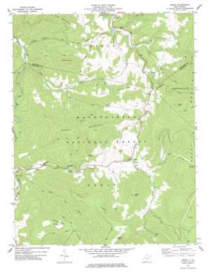
Mingo Topo Map West Virginia
To zoom in, hover over the map of Mingo
USGS Topo Quad 38080d1 - 1:24,000 scale
| Topo Map Name: | Mingo |
| USGS Topo Quad ID: | 38080d1 |
| Print Size: | ca. 21 1/4" wide x 27" high |
| Southeast Coordinates: | 38.375° N latitude / 80° W longitude |
| Map Center Coordinates: | 38.4375° N latitude / 80.0625° W longitude |
| U.S. State: | WV |
| Filename: | o38080d1.jpg |
| Download Map JPG Image: | Mingo topo map 1:24,000 scale |
| Map Type: | Topographic |
| Topo Series: | 7.5´ |
| Map Scale: | 1:24,000 |
| Source of Map Images: | United States Geological Survey (USGS) |
| Alternate Map Versions: |
Mingo WV 1977, updated 1977 Download PDF Buy paper map Mingo WV 1995, updated 1998 Download PDF Buy paper map Mingo WV 2011 Download PDF Buy paper map Mingo WV 2014 Download PDF Buy paper map Mingo WV 2016 Download PDF Buy paper map |
| FStopo: | US Forest Service topo Mingo is available: Download FStopo PDF Download FStopo TIF |
1:24,000 Topo Quads surrounding Mingo
> Back to 38080a1 at 1:100,000 scale
> Back to 38080a1 at 1:250,000 scale
> Back to U.S. Topo Maps home
Mingo topo map: Gazetteer
Mingo: Flats
Mingo Flats elevation 924m 3031′Mingo: Populated Places
Linwood elevation 899m 2949′Mace elevation 1035m 3395′
Mingo elevation 806m 2644′
Upper Mingo elevation 815m 2673′
Walnut elevation 948m 3110′
Mingo: Post Offices
Slatyfork Post Office elevation 831m 2726′Mingo: Ridges
Buzzard Ridge elevation 1239m 4064′Slaty Ridge elevation 1215m 3986′
Mingo: Springs
Beale Spring elevation 926m 3038′Big Spring elevation 898m 2946′
Charles Ware Spring elevation 936m 3070′
Colonel Samuel B Marshall Spring elevation 971m 3185′
Helen V Hannah Spring elevation 877m 2877′
Maude Crouch Spring elevation 933m 3061′
Troy Mace Spring elevation 1069m 3507′
Mingo: Streams
Blackhole Run elevation 766m 2513′Cup Run elevation 917m 3008′
Douglas Fork elevation 831m 2726′
Dry Fork elevation 761m 2496′
Falling Spring Run elevation 758m 2486′
Mill Run elevation 879m 2883′
Mingo Run elevation 816m 2677′
Slaty Fork elevation 826m 2709′
Mingo: Summits
Barlow Top elevation 1311m 4301′Gibson Knob elevation 1348m 4422′
Mace Knob elevation 1426m 4678′
Middle Mountain elevation 1339m 4393′
Mingo Knob elevation 1256m 4120′
Tallow Knob elevation 1234m 4048′
Valley Mountain elevation 1171m 3841′
Mingo digital topo map on disk
Buy this Mingo topo map showing relief, roads, GPS coordinates and other geographical features, as a high-resolution digital map file on DVD:
Western Virginia & Southern West Virginia
Buy digital topo maps: Western Virginia & Southern West Virginia


