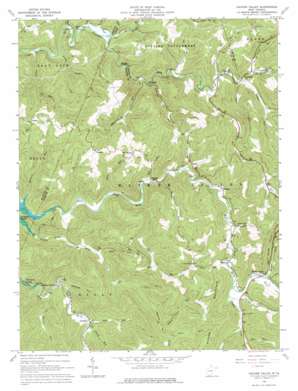
Hacker Valley Topo Map West Virginia
To zoom in, hover over the map of Hacker Valley
USGS Topo Quad 38080f4 - 1:24,000 scale
| Topo Map Name: | Hacker Valley |
| USGS Topo Quad ID: | 38080f4 |
| Print Size: | ca. 21 1/4" wide x 27" high |
| Southeast Coordinates: | 38.625° N latitude / 80.375° W longitude |
| Map Center Coordinates: | 38.6875° N latitude / 80.4375° W longitude |
| U.S. State: | WV |
| Filename: | o38080f4.jpg |
| Download Map JPG Image: | Hacker Valley topo map 1:24,000 scale |
| Map Type: | Topographic |
| Topo Series: | 7.5´ |
| Map Scale: | 1:24,000 |
| Source of Map Images: | United States Geological Survey (USGS) |
| Alternate Map Versions: |
Hacker Valley WV 1967, updated 1968 Download PDF Buy paper map Hacker Valley WV 1967, updated 1977 Download PDF Buy paper map Hacker Valley WV 2010 Download PDF Buy paper map Hacker Valley WV 2014 Download PDF Buy paper map Hacker Valley WV 2016 Download PDF Buy paper map |
1:24,000 Topo Quads surrounding Hacker Valley
> Back to 38080e1 at 1:100,000 scale
> Back to 38080a1 at 1:250,000 scale
> Back to U.S. Topo Maps home
Hacker Valley topo map: Gazetteer
Hacker Valley: Cliffs
Courthouse Rock elevation 367m 1204′Hanging Rock elevation 437m 1433′
Hacker Valley: Populated Places
Bois elevation 342m 1122′Cleveland elevation 389m 1276′
Fishers Crossing elevation 322m 1056′
Guardian elevation 332m 1089′
Hacker Valley elevation 457m 1499′
Poling elevation 372m 1220′
Pugh elevation 442m 1450′
Replete elevation 531m 1742′
Vernon elevation 480m 1574′
Wheeler elevation 427m 1400′
Wildcat (historical) elevation 299m 980′
Hacker Valley: Post Offices
Hacker Valley Post Office elevation 452m 1482′Hacker Valley: Streams
Amos Fork elevation 436m 1430′Andys Run elevation 343m 1125′
Bear Run elevation 476m 1561′
Bear Run elevation 336m 1102′
Bear Run elevation 358m 1174′
Beaver Run elevation 333m 1092′
Blaze Fork elevation 346m 1135′
Buffalo Run elevation 385m 1263′
Dry Run elevation 459m 1505′
Flat Run elevation 376m 1233′
Hacker Lick Run elevation 448m 1469′
Highbank Run elevation 323m 1059′
Hodam Creek elevation 444m 1456′
Honey Camp Run elevation 391m 1282′
Jerry Run elevation 367m 1204′
Kelly Run elevation 332m 1089′
Laurel Fork elevation 457m 1499′
Laurel Run elevation 275m 902′
Left Fork Laurel Run elevation 313m 1026′
Little Laurel Run elevation 281m 921′
Long Run elevation 348m 1141′
Mudlick Run elevation 297m 974′
Narrows Run elevation 319m 1046′
Negro Camp Run elevation 420m 1377′
Panther Lick Run elevation 424m 1391′
Papaw Run elevation 279m 915′
Potts Run elevation 365m 1197′
Pretty Run elevation 287m 941′
Radabaugh Run elevation 384m 1259′
Right Fork Little Kanawha River elevation 288m 944′
Short Run elevation 384m 1259′
Threelick Run elevation 318m 1043′
Tobacco Run elevation 297m 974′
Williams Camp Run elevation 328m 1076′
Hacker Valley: Valleys
Ice Hollow elevation 300m 984′Hacker Valley digital topo map on disk
Buy this Hacker Valley topo map showing relief, roads, GPS coordinates and other geographical features, as a high-resolution digital map file on DVD:
Western Virginia & Southern West Virginia
Buy digital topo maps: Western Virginia & Southern West Virginia


