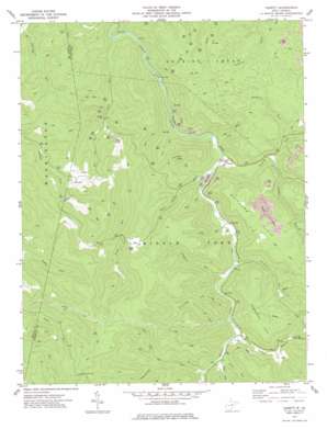
Cassity Topo Map West Virginia
To zoom in, hover over the map of Cassity
USGS Topo Quad 38080g1 - 1:24,000 scale
| Topo Map Name: | Cassity |
| USGS Topo Quad ID: | 38080g1 |
| Print Size: | ca. 21 1/4" wide x 27" high |
| Southeast Coordinates: | 38.75° N latitude / 80° W longitude |
| Map Center Coordinates: | 38.8125° N latitude / 80.0625° W longitude |
| U.S. State: | WV |
| Filename: | o38080g1.jpg |
| Download Map JPG Image: | Cassity topo map 1:24,000 scale |
| Map Type: | Topographic |
| Topo Series: | 7.5´ |
| Map Scale: | 1:24,000 |
| Source of Map Images: | United States Geological Survey (USGS) |
| Alternate Map Versions: |
Cassity WV 1977, updated 1977 Download PDF Buy paper map Cassity WV 2010 Download PDF Buy paper map Cassity WV 2014 Download PDF Buy paper map Cassity WV 2016 Download PDF Buy paper map |
1:24,000 Topo Quads surrounding Cassity
> Back to 38080e1 at 1:100,000 scale
> Back to 38080a1 at 1:250,000 scale
> Back to U.S. Topo Maps home
Cassity topo map: Gazetteer
Cassity: Flats
Cranberry Flat elevation 868m 2847′Whitman Flats elevation 807m 2647′
Cassity: Gaps
See Camp Gap elevation 997m 3270′Cassity: Populated Places
Cassity elevation 618m 2027′Cubana elevation 738m 2421′
Huff (historical) elevation 862m 2828′
Loda elevation 717m 2352′
Cassity: Streams
Birch Fork elevation 744m 2440′Cassity Fork elevation 613m 2011′
Hierr Lick Run elevation 612m 2007′
Laurel Branch elevation 675m 2214′
Laurel Run elevation 666m 2185′
Lick Run elevation 609m 1998′
Long Run elevation 573m 1879′
Lost Run elevation 601m 1971′
Mulberry Fork elevation 661m 2168′
Panther Run elevation 641m 2103′
Pleasant Run elevation 652m 2139′
Rough Run elevation 576m 1889′
Schoolcraft Run elevation 692m 2270′
Spice Run elevation 685m 2247′
Stonecoal Run elevation 643m 2109′
Sugar Run elevation 634m 2080′
Sugar Run elevation 689m 2260′
Three Forks Run elevation 617m 2024′
Cassity: Summits
Bear Knob elevation 869m 2851′Kelly Knob elevation 867m 2844′
Kelly Knob elevation 813m 2667′
Long Run Hill elevation 876m 2874′
Cassity digital topo map on disk
Buy this Cassity topo map showing relief, roads, GPS coordinates and other geographical features, as a high-resolution digital map file on DVD:
Western Virginia & Southern West Virginia
Buy digital topo maps: Western Virginia & Southern West Virginia


