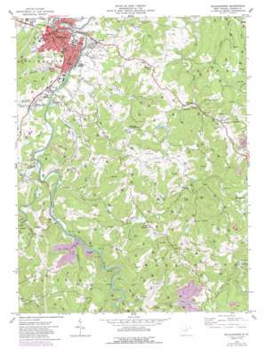
Buckhannon Topo Map West Virginia
To zoom in, hover over the map of Buckhannon
USGS Topo Quad 38080h2 - 1:24,000 scale
| Topo Map Name: | Buckhannon |
| USGS Topo Quad ID: | 38080h2 |
| Print Size: | ca. 21 1/4" wide x 27" high |
| Southeast Coordinates: | 38.875° N latitude / 80.125° W longitude |
| Map Center Coordinates: | 38.9375° N latitude / 80.1875° W longitude |
| U.S. State: | WV |
| Filename: | o38080h2.jpg |
| Download Map JPG Image: | Buckhannon topo map 1:24,000 scale |
| Map Type: | Topographic |
| Topo Series: | 7.5´ |
| Map Scale: | 1:24,000 |
| Source of Map Images: | United States Geological Survey (USGS) |
| Alternate Map Versions: |
Buckhannon WV 1974, updated 1989 Download PDF Buy paper map Buckhannon WV 1977, updated 1977 Download PDF Buy paper map Buckhannon WV 2011 Download PDF Buy paper map Buckhannon WV 2014 Download PDF Buy paper map Buckhannon WV 2016 Download PDF Buy paper map |
1:24,000 Topo Quads surrounding Buckhannon
> Back to 38080e1 at 1:100,000 scale
> Back to 38080a1 at 1:250,000 scale
> Back to U.S. Topo Maps home
Buckhannon topo map: Gazetteer
Buckhannon: Dams
Renny Halls Farm Pond Dam elevation 504m 1653′Ten Mile Creek Dam elevation 658m 2158′
Buckhannon: Parks
North End Youth Center elevation 431m 1414′Buckhannon: Populated Places
Buckhannon elevation 436m 1430′Daysville elevation 489m 1604′
Deanville elevation 440m 1443′
Excelsior elevation 516m 1692′
Goodwin elevation 512m 1679′
Hampton elevation 443m 1453′
Heavener Grove elevation 520m 1706′
Heavner (historical) elevation 436m 1430′
Ivy elevation 515m 1689′
Kedron elevation 561m 1840′
Overhill elevation 474m 1555′
Reger elevation 493m 1617′
Sago elevation 438m 1437′
South Buckhannon elevation 437m 1433′
Tallmansville elevation 510m 1673′
Tennerton elevation 449m 1473′
Buckhannon: Post Offices
Buckhannon Post Office elevation 433m 1420′Tallmansville Post Office elevation 514m 1686′
Buckhannon: Springs
Daysville School Spring elevation 500m 1640′Excelsior School Spring elevation 581m 1906′
Holly Inn Spring elevation 574m 1883′
Tallmansville Spring elevation 541m 1774′
Buckhannon: Streams
Beech Run elevation 479m 1571′Cutright Run elevation 433m 1420′
Fink Run elevation 430m 1410′
French Creek elevation 430m 1410′
Grassy Run elevation 442m 1450′
Gravel Run elevation 464m 1522′
Hickory Flat Run elevation 430m 1410′
Jawbone Run elevation 426m 1397′
Laurel Run elevation 479m 1571′
Laurel Run elevation 562m 1843′
Left Fork Little Sand Run elevation 431m 1414′
Left Fork Sand Run elevation 470m 1541′
Little Laurel Run elevation 472m 1548′
Little Sand Run elevation 429m 1407′
Middle Fork Laurel Fork Sand Run elevation 481m 1578′
Ratcliff Run elevation 433m 1420′
Sawmill Run elevation 438m 1437′
Sharps Run elevation 481m 1578′
Stony Run elevation 430m 1410′
Tenmile Creek elevation 525m 1722′
Trubie Run elevation 430m 1410′
Buckhannon digital topo map on disk
Buy this Buckhannon topo map showing relief, roads, GPS coordinates and other geographical features, as a high-resolution digital map file on DVD:
Western Virginia & Southern West Virginia
Buy digital topo maps: Western Virginia & Southern West Virginia


