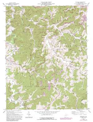
Roanoke Topo Map West Virginia
To zoom in, hover over the map of Roanoke
USGS Topo Quad 38080h4 - 1:24,000 scale
| Topo Map Name: | Roanoke |
| USGS Topo Quad ID: | 38080h4 |
| Print Size: | ca. 21 1/4" wide x 27" high |
| Southeast Coordinates: | 38.875° N latitude / 80.375° W longitude |
| Map Center Coordinates: | 38.9375° N latitude / 80.4375° W longitude |
| U.S. State: | WV |
| Filename: | o38080h4.jpg |
| Download Map JPG Image: | Roanoke topo map 1:24,000 scale |
| Map Type: | Topographic |
| Topo Series: | 7.5´ |
| Map Scale: | 1:24,000 |
| Source of Map Images: | United States Geological Survey (USGS) |
| Alternate Map Versions: |
Roanoke WV 1966, updated 1968 Download PDF Buy paper map Roanoke WV 1966, updated 1979 Download PDF Buy paper map Roanoke WV 1966, updated 1989 Download PDF Buy paper map Roanoke WV 2010 Download PDF Buy paper map Roanoke WV 2014 Download PDF Buy paper map Roanoke WV 2016 Download PDF Buy paper map |
1:24,000 Topo Quads surrounding Roanoke
> Back to 38080e1 at 1:100,000 scale
> Back to 38080a1 at 1:250,000 scale
> Back to U.S. Topo Maps home
Roanoke topo map: Gazetteer
Roanoke: Dams
Stonecoal Creek Dam elevation 333m 1092′Roanoke: Parks
Stonewall Jackson Lake State Park elevation 344m 1128′Stonewall Jackson Lake Wildlife Management Area elevation 345m 1131′
Roanoke: Populated Places
Alkires Mills elevation 327m 1072′Emmart elevation 329m 1079′
Georgetown elevation 334m 1095′
Jacksonville elevation 329m 1079′
Roanoke elevation 327m 1072′
Rohrbough elevation 327m 1072′
Vandalia elevation 331m 1085′
Roanoke: Reservoirs
Stonecoal Reservoir elevation 339m 1112′Roanoke: Streams
Abrams Run elevation 327m 1072′Aquilla Run elevation 328m 1076′
Blacklick Run elevation 327m 1072′
Canoe Run elevation 327m 1072′
Cap Run elevation 327m 1072′
Carrion Run elevation 327m 1072′
Charles Run elevation 327m 1072′
Crooked Run elevation 327m 1072′
Curtis Run elevation 327m 1072′
Dunkin Run elevation 328m 1076′
Fitz Run elevation 328m 1076′
Glady Fork elevation 327m 1072′
Hershman Run elevation 329m 1079′
Hughes Fork elevation 327m 1072′
Keith Fork elevation 328m 1076′
Linger Run elevation 327m 1072′
Little Skin Creek elevation 327m 1072′
Millstone Run elevation 327m 1072′
Mudlick Run elevation 327m 1072′
Pen Run elevation 327m 1072′
Peters Lick Run elevation 327m 1072′
Poplar Lick Run elevation 327m 1072′
Ranges Run elevation 327m 1072′
Right Fork Stonecoal Creek elevation 319m 1046′
Sammy Run elevation 330m 1082′
Sand Fork elevation 327m 1072′
Skin Creek elevation 327m 1072′
Stonelick Run elevation 327m 1072′
Straight Fork elevation 327m 1072′
Toms Run elevation 329m 1079′
Ward Run elevation 328m 1076′
Wheeler Fork elevation 330m 1082′
White Oak Lick Run elevation 327m 1072′
Wildcat Run elevation 333m 1092′
Wolf Fork elevation 327m 1072′
Wolf Run elevation 329m 1079′
Roanoke: Summits
Bald Knob elevation 526m 1725′Pine Knob elevation 497m 1630′
Wilson Knob elevation 546m 1791′
Wolf Fork Mountain elevation 517m 1696′
Roanoke: Valleys
Camden Hollow elevation 333m 1092′Coal Hollow elevation 327m 1072′
Hog Hollow elevation 327m 1072′
Rohrbough Hollow elevation 327m 1072′
Roanoke digital topo map on disk
Buy this Roanoke topo map showing relief, roads, GPS coordinates and other geographical features, as a high-resolution digital map file on DVD:
Western Virginia & Southern West Virginia
Buy digital topo maps: Western Virginia & Southern West Virginia


