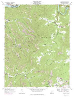
Beckwith Topo Map West Virginia
To zoom in, hover over the map of Beckwith
USGS Topo Quad 38081a2 - 1:24,000 scale
| Topo Map Name: | Beckwith |
| USGS Topo Quad ID: | 38081a2 |
| Print Size: | ca. 21 1/4" wide x 27" high |
| Southeast Coordinates: | 38° N latitude / 81.125° W longitude |
| Map Center Coordinates: | 38.0625° N latitude / 81.1875° W longitude |
| U.S. State: | WV |
| Filename: | o38081a2.jpg |
| Download Map JPG Image: | Beckwith topo map 1:24,000 scale |
| Map Type: | Topographic |
| Topo Series: | 7.5´ |
| Map Scale: | 1:24,000 |
| Source of Map Images: | United States Geological Survey (USGS) |
| Alternate Map Versions: |
Beckwith WV 1969, updated 1972 Download PDF Buy paper map Beckwith WV 1969, updated 1977 Download PDF Buy paper map Beckwith WV 2011 Download PDF Buy paper map Beckwith WV 2014 Download PDF Buy paper map Beckwith WV 2016 Download PDF Buy paper map |
1:24,000 Topo Quads surrounding Beckwith
> Back to 38081a1 at 1:100,000 scale
> Back to 38080a1 at 1:250,000 scale
> Back to U.S. Topo Maps home
Beckwith topo map: Gazetteer
Beckwith: Dams
Gauley Junction Dam elevation 234m 767′Beckwith: Populated Places
Beards Fork elevation 382m 1253′Beckwith elevation 363m 1190′
Charlton Heights elevation 202m 662′
Cotton Hill elevation 244m 800′
Dempsey elevation 408m 1338′
Hamilton (historical) elevation 401m 1315′
Ingram Branch elevation 404m 1325′
Lick Fork elevation 473m 1551′
Lochgelly elevation 592m 1942′
Midway elevation 583m 1912′
Robson elevation 267m 875′
Summerlee elevation 610m 2001′
Wriston elevation 459m 1505′
Youngstown elevation 416m 1364′
Beckwith: Reservoirs
Hawk Lake elevation 234m 767′Beckwith: Springs
Summerlee Spring elevation 613m 2011′Beckwith: Streams
Beards Fork elevation 281m 921′Carter Branch elevation 435m 1427′
Carter Branch elevation 427m 1400′
Cassidy Branch elevation 397m 1302′
Coalmans Branch elevation 394m 1292′
Coleman Branch elevation 315m 1033′
Dempsey Branch elevation 266m 872′
Dempsey Branch elevation 406m 1332′
Hamilton Branch elevation 401m 1315′
Jenkins Branch elevation 358m 1174′
Laurel Creek elevation 229m 751′
Lick Fork elevation 471m 1545′
Mulberry Fork elevation 294m 964′
Open Fork elevation 412m 1351′
Orchard Branch elevation 392m 1286′
Paddy Branch elevation 187m 613′
Right Fork Beards Fork elevation 378m 1240′
Seng Branch elevation 390m 1279′
Sugar Branch elevation 459m 1505′
Sugar Creek elevation 381m 1250′
Sugarcamp Branch elevation 377m 1236′
Taylor Branch elevation 430m 1410′
Turkey Creek elevation 253m 830′
White Oak Fork elevation 455m 1492′
Wilson Branch elevation 374m 1227′
Beckwith: Summits
Big Rock elevation 758m 2486′Cotton Hill elevation 628m 2060′
Ford Knob elevation 844m 2769′
Beckwith digital topo map on disk
Buy this Beckwith topo map showing relief, roads, GPS coordinates and other geographical features, as a high-resolution digital map file on DVD:
Western Virginia & Southern West Virginia
Buy digital topo maps: Western Virginia & Southern West Virginia


