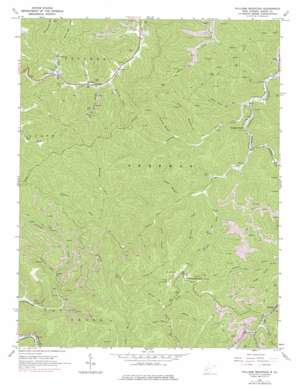
Williams Mountain Topo Map West Virginia
To zoom in, hover over the map of Williams Mountain
USGS Topo Quad 38081a6 - 1:24,000 scale
| Topo Map Name: | Williams Mountain |
| USGS Topo Quad ID: | 38081a6 |
| Print Size: | ca. 21 1/4" wide x 27" high |
| Southeast Coordinates: | 38° N latitude / 81.625° W longitude |
| Map Center Coordinates: | 38.0625° N latitude / 81.6875° W longitude |
| U.S. State: | WV |
| Filename: | o38081a6.jpg |
| Download Map JPG Image: | Williams Mountain topo map 1:24,000 scale |
| Map Type: | Topographic |
| Topo Series: | 7.5´ |
| Map Scale: | 1:24,000 |
| Source of Map Images: | United States Geological Survey (USGS) |
| Alternate Map Versions: |
Williams Mountain WV 1965, updated 1966 Download PDF Buy paper map Williams Mountain WV 1965, updated 1975 Download PDF Buy paper map Williams Mountain WV 1965, updated 1977 Download PDF Buy paper map Williams Mountain WV 1996, updated 2003 Download PDF Buy paper map Williams Mountain WV 2011 Download PDF Buy paper map Williams Mountain WV 2014 Download PDF Buy paper map Williams Mountain WV 2016 Download PDF Buy paper map |
1:24,000 Topo Quads surrounding Williams Mountain
> Back to 38081a1 at 1:100,000 scale
> Back to 38080a1 at 1:250,000 scale
> Back to U.S. Topo Maps home
Williams Mountain topo map: Gazetteer
Williams Mountain: Dams
Lotts Branch Slurry Impoundment Dam elevation 449m 1473′Road Fork Dam Number 1 Upper elevation 406m 1332′
Road Fork Dam Number 2 Lower elevation 274m 898′
Williams Mountain: Populated Places
Andrew elevation 264m 866′Hopkins Fork elevation 220m 721′
Prenter elevation 295m 967′
Sterling (historical) elevation 232m 761′
Williams Mountain elevation 522m 1712′
Williams Mountain: Post Offices
Prenter Post Office elevation 300m 984′Seth Post Office elevation 225m 738′
Williams Mountain Post Office elevation 505m 1656′
Williams Mountain: Reservoirs
Big Mountain Slurry Pond elevation 449m 1473′Chesterfield Mine Siltation Pond elevation 406m 1332′
Williams Mountain: Streams
Bennett Fork elevation 289m 948′Burnside Branch elevation 254m 833′
Cabin Fork elevation 263m 862′
Chrisley Fork elevation 249m 816′
Cold Fork elevation 246m 807′
Dolans Fork elevation 338m 1108′
George Branch elevation 255m 836′
Hopkins Fork elevation 223m 731′
Laurel Branch elevation 262m 859′
Little Jarrells Creek elevation 307m 1007′
Little Laurel Creek elevation 308m 1010′
Long Branch elevation 255m 836′
Lots Branch elevation 300m 984′
Lots Branch elevation 322m 1056′
Morgan Branch elevation 258m 846′
Mudlick Fork elevation 319m 1046′
Orchard Branch elevation 281m 921′
Potato Branch elevation 275m 902′
Ruffys Fork elevation 356m 1167′
Sandlick Creek elevation 214m 702′
Stolling Fork elevation 319m 1046′
Three Fork Branch elevation 227m 744′
Toney Fork elevation 278m 912′
Williams Mountain: Valleys
Frozen Hollow elevation 294m 964′Horse Hollow elevation 362m 1187′
Low Point Hollow elevation 336m 1102′
Williams Mountain digital topo map on disk
Buy this Williams Mountain topo map showing relief, roads, GPS coordinates and other geographical features, as a high-resolution digital map file on DVD:
Western Virginia & Southern West Virginia
Buy digital topo maps: Western Virginia & Southern West Virginia


