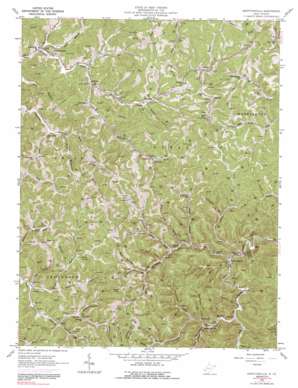
Griffithsville Topo Map West Virginia
To zoom in, hover over the map of Griffithsville
USGS Topo Quad 38081b8 - 1:24,000 scale
| Topo Map Name: | Griffithsville |
| USGS Topo Quad ID: | 38081b8 |
| Print Size: | ca. 21 1/4" wide x 27" high |
| Southeast Coordinates: | 38.125° N latitude / 81.875° W longitude |
| Map Center Coordinates: | 38.1875° N latitude / 81.9375° W longitude |
| U.S. State: | WV |
| Filename: | o38081b8.jpg |
| Download Map JPG Image: | Griffithsville topo map 1:24,000 scale |
| Map Type: | Topographic |
| Topo Series: | 7.5´ |
| Map Scale: | 1:24,000 |
| Source of Map Images: | United States Geological Survey (USGS) |
| Alternate Map Versions: |
Griffithsville WV 1962, updated 1964 Download PDF Buy paper map Griffithsville WV 1962, updated 1973 Download PDF Buy paper map Griffithsville WV 1962, updated 1991 Download PDF Buy paper map Griffithsville WV 2011 Download PDF Buy paper map Griffithsville WV 2014 Download PDF Buy paper map Griffithsville WV 2016 Download PDF Buy paper map |
1:24,000 Topo Quads surrounding Griffithsville
> Back to 38081a1 at 1:100,000 scale
> Back to 38080a1 at 1:250,000 scale
> Back to U.S. Topo Maps home
Griffithsville topo map: Gazetteer
Griffithsville: Populated Places
Alkol elevation 228m 748′Breece elevation 233m 764′
Bulger elevation 245m 803′
Dodson Junction elevation 230m 754′
East (historical) elevation 233m 764′
Fork Junction elevation 211m 692′
Griffithsville elevation 201m 659′
Layville elevation 262m 859′
Morrisvale elevation 235m 770′
Snowden elevation 239m 784′
Sod elevation 238m 780′
Sumerco elevation 369m 1210′
Summit elevation 346m 1135′
Woodville elevation 207m 679′
Yawkey elevation 227m 744′
Griffithsville: Post Offices
Alkol Post Office elevation 230m 754′Griffithsville Post Office elevation 205m 672′
Sumerco Post Office elevation 349m 1145′
Woodville Post Office elevation 216m 708′
Yawkey Post Office elevation 206m 675′
Griffithsville: Streams
Barkcamp Branch elevation 256m 839′Bear Branch elevation 207m 679′
Bear Fork elevation 207m 679′
Big Branch elevation 222m 728′
Brushy Fork elevation 222m 728′
Dodson Fork elevation 219m 718′
Dogbone Branch elevation 247m 810′
Flat Creek elevation 243m 797′
Jack Smith Branch elevation 231m 757′
Laurel Fork elevation 204m 669′
Long Branch elevation 227m 744′
Maul Fork elevation 228m 748′
Milk Branch elevation 250m 820′
Old House Branch elevation 212m 695′
Old House Branch elevation 233m 764′
Owl Creek elevation 260m 853′
Peters Cave Fork elevation 208m 682′
Porter Fork elevation 208m 682′
Rock Branch elevation 212m 695′
Sams Branch elevation 202m 662′
Sand Fork elevation 210m 688′
Spring Branch elevation 217m 711′
Sugarcamp Branch elevation 233m 764′
Sulphur Spring Fork elevation 230m 754′
Sycamore Fork elevation 233m 764′
Tackett Fork elevation 240m 787′
Turkeypen Run elevation 228m 748′
Valley Fork elevation 203m 666′
Wolpen Branch elevation 264m 866′
Griffithsville: Summits
Blue Knob elevation 420m 1377′Buck Knob elevation 412m 1351′
Griffithsville: Valleys
Charley Hollow elevation 236m 774′Coon Hollow elevation 269m 882′
Gritter Hollow elevation 279m 915′
Jack Hollow elevation 270m 885′
McClure Hollow elevation 225m 738′
Meadows Hollow elevation 243m 797′
Pigpen Hollow elevation 262m 859′
Rattlesnake Hollow elevation 239m 784′
Ryan Hollow elevation 243m 797′
Saw Pit Hollow elevation 279m 915′
Wolfden Hollow elevation 256m 839′
Griffithsville digital topo map on disk
Buy this Griffithsville topo map showing relief, roads, GPS coordinates and other geographical features, as a high-resolution digital map file on DVD:
Western Virginia & Southern West Virginia
Buy digital topo maps: Western Virginia & Southern West Virginia


