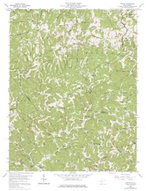
Kettle Topo Map West Virginia
To zoom in, hover over the map of Kettle
USGS Topo Quad 38081e4 - 1:24,000 scale
| Topo Map Name: | Kettle |
| USGS Topo Quad ID: | 38081e4 |
| Print Size: | ca. 21 1/4" wide x 27" high |
| Southeast Coordinates: | 38.5° N latitude / 81.375° W longitude |
| Map Center Coordinates: | 38.5625° N latitude / 81.4375° W longitude |
| U.S. State: | WV |
| Filename: | o38081e4.jpg |
| Download Map JPG Image: | Kettle topo map 1:24,000 scale |
| Map Type: | Topographic |
| Topo Series: | 7.5´ |
| Map Scale: | 1:24,000 |
| Source of Map Images: | United States Geological Survey (USGS) |
| Alternate Map Versions: |
Kettle WV 1958, updated 1959 Download PDF Buy paper map Kettle WV 1958, updated 1967 Download PDF Buy paper map Kettle WV 1958, updated 1976 Download PDF Buy paper map Kettle WV 2011 Download PDF Buy paper map Kettle WV 2014 Download PDF Buy paper map Kettle WV 2016 Download PDF Buy paper map |
1:24,000 Topo Quads surrounding Kettle
> Back to 38081e1 at 1:100,000 scale
> Back to 38080a1 at 1:250,000 scale
> Back to U.S. Topo Maps home
Kettle topo map: Gazetteer
Kettle: Gaps
Mattie Gap elevation 291m 954′Kettle: Oilfields
Green Creek Oil Field elevation 254m 833′McKown Creek Oil Field elevation 298m 977′
Rock Creek Oil Field elevation 279m 915′
Kettle: Populated Places
Doddtown elevation 335m 1099′Frame elevation 207m 679′
Kettle elevation 205m 672′
Mattie (historical) elevation 328m 1076′
Mount Hope elevation 325m 1066′
Mount Welcome elevation 328m 1076′
Kettle: Ridges
Ambler Ridge elevation 344m 1128′Dry Ridge elevation 356m 1167′
Long Ridge elevation 341m 1118′
Lynch Ridge elevation 326m 1069′
Paxton Ridge elevation 338m 1108′
Pigeonroost Ridge elevation 344m 1128′
Robinson Ridge elevation 324m 1062′
Kettle: Streams
Anderson Lick Run elevation 239m 784′Bear Branch elevation 216m 708′
Big Fork elevation 203m 666′
Campbell Branch elevation 246m 807′
Coleman Fork elevation 209m 685′
Hunt Fork elevation 219m 718′
Hurricane Branch elevation 217m 711′
Jakes Run elevation 202m 662′
Johns Fork elevation 216m 708′
July Run elevation 210m 688′
Laurel Fork elevation 221m 725′
Left Fork Green Creek elevation 207m 679′
Left Hand Run elevation 221m 725′
Long Fork elevation 232m 761′
Lynncamp Run elevation 234m 767′
Patterson Fork elevation 233m 764′
Poca Fork elevation 201m 659′
Robinson Run elevation 223m 731′
Rocky Fork elevation 209m 685′
Rucker Fork elevation 210m 688′
Ruffner Fork elevation 199m 652′
Rush Fork elevation 215m 705′
Simons Branch elevation 227m 744′
Trace Fork elevation 216m 708′
Trail Branch elevation 226m 741′
Upper July Run elevation 212m 695′
Whipple Run elevation 322m 1056′
Wolf Creek elevation 204m 669′
Kettle: Summits
Campbell Hill elevation 397m 1302′Frail Knob elevation 347m 1138′
Gunstock Knob elevation 387m 1269′
Kettle: Valleys
Big Hollow elevation 226m 741′Campbell Hollow elevation 209m 685′
Canterbury Hollow elevation 213m 698′
Clint Hollow elevation 233m 764′
Harper Hollow elevation 218m 715′
Long Hollow elevation 227m 744′
Ramsey Hollow elevation 241m 790′
Smith Hollow elevation 211m 692′
Stump Hollow elevation 215m 705′
Kettle digital topo map on disk
Buy this Kettle topo map showing relief, roads, GPS coordinates and other geographical features, as a high-resolution digital map file on DVD:
Western Virginia & Southern West Virginia
Buy digital topo maps: Western Virginia & Southern West Virginia


