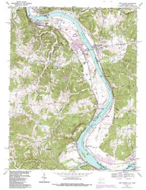
New Haven Topo Map West Virginia
To zoom in, hover over the map of New Haven
USGS Topo Quad 38081h8 - 1:24,000 scale
| Topo Map Name: | New Haven |
| USGS Topo Quad ID: | 38081h8 |
| Print Size: | ca. 21 1/4" wide x 27" high |
| Southeast Coordinates: | 38.875° N latitude / 81.875° W longitude |
| Map Center Coordinates: | 38.9375° N latitude / 81.9375° W longitude |
| U.S. States: | WV, OH |
| Filename: | o38081h8.jpg |
| Download Map JPG Image: | New Haven topo map 1:24,000 scale |
| Map Type: | Topographic |
| Topo Series: | 7.5´ |
| Map Scale: | 1:24,000 |
| Source of Map Images: | United States Geological Survey (USGS) |
| Alternate Map Versions: |
New Haven WV 1958, updated 1960 Download PDF Buy paper map New Haven WV 1968, updated 1969 Download PDF Buy paper map New Haven WV 1968, updated 1976 Download PDF Buy paper map New Haven WV 1968, updated 1987 Download PDF Buy paper map New Haven WV 1994, updated 1998 Download PDF Buy paper map New Haven WV 2011 Download PDF Buy paper map New Haven WV 2014 Download PDF Buy paper map New Haven WV 2016 Download PDF Buy paper map |
1:24,000 Topo Quads surrounding New Haven
> Back to 38081e1 at 1:100,000 scale
> Back to 38080a1 at 1:250,000 scale
> Back to U.S. Topo Maps home
New Haven topo map: Gazetteer
New Haven: Bars
Weaver Bar elevation 168m 551′Wolf Bar elevation 181m 593′
New Haven: Dams
Lock and Dam Number 24 (historical) elevation 166m 544′Lock Number 24 (historical) elevation 166m 544′
Racine Locks and Dam elevation 168m 551′
Racine Locks and Dam elevation 168m 551′
Steve Finlaw Lake Dam elevation 210m 688′
New Haven: Flats
Letart Falls Bottoms elevation 185m 606′New Haven: Islands
Letart Island elevation 174m 570′New Haven: Lakes
Bailey Lake elevation 180m 590′New Haven: Parks
Quillen Park elevation 181m 593′New Haven: Populated Places
Antiquity elevation 180m 590′Board elevation 211m 692′
Condeville elevation 182m 597′
Dorcas elevation 177m 580′
East Letart elevation 213m 698′
Letart elevation 177m 580′
Letart Falls elevation 180m 590′
Longdale elevation 177m 580′
New Haven elevation 183m 600′
Oakgrove (historical) elevation 218m 715′
Plants elevation 183m 600′
Racine elevation 176m 577′
Syracuse elevation 179m 587′
Upper Flats elevation 213m 698′
New Haven: Post Offices
Antiquity Post Office (historical) elevation 175m 574′Dorcas Post Office (historical) elevation 177m 580′
Letart Falls Post Office (historical) elevation 180m 590′
Plants Post Office (historical) elevation 184m 603′
Racine Post Office elevation 176m 577′
Syracuse Post Office elevation 179m 587′
New Haven: Reservoirs
Steve Finlaw Lake elevation 210m 688′New Haven: Springs
Elroy Kaylor Spring elevation 247m 810′Elroy Kaylor Spring elevation 244m 800′
Okey Roush Spring elevation 215m 705′
Rayford Roush Spring elevation 205m 672′
New Haven: Streams
Bowman Run elevation 169m 554′Brinker Run elevation 169m 554′
Broad Run elevation 165m 541′
Cabin Creek elevation 171m 561′
Carleton Creek elevation 174m 570′
Claylick Run elevation 176m 577′
Forked Run elevation 168m 551′
German Fork elevation 171m 561′
Jennie Watts Run elevation 171m 561′
Jessie Creek elevation 166m 544′
Johns Run elevation 169m 554′
Little Broad Run elevation 167m 547′
Mud Run elevation 168m 551′
Peytons Run elevation 168m 551′
Seaman Run elevation 171m 561′
Spring Run elevation 172m 564′
Tombleson Run elevation 172m 564′
Tuppers Run elevation 169m 554′
Twomile Creek elevation 168m 551′
West Creek elevation 167m 547′
Wolf Run elevation 170m 557′
Yellowbush Creek elevation 167m 547′
New Haven: Summits
Cedar Hill elevation 261m 856′New Haven digital topo map on disk
Buy this New Haven topo map showing relief, roads, GPS coordinates and other geographical features, as a high-resolution digital map file on DVD:
Western Virginia & Southern West Virginia
Buy digital topo maps: Western Virginia & Southern West Virginia


