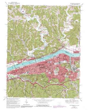
Huntington Topo Map Ohio
To zoom in, hover over the map of Huntington
USGS Topo Quad 38082d4 - 1:24,000 scale
| Topo Map Name: | Huntington |
| USGS Topo Quad ID: | 38082d4 |
| Print Size: | ca. 21 1/4" wide x 27" high |
| Southeast Coordinates: | 38.375° N latitude / 82.375° W longitude |
| Map Center Coordinates: | 38.4375° N latitude / 82.4375° W longitude |
| U.S. States: | OH, WV |
| Filename: | o38082d4.jpg |
| Download Map JPG Image: | Huntington topo map 1:24,000 scale |
| Map Type: | Topographic |
| Topo Series: | 7.5´ |
| Map Scale: | 1:24,000 |
| Source of Map Images: | United States Geological Survey (USGS) |
| Alternate Map Versions: |
Huntington WV 1957, updated 1959 Download PDF Buy paper map Huntington WV 1968, updated 1970 Download PDF Buy paper map Huntington WV 1968, updated 1977 Download PDF Buy paper map Huntington WV 1968, updated 1985 Download PDF Buy paper map Huntington WV 1968, updated 1991 Download PDF Buy paper map Huntington WV 1976, updated 1979 Download PDF Buy paper map Huntington WV 2011 Download PDF Buy paper map Huntington WV 2014 Download PDF Buy paper map Huntington WV 2016 Download PDF Buy paper map |
1:24,000 Topo Quads surrounding Huntington
> Back to 38082a1 at 1:100,000 scale
> Back to 38082a1 at 1:250,000 scale
> Back to U.S. Topo Maps home
Huntington topo map: Gazetteer
Huntington: Airports
Cabell Huntington Hospital Heliport elevation 181m 593′Lawrence County Airpark elevation 171m 561′
Saint Marys Hospital Heliport elevation 170m 557′
Huntington: Bars
Guyandot Shoals elevation 158m 518′Huntington: Bridges
East Huntington Bridge elevation 158m 518′Huntington: Crossings
Interchange 11 elevation 181m 593′Interchange 6 elevation 175m 574′
Interchange 8 elevation 191m 626′
Huntington: Lakes
Sky Lake elevation 175m 574′Huntington: Parks
David Harris Riverfront Park elevation 162m 531′Fairfield Stadium (historical) elevation 170m 557′
Holderby Commons elevation 172m 564′
Huntington Downtown Historic District elevation 174m 570′
Kiwanis Park elevation 178m 583′
Ninth Street West Historic District elevation 169m 554′
Ritter Park elevation 200m 656′
Ritter Park Historic District elevation 267m 875′
Riverside Park elevation 167m 547′
Saint Cloud Commons elevation 160m 524′
United States Post Office and Courthouse Historic District elevation 173m 567′
Huntington: Populated Places
Anita Heights elevation 193m 633′Bartramville elevation 175m 574′
Belmont Park elevation 244m 800′
Beverly Hills elevation 202m 662′
Beverly Hills elevation 194m 636′
Bradrick elevation 195m 639′
Brentwood elevation 176m 577′
Brownstown (historical) elevation 169m 554′
Chancellor Hills elevation 199m 652′
Chesapeake elevation 169m 554′
Corryville elevation 178m 583′
Crescent Lake elevation 256m 839′
Enslow Park Place elevation 192m 629′
Freeman Estates elevation 270m 885′
Garden Farms elevation 197m 646′
Gaylersville elevation 201m 659′
Getaway elevation 172m 564′
Grandview Heights elevation 245m 803′
Guyandotte elevation 166m 544′
Harveytown elevation 166m 544′
Huntington elevation 173m 567′
Marcum Terrace elevation 188m 616′
Northcott Court elevation 175m 574′
Park Hills elevation 265m 869′
Proctorville elevation 169m 554′
Reid elevation 192m 629′
Ridgewood elevation 194m 636′
Rockwood elevation 170m 557′
Stamford Park elevation 201m 659′
Sunny Acres elevation 167m 547′
Symmes Park elevation 179m 587′
Washington Square elevation 174m 570′
West Huntington elevation 170m 557′
Whitaker Terrace elevation 265m 869′
Huntington: Post Offices
Bradrick Post Office (historical) elevation 201m 659′Chesapeake Post Office elevation 170m 557′
Getaway Post Office (historical) elevation 170m 557′
Guyandotte Station Huntington Post Office elevation 168m 551′
Huntington Post Office elevation 173m 567′
Proctorville Post Office elevation 168m 551′
West Huntington Post Office (historical) elevation 166m 544′
Huntington: Reservoirs
Twin Lakes elevation 194m 636′Huntington: Streams
Bear Creek elevation 164m 538′Bent Creek elevation 158m 518′
Big Branch Creek elevation 160m 524′
Buffalo Creek elevation 157m 515′
Charley Creek elevation 157m 515′
Fivemile Creek elevation 170m 557′
Fourmile Creek elevation 171m 561′
Grapevine Branch elevation 181m 593′
Guyandotte River elevation 158m 518′
Hisey Fork Fourpole Creek elevation 164m 538′
Indian Guyan Creek elevation 158m 518′
McKinney Creek elevation 165m 541′
Medley Fork elevation 164m 538′
Rankin Creek elevation 169m 554′
Sandusky Creek elevation 159m 521′
Symmes Creek elevation 158m 518′
Huntington: Valleys
Gimlet Hollow elevation 168m 551′Huntington: Woods
Holderby Grove (historical) elevation 175m 574′Huntington digital topo map on disk
Buy this Huntington topo map showing relief, roads, GPS coordinates and other geographical features, as a high-resolution digital map file on DVD:
Western Virginia & Southern West Virginia
Buy digital topo maps: Western Virginia & Southern West Virginia


