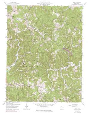
Arlee Topo Map West Virginia
To zoom in, hover over the map of Arlee
USGS Topo Quad 38082f1 - 1:24,000 scale
| Topo Map Name: | Arlee |
| USGS Topo Quad ID: | 38082f1 |
| Print Size: | ca. 21 1/4" wide x 27" high |
| Southeast Coordinates: | 38.625° N latitude / 82° W longitude |
| Map Center Coordinates: | 38.6875° N latitude / 82.0625° W longitude |
| U.S. State: | WV |
| Filename: | o38082f1.jpg |
| Download Map JPG Image: | Arlee topo map 1:24,000 scale |
| Map Type: | Topographic |
| Topo Series: | 7.5´ |
| Map Scale: | 1:24,000 |
| Source of Map Images: | United States Geological Survey (USGS) |
| Alternate Map Versions: |
Arlee WV 1958, updated 1960 Download PDF Buy paper map Arlee WV 1958, updated 1969 Download PDF Buy paper map Arlee WV 1958, updated 1976 Download PDF Buy paper map Arlee WV 2011 Download PDF Buy paper map Arlee WV 2014 Download PDF Buy paper map Arlee WV 2016 Download PDF Buy paper map |
1:24,000 Topo Quads surrounding Arlee
> Back to 38082e1 at 1:100,000 scale
> Back to 38082a1 at 1:250,000 scale
> Back to U.S. Topo Maps home
Arlee topo map: Gazetteer
Arlee: Parks
Chief Cornstalk Wildlife Management Area elevation 228m 748′Arlee: Populated Places
Arlee elevation 198m 649′Condee (historical) elevation 206m 675′
Flaxton (historical) elevation 286m 938′
Pondlick elevation 186m 610′
Veranda (historical) elevation 285m 935′
Arlee: Ridges
Crooked Ridge elevation 274m 898′Dunlavy Ridge elevation 282m 925′
Hambrick Ridge elevation 290m 951′
Loggerhead Ridge elevation 298m 977′
Long Ridge elevation 275m 902′
Mount Carmel Ridge elevation 276m 905′
Mount Union Ridge elevation 281m 921′
Potts Chapel Ridge elevation 273m 895′
Sevenmile Ridge elevation 281m 921′
Arlee: Springs
Balcott Spring elevation 246m 807′Balcott Spring elevation 245m 803′
Charles Angles Spring elevation 215m 705′
Hanes Spring elevation 195m 639′
Madison Bowles Spring elevation 185m 606′
Woyan Spring elevation 222m 728′
Woyan Spring elevation 265m 869′
Arlee: Streams
Fivefork Branch elevation 183m 600′Loggerhead Fork elevation 188m 616′
Righthand Fork elevation 172m 564′
Righthand Fork Sixteenmile Creek elevation 172m 564′
Willow Branch elevation 193m 633′
Wolfpen Run elevation 195m 639′
Arlee: Valleys
Barn Hollow elevation 180m 590′Potts Hollow elevation 178m 583′
Arlee digital topo map on disk
Buy this Arlee topo map showing relief, roads, GPS coordinates and other geographical features, as a high-resolution digital map file on DVD:
Western Virginia & Southern West Virginia
Buy digital topo maps: Western Virginia & Southern West Virginia


