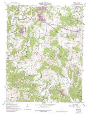
Rodney Topo Map Ohio
To zoom in, hover over the map of Rodney
USGS Topo Quad 38082g3 - 1:24,000 scale
| Topo Map Name: | Rodney |
| USGS Topo Quad ID: | 38082g3 |
| Print Size: | ca. 21 1/4" wide x 27" high |
| Southeast Coordinates: | 38.75° N latitude / 82.25° W longitude |
| Map Center Coordinates: | 38.8125° N latitude / 82.3125° W longitude |
| U.S. State: | OH |
| Filename: | o38082g3.jpg |
| Download Map JPG Image: | Rodney topo map 1:24,000 scale |
| Map Type: | Topographic |
| Topo Series: | 7.5´ |
| Map Scale: | 1:24,000 |
| Source of Map Images: | United States Geological Survey (USGS) |
| Alternate Map Versions: |
Rodney OH 1961, updated 1963 Download PDF Buy paper map Rodney OH 1961, updated 1976 Download PDF Buy paper map Rodney OH 1961, updated 1991 Download PDF Buy paper map Rodney OH 1975, updated 1977 Download PDF Buy paper map Rodney OH 2002, updated 2006 Download PDF Buy paper map Rodney OH 2011 Download PDF Buy paper map Rodney OH 2013 Download PDF Buy paper map Rodney OH 2016 Download PDF Buy paper map |
| FStopo: | US Forest Service topo Rodney is available: Download FStopo PDF Download FStopo TIF |
1:24,000 Topo Quads surrounding Rodney
> Back to 38082e1 at 1:100,000 scale
> Back to 38082a1 at 1:250,000 scale
> Back to U.S. Topo Maps home
Rodney topo map: Gazetteer
Rodney: Bridges
Blessing Bridge elevation 170m 557′Cora Covered Bridge elevation 174m 570′
Garners Ford Bridge elevation 176m 577′
Rodney: Parks
Raccoon Creek County Park elevation 204m 669′Rodney: Populated Places
Centenary elevation 176m 577′Cora elevation 176m 577′
Fairfield Acres elevation 208m 682′
Fairview elevation 186m 610′
Hideaway Acres elevation 210m 688′
Kerr elevation 186m 610′
McCormick (historical) elevation 190m 623′
Morton Flats elevation 197m 646′
Northup elevation 178m 583′
Park Lane Subdivision elevation 183m 600′
Porterbrook elevation 208m 682′
Quail Creek Trailer Park elevation 207m 679′
Rodney elevation 207m 679′
Siloam (historical) elevation 178m 583′
Spring Valle Estates elevation 188m 616′
Spring Valley elevation 180m 590′
The Meadows elevation 207m 679′
Westwood Acres elevation 177m 580′
Wigner (historical) elevation 171m 561′
Rodney: Post Offices
Cora Post Office (historical) elevation 174m 570′Kerr Post Office elevation 186m 610′
McCormick Post Office (historical) elevation 190m 623′
Northup post office elevation 178m 583′
Siloam Post Office (historical) elevation 171m 561′
Wigner Post Office (historical) elevation 171m 561′
Rodney: Ridges
Buck Ridge elevation 227m 744′Kriner Ridge elevation 264m 866′
Rodney: Streams
Beaver Creek elevation 177m 580′Claylick Run elevation 170m 557′
Clear Fork elevation 166m 544′
Fork Creek elevation 169m 554′
Fox Branch elevation 169m 554′
Laurel Creek elevation 177m 580′
Little Claylick Run elevation 174m 570′
Mud Creek elevation 170m 557′
Polecat Run elevation 176m 577′
Rocky Fork elevation 171m 561′
Ryan Run elevation 182m 597′
Rodney: Summits
Poplar Knob elevation 305m 1000′Rodney: Trails
Deer Hollow Trail elevation 191m 626′Natural Gorge Trail elevation 197m 646′
Rodney: Valleys
Liddy Hollow elevation 181m 593′Rodney digital topo map on disk
Buy this Rodney topo map showing relief, roads, GPS coordinates and other geographical features, as a high-resolution digital map file on DVD:
Western Virginia & Southern West Virginia
Buy digital topo maps: Western Virginia & Southern West Virginia


