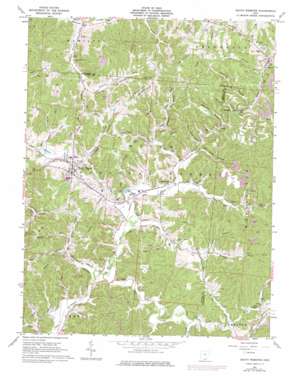
South Webster Topo Map Ohio
To zoom in, hover over the map of South Webster
USGS Topo Quad 38082g6 - 1:24,000 scale
| Topo Map Name: | South Webster |
| USGS Topo Quad ID: | 38082g6 |
| Print Size: | ca. 21 1/4" wide x 27" high |
| Southeast Coordinates: | 38.75° N latitude / 82.625° W longitude |
| Map Center Coordinates: | 38.8125° N latitude / 82.6875° W longitude |
| U.S. State: | OH |
| Filename: | o38082g6.jpg |
| Download Map JPG Image: | South Webster topo map 1:24,000 scale |
| Map Type: | Topographic |
| Topo Series: | 7.5´ |
| Map Scale: | 1:24,000 |
| Source of Map Images: | United States Geological Survey (USGS) |
| Alternate Map Versions: |
South Webster OH 1961, updated 1962 Download PDF Buy paper map South Webster OH 1961, updated 1977 Download PDF Buy paper map South Webster OH 2002, updated 2006 Download PDF Buy paper map South Webster OH 2011 Download PDF Buy paper map South Webster OH 2013 Download PDF Buy paper map South Webster OH 2016 Download PDF Buy paper map |
| FStopo: | US Forest Service topo South Webster is available: Download FStopo PDF Download FStopo TIF |
1:24,000 Topo Quads surrounding South Webster
> Back to 38082e1 at 1:100,000 scale
> Back to 38082a1 at 1:250,000 scale
> Back to U.S. Topo Maps home
South Webster topo map: Gazetteer
South Webster: Dams
South Webster Reservoir Dam elevation 201m 659′South Webster: Populated Places
Bloom Junction elevation 187m 613′Eifort elevation 205m 672′
Firebrick elevation 204m 669′
Hales Creek elevation 200m 656′
Madland (historical) elevation 190m 623′
Monroe elevation 210m 688′
Olive Furnace elevation 206m 675′
South Webster elevation 218m 715′
South Webster: Post Offices
Eifort Post Office (historical) elevation 204m 669′Firebrick Post Office (historical) elevation 203m 666′
Hales Creek Post Office (historical) elevation 197m 646′
Madland Post Office (historical) elevation 191m 626′
Olive Furnace Post Office (historical) elevation 205m 672′
South Webster Post Office elevation 217m 711′
South Webster: Reservoirs
South Webster Reservoir elevation 201m 659′South Webster: Ridges
Simmering Ridge elevation 293m 961′South Webster: Streams
Bloom Furnace Creek elevation 189m 620′Brady Run elevation 195m 639′
Brushy Fork elevation 195m 639′
Hales Creek elevation 189m 620′
Jackson Fork elevation 192m 629′
Jackson Furnace Creek elevation 189m 620′
Olive Creek elevation 195m 639′
Youngs Branch elevation 191m 626′
South Webster: Valleys
Barnhart Hollow elevation 212m 695′Diamond Hollow elevation 202m 662′
Dutch Hollow elevation 189m 620′
Harrison Hollow elevation 203m 666′
Hawkins Hollow elevation 214m 702′
Hope Hollow elevation 187m 613′
Monroe Hollow elevation 215m 705′
New Globe Hollow elevation 202m 662′
Old Globe Hollow elevation 200m 656′
Rayburn Hollow elevation 189m 620′
Rhoden Hollow elevation 204m 669′
Slab Hollow elevation 209m 685′
Sugar Camp Hollow elevation 203m 666′
South Webster digital topo map on disk
Buy this South Webster topo map showing relief, roads, GPS coordinates and other geographical features, as a high-resolution digital map file on DVD:
Western Virginia & Southern West Virginia
Buy digital topo maps: Western Virginia & Southern West Virginia


