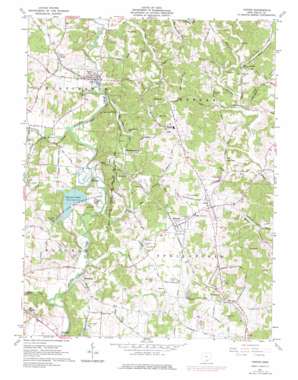
Vinton Topo Map Ohio
To zoom in, hover over the map of Vinton
USGS Topo Quad 38082h3 - 1:24,000 scale
| Topo Map Name: | Vinton |
| USGS Topo Quad ID: | 38082h3 |
| Print Size: | ca. 21 1/4" wide x 27" high |
| Southeast Coordinates: | 38.875° N latitude / 82.25° W longitude |
| Map Center Coordinates: | 38.9375° N latitude / 82.3125° W longitude |
| U.S. State: | OH |
| Filename: | o38082h3.jpg |
| Download Map JPG Image: | Vinton topo map 1:24,000 scale |
| Map Type: | Topographic |
| Topo Series: | 7.5´ |
| Map Scale: | 1:24,000 |
| Source of Map Images: | United States Geological Survey (USGS) |
| Alternate Map Versions: |
Vinton OH 1961, updated 1963 Download PDF Buy paper map Vinton OH 1961, updated 1977 Download PDF Buy paper map Vinton OH 2010 Download PDF Buy paper map Vinton OH 2013 Download PDF Buy paper map Vinton OH 2016 Download PDF Buy paper map |
1:24,000 Topo Quads surrounding Vinton
> Back to 38082e1 at 1:100,000 scale
> Back to 38082a1 at 1:250,000 scale
> Back to U.S. Topo Maps home
Vinton topo map: Gazetteer
Vinton: Bridges
Boice Bridge elevation 194m 636′Vinton: Dams
Clark Chapel Acres Recreation Pond Dam elevation 195m 639′Tycoon Lake - East Dam elevation 182m 597′
Tycoon Lake - South Dam elevation 187m 613′
Vinton: Parks
Tycoon Lake State Wildlife Area elevation 192m 629′Vinton: Populated Places
Adamsville elevation 176m 577′Bidwell elevation 208m 682′
Edoma Trail Subdivision elevation 208m 682′
Evergreen elevation 218m 715′
Glen Summitt elevation 231m 757′
Harrisburg elevation 200m 656′
Morgan Center elevation 198m 649′
Obad (historical) elevation 195m 639′
Porter elevation 209m 685′
Vinton elevation 187m 613′
Woods Mill elevation 184m 603′
Vinton: Post Offices
Bidwell Post Office elevation 207m 679′Evergreen Post Office (historical) elevation 219m 718′
Porter Post Office (historical) elevation 210m 688′
Vinton Post Office (historical) elevation 187m 613′
Vinton: Reservoirs
Clark Chapel Acres Recreation Pond elevation 195m 639′Tycoon Lake elevation 182m 597′
Tycoon Lake elevation 187m 613′
Vinton: Streams
Barren Creek elevation 177m 580′Deer Creek elevation 178m 583′
Indian Creek elevation 176m 577′
Little Raccoon Creek elevation 178m 583′
Long Branch elevation 182m 597′
Robinson Run elevation 184m 603′
Shepherds White Oak Creek elevation 197m 646′
Trace Run elevation 177m 580′
White Oak Creek elevation 182m 597′
Wolf Run elevation 182m 597′
Vinton digital topo map on disk
Buy this Vinton topo map showing relief, roads, GPS coordinates and other geographical features, as a high-resolution digital map file on DVD:
Western Virginia & Southern West Virginia
Buy digital topo maps: Western Virginia & Southern West Virginia


