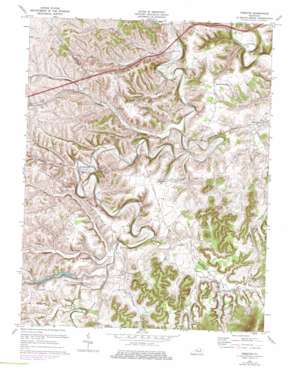
Preston Topo Map Kentucky
To zoom in, hover over the map of Preston
USGS Topo Quad 38083a7 - 1:24,000 scale
| Topo Map Name: | Preston |
| USGS Topo Quad ID: | 38083a7 |
| Print Size: | ca. 21 1/4" wide x 27" high |
| Southeast Coordinates: | 38° N latitude / 83.75° W longitude |
| Map Center Coordinates: | 38.0625° N latitude / 83.8125° W longitude |
| U.S. State: | KY |
| Filename: | o38083a7.jpg |
| Download Map JPG Image: | Preston topo map 1:24,000 scale |
| Map Type: | Topographic |
| Topo Series: | 7.5´ |
| Map Scale: | 1:24,000 |
| Source of Map Images: | United States Geological Survey (USGS) |
| Alternate Map Versions: |
Preston KY 1952, updated 1953 Download PDF Buy paper map Preston KY 1970, updated 1972 Download PDF Buy paper map Preston KY 1970, updated 1978 Download PDF Buy paper map Preston KY 2010 Download PDF Buy paper map Preston KY 2013 Download PDF Buy paper map Preston KY 2016 Download PDF Buy paper map |
1:24,000 Topo Quads surrounding Preston
> Back to 38083a1 at 1:100,000 scale
> Back to 38082a1 at 1:250,000 scale
> Back to U.S. Topo Maps home
Preston topo map: Gazetteer
Preston: Airports
One Oak Airport elevation 291m 954′Preston: Crossings
Walkers Crossing elevation 248m 813′Preston: Populated Places
Antioch Church elevation 254m 833′Chestnut Grove elevation 271m 889′
Hope elevation 244m 800′
Howards Mill elevation 236m 774′
Kendall Springs elevation 278m 912′
Kendall Springs (historical) elevation 277m 908′
Lower Spencer elevation 238m 780′
Preston elevation 231m 757′
Salt Well elevation 254m 833′
Spencer Village elevation 246m 807′
Stepstone elevation 239m 784′
Upper Spencer elevation 241m 790′
Walkers Crossing elevation 249m 816′
Preston: Post Offices
Hope Post Office elevation 247m 810′Peeled Oak Post Office (historical) elevation 269m 882′
Preston Post Office elevation 230m 754′
Spencer Post Office (historical) elevation 235m 770′
Stepstone Post Office (historical) elevation 241m 790′
Preston: Reservoirs
Greenbrier Creek Reservoir elevation 244m 800′Preston: Ridges
Harpers Ridge elevation 270m 885′Preston: Streams
Brush Creek elevation 230m 754′Butlers Branch elevation 220m 721′
Foster Branch elevation 236m 774′
Greenbrier Creek elevation 230m 754′
Harpers Creek elevation 232m 761′
Jones Branch elevation 219m 718′
Little Mill Creek elevation 224m 734′
Little Slate Creek elevation 228m 748′
Peeled Oak Creek elevation 225m 738′
Pretty Run elevation 235m 770′
Salt Well Branch elevation 248m 813′
Salt Well Branch elevation 240m 787′
Salt Well Creek elevation 217m 711′
South Fork Salt Well Creek elevation 229m 751′
Spencer Creek elevation 229m 751′
Stepstone Creek elevation 222m 728′
Sycamore Creek elevation 231m 757′
Town Branch elevation 226m 741′
Preston: Summits
Indian Hill elevation 260m 853′Preston: Valleys
Foley Hollow elevation 244m 800′Sponcil Hollow elevation 250m 820′
Preston digital topo map on disk
Buy this Preston topo map showing relief, roads, GPS coordinates and other geographical features, as a high-resolution digital map file on DVD:
Western Virginia & Southern West Virginia
Buy digital topo maps: Western Virginia & Southern West Virginia


