Stricklett Topo Map Kentucky
To zoom in, hover over the map of Stricklett
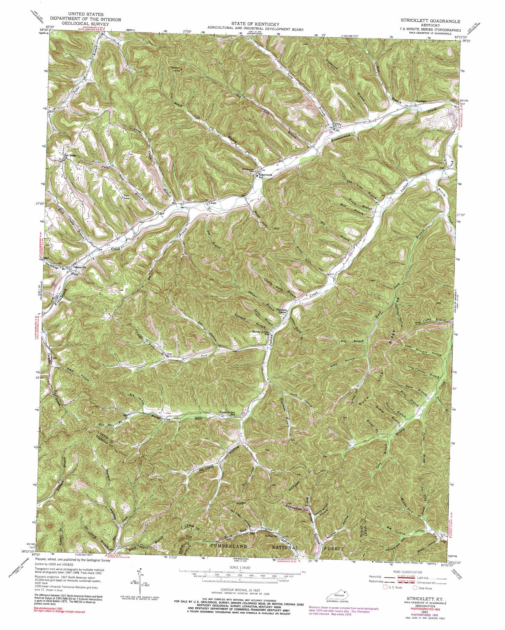
USGS Topo Quad 38083d4 - 1:24,000 scale
| Topo Map Name: | Stricklett |
| USGS Topo Quad ID: | 38083d4 |
| Print Size: | ca. 21 1/4" wide x 27" high |
| Southeast Coordinates: | 38.375° N latitude / 83.375° W longitude |
| Map Center Coordinates: | 38.4375° N latitude / 83.4375° W longitude |
| U.S. State: | KY |
| Filename: | o38083d4.jpg |
| Download Map JPG Image: | Stricklett topo map 1:24,000 scale |
| Map Type: | Topographic |
| Topo Series: | 7.5´ |
| Map Scale: | 1:24,000 |
| Source of Map Images: | United States Geological Survey (USGS) |
| Alternate Map Versions: |
Stricklett KY 1951, updated 1953 Download PDF Buy paper map Stricklett KY 1951, updated 1973 Download PDF Buy paper map Stricklett KY 1951, updated 1978 Download PDF Buy paper map Stricklett KY 1951, updated 1991 Download PDF Buy paper map Stricklett KY 2011 Download PDF Buy paper map Stricklett KY 2013 Download PDF Buy paper map Stricklett KY 2016 Download PDF Buy paper map |
| FStopo: | US Forest Service topo Stricklett is available: Download FStopo PDF Download FStopo TIF |
1:24,000 Topo Quads surrounding Stricklett
Maysville East |
Manchester Islands |
Concord |
Buena Vista |
Pond Run |
Orangeburg |
Tollesboro |
Charters |
Vanceburg |
Garrison |
Flemingsburg |
Burtonville |
Stricklett |
Head Of Grassy |
Wesleyville |
Hillsboro |
Plummers Landing |
Cranston |
Soldier |
Olive Hill |
Colfax |
Farmers |
Morehead |
Haldeman |
Ault |
> Back to 38083a1 at 1:100,000 scale
> Back to 38082a1 at 1:250,000 scale
> Back to U.S. Topo Maps home
Stricklett topo map: Gazetteer
Stricklett: Populated Places
Crum elevation 240m 787′Oak Ridge elevation 342m 1122′
Petersville elevation 253m 830′
Stricklett elevation 221m 725′
Upper Indian Creek elevation 292m 958′
Stricklett: Post Offices
Crum Post Office (historical) elevation 241m 790′Noah Post Office (historical) elevation 342m 1122′
Petersville Post Office (historical) elevation 254m 833′
Stricklett: Ridges
Buck Lick Ridge elevation 390m 1279′Stricklett: Streams
Bear Branch elevation 220m 721′Bee Branch elevation 239m 784′
Bee Branch elevation 238m 780′
Big Branch elevation 288m 944′
Big Branch elevation 243m 797′
Bill Rice Branch elevation 324m 1062′
Bishop Branch elevation 287m 941′
Black Lick Branch elevation 231m 757′
Black Stairs Branch elevation 256m 839′
Bobbie Branch elevation 279m 915′
Briery Creek elevation 223m 731′
Buck Lick Branch elevation 235m 770′
Burnt Cabin Branch elevation 241m 790′
Cloddy Field Branch elevation 255m 836′
Clover Field Branch elevation 255m 836′
Cooper Fork Branch elevation 303m 994′
Dunaway Branch elevation 251m 823′
Elk Lick Branch elevation 226m 741′
Hardy Fork elevation 286m 938′
Hog Camp Branch elevation 262m 859′
House Branch elevation 231m 757′
Jess Canille Branch elevation 274m 898′
Jordan Branch elevation 280m 918′
Kilan Branch elevation 297m 974′
Kincaid Branch elevation 258m 846′
Lee Branch elevation 238m 780′
Little Branch elevation 256m 839′
Long Branch elevation 225m 738′
Long Branch elevation 293m 961′
Middle Lick Branch elevation 284m 931′
Mill Branch elevation 231m 757′
Paint Lick Branch elevation 240m 787′
Pea Vine Branch elevation 230m 754′
Polecat Branch elevation 287m 941′
Riley Branch elevation 282m 925′
Rock Camp Branch elevation 249m 816′
Stamm Fork elevation 265m 869′
Stein Branch elevation 278m 912′
Thomas Branch elevation 254m 833′
Thurman Branch elevation 272m 892′
Trumstock Branch elevation 225m 738′
Stricklett: Summits
The Black Stairs elevation 319m 1046′Stricklett: Valleys
Big Hollow elevation 322m 1056′Big Johnson Hollow elevation 268m 879′
Big Lick Hollow elevation 284m 931′
Bill Brown Hollow elevation 300m 984′
Bob Cooper Hollow elevation 322m 1056′
Brown Hollow elevation 285m 935′
Duff Hollow elevation 309m 1013′
Hardin Hollow elevation 262m 859′
Henderson Hollow elevation 297m 974′
Henry Short Hollow elevation 312m 1023′
McCless Hollow elevation 290m 951′
McCless Hollow elevation 320m 1049′
Nickles Hollow elevation 301m 987′
Oil Well Hollow elevation 270m 885′
Owl Hollow elevation 285m 935′
Pitts Hollow elevation 289m 948′
Road Fork Hollow elevation 291m 954′
Siam Hollow elevation 280m 918′
Silver Lick Hollow elevation 241m 790′
Silver Lick Hollow elevation 267m 875′
Smith Hollow elevation 312m 1023′
Troy Gilmore Hollow elevation 270m 885′
Ulett Hollow elevation 300m 984′
Stricklett digital topo map on disk
Buy this Stricklett topo map showing relief, roads, GPS coordinates and other geographical features, as a high-resolution digital map file on DVD:
Western Virginia & Southern West Virginia
Buy digital topo maps: Western Virginia & Southern West Virginia