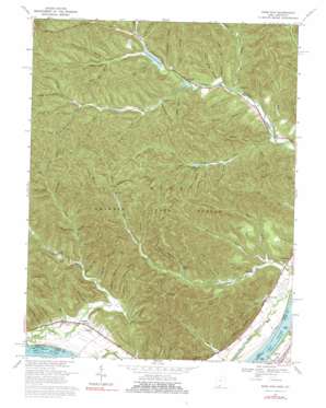
Pond Run Topo Map Ohio
To zoom in, hover over the map of Pond Run
USGS Topo Quad 38083f2 - 1:24,000 scale
| Topo Map Name: | Pond Run |
| USGS Topo Quad ID: | 38083f2 |
| Print Size: | ca. 21 1/4" wide x 27" high |
| Southeast Coordinates: | 38.625° N latitude / 83.125° W longitude |
| Map Center Coordinates: | 38.6875° N latitude / 83.1875° W longitude |
| U.S. States: | OH, KY |
| Filename: | o38083f2.jpg |
| Download Map JPG Image: | Pond Run topo map 1:24,000 scale |
| Map Type: | Topographic |
| Topo Series: | 7.5´ |
| Map Scale: | 1:24,000 |
| Source of Map Images: | United States Geological Survey (USGS) |
| Alternate Map Versions: |
Pond Run OH 1949, updated 1960 Download PDF Buy paper map Pond Run OH 1951 Download PDF Buy paper map Pond Run OH 1967, updated 1970 Download PDF Buy paper map Pond Run OH 1967, updated 1976 Download PDF Buy paper map Pond Run OH 1967, updated 1991 Download PDF Buy paper map Pond Run OH 2010 Download PDF Buy paper map Pond Run OH 2013 Download PDF Buy paper map Pond Run OH 2016 Download PDF Buy paper map |
1:24,000 Topo Quads surrounding Pond Run
> Back to 38083e1 at 1:100,000 scale
> Back to 38082a1 at 1:250,000 scale
> Back to U.S. Topo Maps home
Pond Run topo map: Gazetteer
Pond Run: Airports
Shawnee State Lodge Heliport elevation 305m 1000′Pond Run: Dams
Roosevelt Lake Dam elevation 203m 666′Turkey Creek Lake Dam elevation 220m 721′
Pond Run: Flats
Formans Bottom elevation 163m 534′Pond Run: Guts
Stable Gut elevation 183m 600′Pond Run: Parks
Shawnee State Forest elevation 299m 980′Shawnee State Park elevation 273m 895′
Pond Run: Populated Places
Camp Oyo elevation 195m 639′Kennvale elevation 161m 528′
McGaw elevation 162m 531′
Pond Run elevation 166m 544′
Pond Run: Post Offices
McGaw Post Office (historical) elevation 162m 531′Pondrun Post Office (historical) elevation 167m 547′
Pond Run: Reservoirs
McBride Lake elevation 220m 721′Pond Lick Lake elevation 221m 725′
Roosevelt Lake elevation 203m 666′
Turkey Creek Lake elevation 220m 721′
Pond Run: Streams
Bald Knob Run elevation 226m 741′Barbara Run elevation 177m 580′
Boland Run elevation 152m 498′
Brush Fork elevation 228m 748′
Brushy Fork elevation 276m 905′
Buck Lick elevation 184m 603′
Dry Run elevation 153m 501′
East Fork Pond Run elevation 157m 515′
East Fork Upper Twin Creek elevation 196m 643′
Gabe Run elevation 267m 875′
Grass Lick Run elevation 183m 600′
Harber Fork Turkey Creek elevation 189m 620′
Jake Run elevation 222m 728′
Lampblack Run elevation 227m 744′
Mackletree Tree elevation 204m 669′
McBride Run elevation 210m 688′
Middle Fork Pond Run elevation 157m 515′
Mundy Run elevation 155m 508′
Old Lade Run elevation 237m 777′
Plummer Fork elevation 256m 839′
Pond Lick Run elevation 171m 561′
Rock Lick elevation 242m 793′
Rock Lick elevation 234m 767′
Tucker Run elevation 165m 541′
Upper Twin Creek elevation 152m 498′
Vance Creek elevation 152m 498′
Wes Run elevation 176m 577′
Wolfden Run elevation 253m 830′
Pond Run: Summits
Picnic Point elevation 332m 1089′Pond Run: Valleys
Blue Clay Hollow elevation 220m 721′Bond Hollow elevation 189m 620′
Broad Hollow elevation 221m 725′
Brown Hollow elevation 185m 606′
Conklin Hollow elevation 184m 603′
Cotton Eye Hollow elevation 246m 807′
Cutlipp Hollow elevation 188m 616′
Dead Man Hollow elevation 265m 869′
Dodds Hollow elevation 183m 600′
Evans Hollow elevation 246m 807′
Groundhog Hollow elevation 171m 561′
Hobey Hollow elevation 215m 705′
Hog Thief Hollow elevation 198m 649′
Hogpen Hollow elevation 214m 702′
Hoosier Hollow elevation 241m 790′
Long Hollow elevation 222m 728′
Long Hollow elevation 190m 623′
Long Hollow elevation 267m 875′
Lower Shaw Hollow elevation 191m 626′
Massey Hollow elevation 191m 626′
Middle Hollow elevation 353m 1158′
Mudlick Hollow elevation 234m 767′
Pheasant Hollow elevation 233m 764′
Poplar Hollow elevation 233m 764′
Poplar Tree Hollow elevation 256m 839′
Quitoff Hollow elevation 282m 925′
Rock Lick Hollow elevation 222m 728′
Rocky Hollow elevation 225m 738′
Sawmill Hollow elevation 188m 616′
Shady Hollow elevation 214m 702′
Sheep House Hollow elevation 237m 777′
Sheep Lot Hollow elevation 279m 915′
Slate Hollow elevation 233m 764′
Swanigen Hollow elevation 214m 702′
Tarkiln Hollow elevation 256m 839′
Upper Shaw Hollow elevation 195m 639′
Webb Hollow elevation 267m 875′
Williamson Hollow elevation 228m 748′
Pond Run digital topo map on disk
Buy this Pond Run topo map showing relief, roads, GPS coordinates and other geographical features, as a high-resolution digital map file on DVD:
Western Virginia & Southern West Virginia
Buy digital topo maps: Western Virginia & Southern West Virginia


