Lynx Topo Map Ohio
To zoom in, hover over the map of Lynx
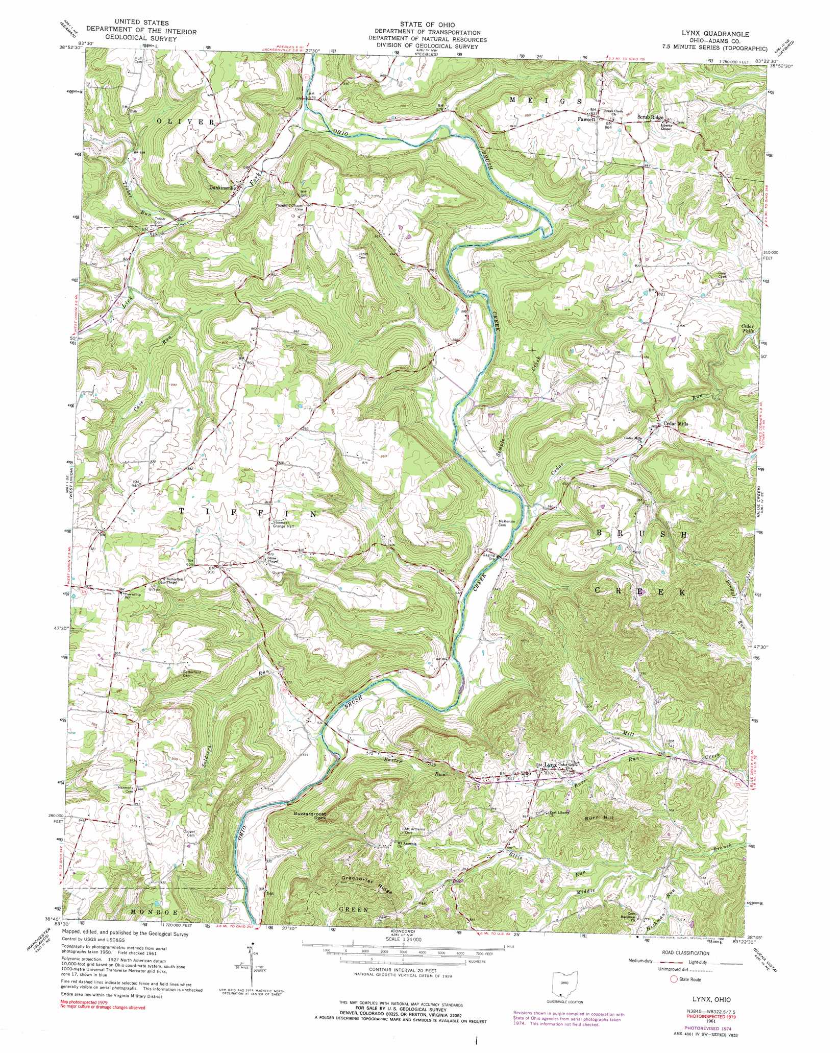
USGS Topo Quad 38083g4 - 1:24,000 scale
| Topo Map Name: | Lynx |
| USGS Topo Quad ID: | 38083g4 |
| Print Size: | ca. 21 1/4" wide x 27" high |
| Southeast Coordinates: | 38.75° N latitude / 83.375° W longitude |
| Map Center Coordinates: | 38.8125° N latitude / 83.4375° W longitude |
| U.S. State: | OH |
| Filename: | o38083g4.jpg |
| Download Map JPG Image: | Lynx topo map 1:24,000 scale |
| Map Type: | Topographic |
| Topo Series: | 7.5´ |
| Map Scale: | 1:24,000 |
| Source of Map Images: | United States Geological Survey (USGS) |
| Alternate Map Versions: |
Lynx OH 1961, updated 1962 Download PDF Buy paper map Lynx OH 1961, updated 1976 Download PDF Buy paper map Lynx OH 1961, updated 1990 Download PDF Buy paper map Lynx OH 2010 Download PDF Buy paper map Lynx OH 2013 Download PDF Buy paper map Lynx OH 2016 Download PDF Buy paper map |
1:24,000 Topo Quads surrounding Lynx
Sugar Tree Ridge |
Belfast |
Sinking Spring |
Byington |
Latham |
Winchester |
Seaman |
Peebles |
Jaybird |
Rarden |
Decatur |
West Union |
Lynx |
Blue Creek |
Otway |
Maysville East |
Manchester Islands |
Concord |
Buena Vista |
Pond Run |
Orangeburg |
Tollesboro |
Charters |
Vanceburg |
Garrison |
> Back to 38083e1 at 1:100,000 scale
> Back to 38082a1 at 1:250,000 scale
> Back to U.S. Topo Maps home
Lynx topo map: Gazetteer
Lynx: Airports
Spires Airport elevation 249m 816′Lynx: Falls
Cedar Falls elevation 212m 695′Lynx: Pillars
Buzzardroost Rock elevation 298m 977′Lynx: Populated Places
Cedar Mills elevation 173m 567′Dunkinsville elevation 187m 613′
Fawcett elevation 254m 833′
Lynx elevation 249m 816′
Moore (historical) elevation 160m 524′
Scrub Ridge elevation 263m 862′
Lynx: Post Offices
Cedar Mills Post Office (historical) elevation 173m 567′Dunkinsville Post Office (historical) elevation 187m 613′
Fawcett Post Office (historical) elevation 251m 823′
Lynx Post Office elevation 244m 800′
Moore Post Office (historical) elevation 160m 524′
Lynx: Ridges
Greenbrier Ridge elevation 385m 1263′Lynx: Streams
Burr Run elevation 219m 718′Cave Run elevation 189m 620′
Cedar Run elevation 158m 518′
Easter Run elevation 158m 518′
Ellis Run elevation 218m 715′
Hickman Run elevation 213m 698′
Lick Fork elevation 169m 554′
Semple Creek elevation 159m 521′
Soldiers Run elevation 157m 515′
Treber Run elevation 182m 597′
Lynx: Summits
Burr Hill elevation 342m 1122′Lynx: Valleys
Freelan Hollow elevation 209m 685′Lynx digital topo map on disk
Buy this Lynx topo map showing relief, roads, GPS coordinates and other geographical features, as a high-resolution digital map file on DVD:
Western Virginia & Southern West Virginia
Buy digital topo maps: Western Virginia & Southern West Virginia