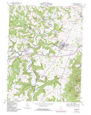
Peebles Topo Map Ohio
To zoom in, hover over the map of Peebles
USGS Topo Quad 38083h4 - 1:24,000 scale
| Topo Map Name: | Peebles |
| USGS Topo Quad ID: | 38083h4 |
| Print Size: | ca. 21 1/4" wide x 27" high |
| Southeast Coordinates: | 38.875° N latitude / 83.375° W longitude |
| Map Center Coordinates: | 38.9375° N latitude / 83.4375° W longitude |
| U.S. State: | OH |
| Filename: | o38083h4.jpg |
| Download Map JPG Image: | Peebles topo map 1:24,000 scale |
| Map Type: | Topographic |
| Topo Series: | 7.5´ |
| Map Scale: | 1:24,000 |
| Source of Map Images: | United States Geological Survey (USGS) |
| Alternate Map Versions: |
Peebles OH 1961, updated 1963 Download PDF Buy paper map Peebles OH 1961, updated 1975 Download PDF Buy paper map Peebles OH 1961, updated 1982 Download PDF Buy paper map Peebles OH 1961, updated 1987 Download PDF Buy paper map Peebles OH 2010 Download PDF Buy paper map Peebles OH 2013 Download PDF Buy paper map Peebles OH 2016 Download PDF Buy paper map |
1:24,000 Topo Quads surrounding Peebles
> Back to 38083e1 at 1:100,000 scale
> Back to 38082a1 at 1:250,000 scale
> Back to U.S. Topo Maps home
Peebles topo map: Gazetteer
Peebles: Airports
Lewis Airport elevation 261m 856′Peebles: Bends
Horseshoe Bend elevation 220m 721′Peebles: Cliffs
Murphin Point elevation 263m 862′Peebles: Dams
Laycocks Farm Pond Dam Number One elevation 252m 826′Laycocks Farm Pond Dam Number Two elevation 235m 770′
Peebles: Parks
Tranquility State Wildlife Area elevation 258m 846′Peebles: Populated Places
Jacksonville elevation 272m 892′Lawshe elevation 192m 629′
Locust Grove elevation 239m 784′
Louisville elevation 278m 912′
Marble Furnace elevation 205m 672′
Peebles elevation 252m 826′
Steam Furnace elevation 256m 839′
Peebles: Post Offices
Jacksonville Post Office (historical) elevation 272m 892′Lawshe Post Office (historical) elevation 192m 629′
Locustgrove Post Office (historical) elevation 239m 784′
Locustgrove Post Office (historical) elevation 239m 784′
Marble Furnace Post Office (historical) elevation 205m 672′
Peebles Post Office elevation 254m 833′
Peebles: Reservoirs
Laycocks Farm Pond Number One elevation 252m 826′Laycocks Farm Pond Number Two elevation 235m 770′
Peebles: Ridges
Hoop Ridge elevation 274m 898′Tater Ridge elevation 292m 958′
Wheat Ridge elevation 287m 941′
Peebles: Streams
Big Run elevation 197m 646′Bundle Run elevation 177m 580′
Georges Creek elevation 188m 616′
Little East Fork Ohio Brush Creek elevation 188m 616′
Shimer Run elevation 183m 600′
Spoon River elevation 186m 610′
West Fork Ohio Brush Creek elevation 182m 597′
Wolf Creek elevation 205m 672′
Peebles: Summits
Deer Lick Knob elevation 341m 1118′Peebles: Valleys
Polk Hollow elevation 177m 580′Peebles digital topo map on disk
Buy this Peebles topo map showing relief, roads, GPS coordinates and other geographical features, as a high-resolution digital map file on DVD:
Western Virginia & Southern West Virginia
Buy digital topo maps: Western Virginia & Southern West Virginia


