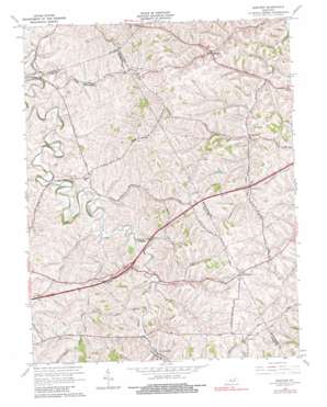
Sideview Topo Map Kentucky
To zoom in, hover over the map of Sideview
USGS Topo Quad 38084a1 - 1:24,000 scale
| Topo Map Name: | Sideview |
| USGS Topo Quad ID: | 38084a1 |
| Print Size: | ca. 21 1/4" wide x 27" high |
| Southeast Coordinates: | 38° N latitude / 84° W longitude |
| Map Center Coordinates: | 38.0625° N latitude / 84.0625° W longitude |
| U.S. State: | KY |
| Filename: | o38084a1.jpg |
| Download Map JPG Image: | Sideview topo map 1:24,000 scale |
| Map Type: | Topographic |
| Topo Series: | 7.5´ |
| Map Scale: | 1:24,000 |
| Source of Map Images: | United States Geological Survey (USGS) |
| Alternate Map Versions: |
Sideview KY 1952, updated 1954 Download PDF Buy paper map Sideview KY 1965, updated 1966 Download PDF Buy paper map Sideview KY 1965, updated 1980 Download PDF Buy paper map Sideview KY 2010 Download PDF Buy paper map Sideview KY 2013 Download PDF Buy paper map Sideview KY 2016 Download PDF Buy paper map |
1:24,000 Topo Quads surrounding Sideview
> Back to 38084a1 at 1:100,000 scale
> Back to 38084a1 at 1:250,000 scale
> Back to U.S. Topo Maps home
Sideview topo map: Gazetteer
Sideview: Bridges
Ecton Pike Bridge elevation 277m 908′Grassy Lick Bridge elevation 262m 859′
Sideview: Populated Places
Centerville elevation 288m 944′Fort Barker elevation 327m 1072′
Grassy Lick elevation 268m 879′
L and E Junction elevation 279m 915′
Mount Zion elevation 278m 912′
Pleasant Ridge elevation 286m 938′
Sewell Shop elevation 327m 1072′
Sideview elevation 278m 912′
Thomson elevation 317m 1040′
Sideview: Post Offices
Adams Post Office (historical) elevation 297m 974′Botts Post Office (historical) elevation 327m 1072′
Busseyville Post Office (historical) elevation 310m 1017′
Dodge Post Office (historical) elevation 282m 925′
Fryville Post Office (historical) elevation 283m 928′
Irad Post Office (historical) elevation 291m 954′
Mount Ida Post Office (historical) elevation 278m 912′
Sideview Post Office (historical) elevation 274m 898′
Stoner Post Office (historical) elevation 278m 912′
Thomson Post Office (historical) elevation 320m 1049′
Wades Mill Post Office (historical) elevation 291m 954′
Sideview: Ridges
Pleasant Ridge elevation 299m 980′Sugar Ridge elevation 305m 1000′
Sideview: Streams
Cabin Creek elevation 265m 869′Donaldson Creek elevation 254m 833′
Georges Branch elevation 277m 908′
Goose Creek elevation 271m 889′
Little Stoner Creek elevation 265m 869′
Sideview digital topo map on disk
Buy this Sideview topo map showing relief, roads, GPS coordinates and other geographical features, as a high-resolution digital map file on DVD:


