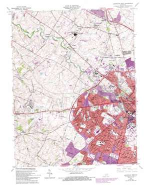
Lexington West Topo Map Kentucky
To zoom in, hover over the map of Lexington West
USGS Topo Quad 38084a5 - 1:24,000 scale
| Topo Map Name: | Lexington West |
| USGS Topo Quad ID: | 38084a5 |
| Print Size: | ca. 21 1/4" wide x 27" high |
| Southeast Coordinates: | 38° N latitude / 84.5° W longitude |
| Map Center Coordinates: | 38.0625° N latitude / 84.5625° W longitude |
| U.S. State: | KY |
| Filename: | o38084a5.jpg |
| Download Map JPG Image: | Lexington West topo map 1:24,000 scale |
| Map Type: | Topographic |
| Topo Series: | 7.5´ |
| Map Scale: | 1:24,000 |
| Source of Map Images: | United States Geological Survey (USGS) |
| Alternate Map Versions: |
Lexington West KY 1950, updated 1952 Download PDF Buy paper map Lexington West KY 1955, updated 1956 Download PDF Buy paper map Lexington West KY 1959, updated 1961 Download PDF Buy paper map Lexington West KY 1965, updated 1967 Download PDF Buy paper map Lexington West KY 1965, updated 1972 Download PDF Buy paper map Lexington West KY 1965, updated 1979 Download PDF Buy paper map Lexington West KY 1965, updated 1987 Download PDF Buy paper map Lexington West KY 1965, updated 1993 Download PDF Buy paper map Lexington West KY 2010 Download PDF Buy paper map Lexington West KY 2013 Download PDF Buy paper map Lexington West KY 2016 Download PDF Buy paper map |
1:24,000 Topo Quads surrounding Lexington West
> Back to 38084a1 at 1:100,000 scale
> Back to 38084a1 at 1:250,000 scale
> Back to U.S. Topo Maps home
Lexington West topo map: Gazetteer
Lexington West: Airports
Blue Grass Airport elevation 297m 974′Saint Joseph Hospital Heliport elevation 288m 944′
University of Kentucky Hospital Heliport elevation 298m 977′
Lexington West: Parks
Douglas Park elevation 299m 980′Lexington Trotting Track elevation 294m 964′
Lexington West: Populated Places
Beaumont Park elevation 296m 971′Bracktown elevation 262m 859′
Brookhaven elevation 307m 1007′
Cardinal Hill elevation 294m 964′
Cardinal Valley elevation 281m 921′
Colony elevation 291m 954′
Crestwood elevation 309m 1013′
Deerfield elevation 301m 987′
Elk Chester elevation 259m 849′
Garden Springs elevation 295m 967′
Gardenside elevation 289m 948′
Greendale elevation 289m 948′
Highlands elevation 283m 928′
Hinda Heights elevation 311m 1020′
Holiday Hills elevation 281m 921′
Indian Hills elevation 301m 987′
Little Georgetown elevation 263m 862′
Meadowthorpe elevation 293m 961′
Open Gates elevation 305m 1000′
Paynes elevation 293m 961′
Pine Meadows elevation 281m 921′
Sandersville elevation 290m 951′
Shawneetown elevation 304m 997′
Southland elevation 297m 974′
Stonewall Estates elevation 296m 971′
Twin Oaks elevation 296m 971′
Van Meter elevation 277m 908′
Viley elevation 269m 882′
Yarnallton elevation 268m 879′
Zandale elevation 303m 994′
Lexington West: Streams
Cave Creek elevation 260m 853′Vaughns Branch elevation 267m 875′
Wolf Run elevation 262m 859′
Lexington West digital topo map on disk
Buy this Lexington West topo map showing relief, roads, GPS coordinates and other geographical features, as a high-resolution digital map file on DVD:


