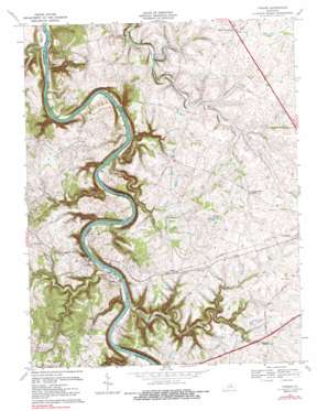
Tyrone Topo Map Kentucky
To zoom in, hover over the map of Tyrone
USGS Topo Quad 38084a7 - 1:24,000 scale
| Topo Map Name: | Tyrone |
| USGS Topo Quad ID: | 38084a7 |
| Print Size: | ca. 21 1/4" wide x 27" high |
| Southeast Coordinates: | 38° N latitude / 84.75° W longitude |
| Map Center Coordinates: | 38.0625° N latitude / 84.8125° W longitude |
| U.S. State: | KY |
| Filename: | o38084a7.jpg |
| Download Map JPG Image: | Tyrone topo map 1:24,000 scale |
| Map Type: | Topographic |
| Topo Series: | 7.5´ |
| Map Scale: | 1:24,000 |
| Source of Map Images: | United States Geological Survey (USGS) |
| Alternate Map Versions: |
Tyrone KY 1954, updated 1955 Download PDF Buy paper map Tyrone KY 1967, updated 1969 Download PDF Buy paper map Tyrone KY 1967, updated 1988 Download PDF Buy paper map Tyrone KY 1976, updated 1980 Download PDF Buy paper map Tyrone KY 2010 Download PDF Buy paper map Tyrone KY 2013 Download PDF Buy paper map Tyrone KY 2016 Download PDF Buy paper map |
1:24,000 Topo Quads surrounding Tyrone
> Back to 38084a1 at 1:100,000 scale
> Back to 38084a1 at 1:250,000 scale
> Back to U.S. Topo Maps home
Tyrone topo map: Gazetteer
Tyrone: Airports
Buzzards Roost Airport elevation 234m 767′Stonegate Farm Heliport elevation 242m 793′
Tyrone: Bars
Watts Bar elevation 146m 479′Tyrone: Bends
Germany Bend elevation 156m 511′Tyrone: Bridges
Blackburn Memorial Bridge elevation 148m 485′Youngs High Bridge (historical) elevation 149m 488′
Tyrone: Cliffs
Kentucky Bluff elevation 165m 541′Lovers Leap elevation 167m 547′
Tyrone: Crossings
Buckley Ferry (historical) elevation 144m 472′Sharps Ferry (historical) elevation 147m 482′
Shryocks Ferry (historical) elevation 149m 488′
Tyrone: Dams
Lock Number 5 elevation 149m 488′Tyrone: Lakes
Clifton Road Lake elevation 246m 807′Tyrone: Populated Places
Clifton elevation 159m 521′McKees Crossroads elevation 271m 889′
Milner elevation 256m 839′
Tyrone elevation 161m 528′
Tyrone: Post Offices
Cicero Post Office (historical) elevation 167m 547′Murphy Post Office (historical) elevation 217m 711′
Tyrone Post Office (historical) elevation 166m 544′
Tyrone: Reservoirs
Matthews Lake elevation 268m 879′Tyrone: Springs
Cave Spring (historical) elevation 175m 574′Tyrone: Streams
Bailey Run elevation 155m 508′Bear Branch elevation 146m 479′
Bear Branch elevation 153m 501′
Buck Run elevation 147m 482′
Camden Creek elevation 234m 767′
Cedar Brook elevation 166m 544′
Dorans Run elevation 230m 754′
Griers Creek elevation 148m 485′
Little Benson Creek elevation 146m 479′
Rabbit Creek elevation 229m 751′
Rowes Run elevation 146m 479′
Salt Lick Branch elevation 149m 488′
Sharps Branch elevation 147m 482′
Turkey Run elevation 145m 475′
Watts Branch elevation 146m 479′
Wildcat Creek elevation 149m 488′
Tyrone: Summits
Mile Hill elevation 262m 859′Tyrone: Valleys
Lock Hollow elevation 153m 501′Tyrone digital topo map on disk
Buy this Tyrone topo map showing relief, roads, GPS coordinates and other geographical features, as a high-resolution digital map file on DVD:


