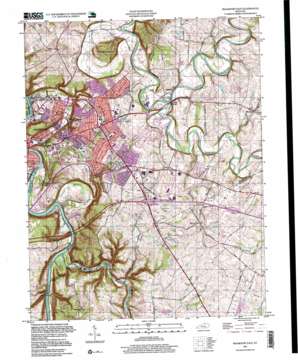
Frankfort East Topo Map Kentucky
To zoom in, hover over the map of Frankfort East
USGS Topo Quad 38084b7 - 1:24,000 scale
| Topo Map Name: | Frankfort East |
| USGS Topo Quad ID: | 38084b7 |
| Print Size: | ca. 21 1/4" wide x 27" high |
| Southeast Coordinates: | 38.125° N latitude / 84.75° W longitude |
| Map Center Coordinates: | 38.1875° N latitude / 84.8125° W longitude |
| U.S. State: | KY |
| Filename: | o38084b7.jpg |
| Download Map JPG Image: | Frankfort East topo map 1:24,000 scale |
| Map Type: | Topographic |
| Topo Series: | 7.5´ |
| Map Scale: | 1:24,000 |
| Source of Map Images: | United States Geological Survey (USGS) |
| Alternate Map Versions: |
Frankfort East KY 1953, updated 1955 Download PDF Buy paper map Frankfort East KY 1959, updated 1960 Download PDF Buy paper map Frankfort East KY 1959, updated 1968 Download PDF Buy paper map Frankfort East KY 1970, updated 1972 Download PDF Buy paper map Frankfort East KY 1970, updated 1976 Download PDF Buy paper map Frankfort East KY 1970, updated 1979 Download PDF Buy paper map Frankfort East KY 1970, updated 1984 Download PDF Buy paper map Frankfort East KY 1970, updated 1988 Download PDF Buy paper map Frankfort East KY 1970, updated 1993 Download PDF Buy paper map Frankfort East KY 1996, updated 1999 Download PDF Buy paper map Frankfort East KY 2010 Download PDF Buy paper map Frankfort East KY 2013 Download PDF Buy paper map Frankfort East KY 2016 Download PDF Buy paper map |
1:24,000 Topo Quads surrounding Frankfort East
> Back to 38084a1 at 1:100,000 scale
> Back to 38084a1 at 1:250,000 scale
> Back to U.S. Topo Maps home
Frankfort East topo map: Gazetteer
Frankfort East: Areas
Buckley Wildlife Sanctuary elevation 243m 797′Frankfort East: Bends
Saffells Bend elevation 151m 495′Trumbo Bottom elevation 158m 518′
Frankfort East: Bridges
South Trimble Memorial Bridge elevation 198m 649′Frankfort East: Dams
Lock and Dam Number 4 elevation 143m 469′Macklin Mill Dam (historical) elevation 198m 649′
Frankfort East: Lakes
Silver Lake elevation 221m 725′Frankfort East: Parks
Capitol View Park elevation 169m 554′Frankfort East: Populated Places
Big Eddy elevation 157m 515′Bon Air Hills elevation 253m 830′
Duckers elevation 248m 813′
Elsinore elevation 197m 646′
Forks of Elkhorn elevation 201m 659′
Frankfort elevation 155m 508′
Indian Hills elevation 227m 744′
Jett elevation 243m 797′
Millville elevation 174m 570′
Slickway elevation 237m 777′
Woodlake elevation 226m 741′
Frankfort East: Post Offices
Dorsey Post Office (historical) elevation 259m 849′Duckers Post Office (historical) elevation 254m 833′
Forks of Elkhorn Post Office (historical) elevation 203m 666′
Jett Post Office (historical) elevation 244m 800′
Millville Post Office (historical) elevation 172m 564′
New Post Office (historical) elevation 231m 757′
Oakley Post Office (historical) elevation 241m 790′
Steadmanville Post Office (historical) elevation 213m 698′
Woodlake Post Office (historical) elevation 226m 741′
Frankfort East: Reservoirs
Wood Lake elevation 242m 793′Frankfort East: Springs
Cove Spring (historical) elevation 233m 764′Locust Grove Spring (historical) elevation 242m 793′
Pond Spring (historical) elevation 217m 711′
Roaring Spring elevation 237m 777′
Frankfort East: Streams
Buck Run elevation 216m 708′Canty Branch elevation 171m 561′
Glenns Creek elevation 144m 472′
Hickman Branch elevation 208m 682′
Hickman Branch South Elkhorn Creek elevation 214m 702′
North Elkhorn Creek elevation 198m 649′
North Fork Glenns Creek elevation 171m 561′
Penitentiary Branch elevation 140m 459′
Slickway Branch elevation 200m 656′
South Elkhorn Creek elevation 198m 649′
Vaughn Branch elevation 149m 488′
Yeatmans Branch elevation 144m 472′
Frankfort East: Summits
Fort Hill elevation 174m 570′Hickman Hill elevation 251m 823′
Locust Hill elevation 257m 843′
Poplar Hill elevation 251m 823′
The Backbone elevation 262m 859′
Frankfort East digital topo map on disk
Buy this Frankfort East topo map showing relief, roads, GPS coordinates and other geographical features, as a high-resolution digital map file on DVD:


