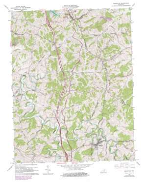
Sadieville Topo Map Kentucky
To zoom in, hover over the map of Sadieville
USGS Topo Quad 38084d5 - 1:24,000 scale
| Topo Map Name: | Sadieville |
| USGS Topo Quad ID: | 38084d5 |
| Print Size: | ca. 21 1/4" wide x 27" high |
| Southeast Coordinates: | 38.375° N latitude / 84.5° W longitude |
| Map Center Coordinates: | 38.4375° N latitude / 84.5625° W longitude |
| U.S. State: | KY |
| Filename: | o38084d5.jpg |
| Download Map JPG Image: | Sadieville topo map 1:24,000 scale |
| Map Type: | Topographic |
| Topo Series: | 7.5´ |
| Map Scale: | 1:24,000 |
| Source of Map Images: | United States Geological Survey (USGS) |
| Alternate Map Versions: |
Sadieville KY 1953, updated 1954 Download PDF Buy paper map Sadieville KY 1965, updated 1966 Download PDF Buy paper map Sadieville KY 1965, updated 1979 Download PDF Buy paper map Sadieville KY 2010 Download PDF Buy paper map Sadieville KY 2013 Download PDF Buy paper map Sadieville KY 2016 Download PDF Buy paper map |
1:24,000 Topo Quads surrounding Sadieville
> Back to 38084a1 at 1:100,000 scale
> Back to 38084a1 at 1:250,000 scale
> Back to U.S. Topo Maps home
Sadieville topo map: Gazetteer
Sadieville: Populated Places
Corinth elevation 295m 967′Hinton elevation 287m 941′
Porter elevation 287m 941′
Sadieville elevation 254m 833′
Stonewall elevation 294m 964′
Sadieville: Post Offices
Mallorys Mill Post Office (historical) elevation 262m 859′Sadieville: Reservoirs
Arrowhead Lake elevation 231m 757′Wild Deer Lake elevation 251m 823′
Sadieville: Streams
Elk Lick Branch elevation 228m 748′Hall Branch elevation 234m 767′
Little Eagle Creek elevation 226m 741′
Mile Run elevation 225m 738′
North Rays Fork elevation 230m 754′
Rays Fork elevation 222m 728′
South Rays Fork elevation 230m 754′
Spoon Branch elevation 233m 764′
Straight Fork elevation 237m 777′
Sadieville digital topo map on disk
Buy this Sadieville topo map showing relief, roads, GPS coordinates and other geographical features, as a high-resolution digital map file on DVD:


