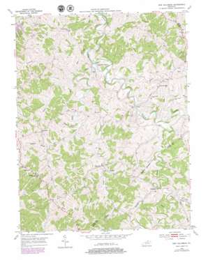
New Columbus Topo Map Kentucky
To zoom in, hover over the map of New Columbus
USGS Topo Quad 38084d6 - 1:24,000 scale
| Topo Map Name: | New Columbus |
| USGS Topo Quad ID: | 38084d6 |
| Print Size: | ca. 21 1/4" wide x 27" high |
| Southeast Coordinates: | 38.375° N latitude / 84.625° W longitude |
| Map Center Coordinates: | 38.4375° N latitude / 84.6875° W longitude |
| U.S. State: | KY |
| Filename: | o38084d6.jpg |
| Download Map JPG Image: | New Columbus topo map 1:24,000 scale |
| Map Type: | Topographic |
| Topo Series: | 7.5´ |
| Map Scale: | 1:24,000 |
| Source of Map Images: | United States Geological Survey (USGS) |
| Alternate Map Versions: |
New Columbus KY 1953, updated 1955 Download PDF Buy paper map New Columbus KY 1953, updated 1977 Download PDF Buy paper map New Columbus KY 1953, updated 1979 Download PDF Buy paper map New Columbus KY 2010 Download PDF Buy paper map New Columbus KY 2013 Download PDF Buy paper map New Columbus KY 2016 Download PDF Buy paper map |
1:24,000 Topo Quads surrounding New Columbus
> Back to 38084a1 at 1:100,000 scale
> Back to 38084a1 at 1:250,000 scale
> Back to U.S. Topo Maps home
New Columbus topo map: Gazetteer
New Columbus: Bridges
Lees Mill Covered Bridge elevation 212m 695′New Columbus: Islands
Mountain Island elevation 245m 803′New Columbus: Populated Places
Beechwood elevation 281m 921′Breck elevation 271m 889′
Fairbanks elevation 276m 905′
Josephine elevation 225m 738′
Natlee elevation 219m 718′
New Columbus elevation 259m 849′
Rockdale elevation 236m 774′
New Columbus: Post Offices
Beechwood Post Office (historical) elevation 281m 921′Bethany Post Office (historical) elevation 285m 935′
Breck Post Office (historical) elevation 275m 902′
Fairbanks Post Office (historical) elevation 276m 905′
Lees Mill Post Office (historical) elevation 218m 715′
Mountain Island Post Office (historical) elevation 236m 774′
Natlee Post Office (historical) elevation 216m 708′
New Columbus Post Office (historical) elevation 265m 869′
Rockdale Post Office (historical) elevation 237m 777′
Slayton Post Office (historical) elevation 213m 698′
New Columbus: Streams
Caney Creek elevation 211m 692′Deep Creek elevation 207m 679′
Dickey Fork elevation 212m 695′
Gwills Branch elevation 217m 711′
Little Indian Branch elevation 230m 754′
Lytles Fork elevation 220m 721′
Opossum Branch elevation 224m 734′
Paynes Run elevation 210m 688′
Red Oak Creek elevation 222m 728′
Rush Run elevation 207m 679′
Shellbark Branch elevation 221m 725′
Southard Branch elevation 230m 754′
New Columbus: Valleys
Clark Hollow elevation 226m 741′New Columbus digital topo map on disk
Buy this New Columbus topo map showing relief, roads, GPS coordinates and other geographical features, as a high-resolution digital map file on DVD:


