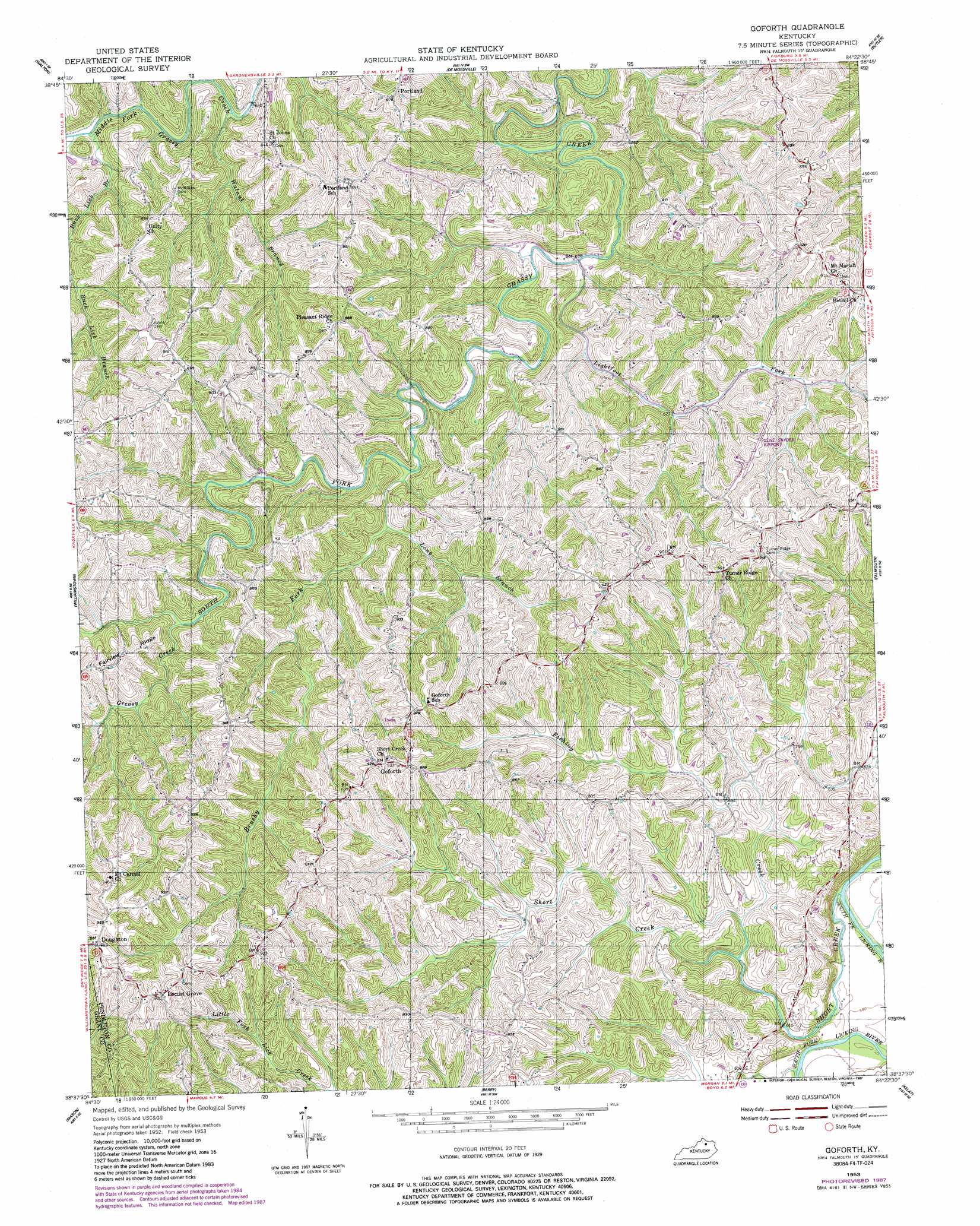
Goforth Topo Map Kentucky
To zoom in, hover over the map of Goforth
USGS Topo Quad 38084f4 - 1:24,000 scale
| Topo Map Name: | Goforth |
| USGS Topo Quad ID: | 38084f4 |
| Print Size: | ca. 21 1/4" wide x 27" high |
| Southeast Coordinates: | 38.625° N latitude / 84.375° W longitude |
| Map Center Coordinates: | 38.6875° N latitude / 84.4375° W longitude |
| U.S. State: | KY |
| Filename: | o38084f4.jpg |
| Download Map JPG Image: | Goforth topo map 1:24,000 scale |
| Map Type: | Topographic |
| Topo Series: | 7.5´ |
| Map Scale: | 1:24,000 |
| Source of Map Images: | United States Geological Survey (USGS) |
| Alternate Map Versions: |
Goforth KY 1953, updated 1955 Download PDF Buy paper map Goforth KY 1953, updated 1987 Download PDF Buy paper map Goforth KY 2010 Download PDF Buy paper map Goforth KY 2013 Download PDF Buy paper map Goforth KY 2016 Download PDF Buy paper map |
1:24,000 Topo Quads surrounding Goforth
Union |
Independence |
Alexandria |
New Richmond |
Laurel |
Verona |
Walton |
De Mossville |
Butler |
Moscow |
Elliston |
Williamstown |
Goforth |
Falmouth |
Berlin |
Lawrenceville |
Mason |
Berry |
Kelat |
Claysville |
New Columbus |
Sadieville |
Breckinridge |
Cynthiana |
Shady Nook |
> Back to 38084e1 at 1:100,000 scale
> Back to 38084a1 at 1:250,000 scale
> Back to U.S. Topo Maps home
Goforth topo map: Gazetteer
Goforth: Airports
Gene Snyder Airport elevation 276m 905′Goforth: Populated Places
Doughton elevation 290m 951′Goforth elevation 281m 921′
Locust Grove elevation 283m 928′
Portland elevation 265m 869′
Goforth: Post Offices
Dividing Ridge Post Office (historical) elevation 270m 885′Doudton Post Office (historical) elevation 287m 941′
Elizabeth Post Office (historical) elevation 277m 908′
Emery Post Office (historical) elevation 276m 905′
Goforth Post Office (historical) elevation 279m 915′
Portland Ridge Post Office (historical) elevation 270m 885′
Tur Post Office (historical) elevation 198m 649′
Goforth: Ridges
Pleasant Ridge elevation 244m 800′Turner Ridge elevation 276m 905′
Goforth: Streams
Brushy Fork elevation 198m 649′Buck Lick Branch elevation 191m 626′
Fishing Creek elevation 184m 603′
Greasy Creek elevation 219m 718′
Johnsons Branch elevation 169m 554′
Lightfoot Fork elevation 188m 616′
Long Branch elevation 203m 666′
North Fork Middle Fork Grassy Creek elevation 192m 629′
Short Creek elevation 169m 554′
Walnut Branch elevation 188m 616′
Goforth digital topo map on disk
Buy this Goforth topo map showing relief, roads, GPS coordinates and other geographical features, as a high-resolution digital map file on DVD: