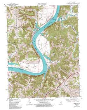
Patriot Topo Map Indiana
To zoom in, hover over the map of Patriot
USGS Topo Quad 38084g7 - 1:24,000 scale
| Topo Map Name: | Patriot |
| USGS Topo Quad ID: | 38084g7 |
| Print Size: | ca. 21 1/4" wide x 27" high |
| Southeast Coordinates: | 38.75° N latitude / 84.75° W longitude |
| Map Center Coordinates: | 38.8125° N latitude / 84.8125° W longitude |
| U.S. States: | IN, KY |
| Filename: | o38084g7.jpg |
| Download Map JPG Image: | Patriot topo map 1:24,000 scale |
| Map Type: | Topographic |
| Topo Series: | 7.5´ |
| Map Scale: | 1:24,000 |
| Source of Map Images: | United States Geological Survey (USGS) |
| Alternate Map Versions: |
Patriot IN 1943 Download PDF Buy paper map Patriot IN 1951, updated 1953 Download PDF Buy paper map Patriot IN 1961, updated 1963 Download PDF Buy paper map Patriot IN 1969, updated 1971 Download PDF Buy paper map Patriot IN 1969, updated 1971 Download PDF Buy paper map Patriot IN 1981, updated 1982 Download PDF Buy paper map Patriot IN 1981, updated 1994 Download PDF Buy paper map Patriot IN 2010 Download PDF Buy paper map Patriot IN 2013 Download PDF Buy paper map Patriot IN 2016 Download PDF Buy paper map |
1:24,000 Topo Quads surrounding Patriot
> Back to 38084e1 at 1:100,000 scale
> Back to 38084a1 at 1:250,000 scale
> Back to U.S. Topo Maps home
Patriot topo map: Gazetteer
Patriot: Bends
Steele Bottom elevation 159m 521′Patriot: Flats
Egypt Bottom elevation 149m 488′Patriot: Islands
Big Bone Island elevation 137m 449′Patriot: Populated Places
Gurley Corner elevation 266m 872′Napoleon elevation 259m 849′
Patriot elevation 144m 472′
Searcy Crossroads elevation 246m 807′
Steeles Creek (historical) elevation 153m 501′
Patriot: Post Offices
Berkshire Post Office (historical) elevation 152m 498′Patriot: Ridges
Searcy Ridge elevation 244m 800′Patriot: Streams
Big Bone Creek elevation 140m 459′Big South Fork elevation 137m 449′
Big Sugar Creek elevation 137m 449′
Buzzard Branch elevation 140m 459′
Fisk Creek elevation 137m 449′
Goose Creek elevation 137m 449′
Little South Fork elevation 146m 479′
Little Sugar Creek elevation 140m 459′
Mud Lick Creek elevation 140m 459′
Paint Lick Creek elevation 140m 459′
Sand Run elevation 140m 459′
Steele Creek elevation 141m 462′
Sterman Branch elevation 140m 459′
Wade Creek elevation 140m 459′
Patriot: Summits
Wade Hill elevation 218m 715′Patriot digital topo map on disk
Buy this Patriot topo map showing relief, roads, GPS coordinates and other geographical features, as a high-resolution digital map file on DVD:


